国立情報学研究所 - ディジタル・シルクロード・プロジェクト
| |||||||||
|
| Scientific Results of a Journey in Central Asia, 1899-1902 : vol.1 | |
| 1899-1902年の中央アジア旅行における科学的成果 : vol.1 |
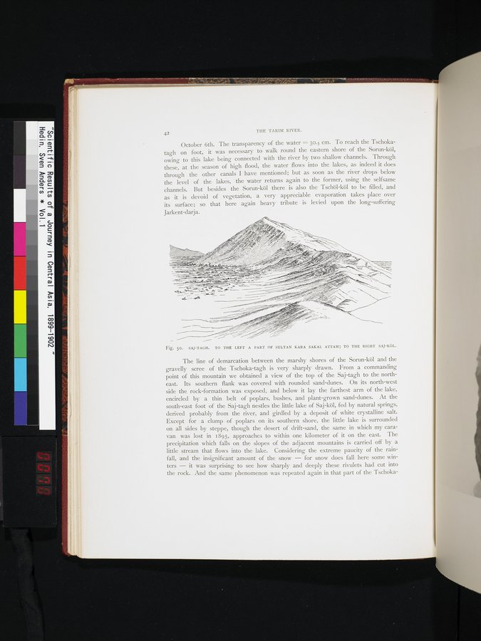 |
| サイ・ターグ。左手にスルタン・カラ・サカル・アタムの部分、右手にサイ・クル。SAJ-TAGH. TO THE LEFT A PART OF SULTAN KARA SAKAL ATTAM; TO THE RIGHT SAJ-KÖL. |
42 THE TARIM RIVER.
October 6th. The transparency of the water = 30.5 cm. To reach the Tschokatagh on foot, it was necessary to walk round the eastern shore of the Sorun-köl, owing to this lake being connected with the river by two shallow channels. Through these, at the season of high flood, the water flows into the lakes, as indeed it does through the other canals I have mentioned; but as soon as the river drops below the level of the lakes, the water returns again to the former, using the selfsame channels. ' But besides the Sorun-köl there is also the Tschöl-köl to be filled, and as it is devoid of vegetation, a very appreciable evaporation takes place over its surface; so that here again heavy tribute is levied upon the long-suffering Jarkent-clarja.
Fig. so. SAJ-TAGH. TO THE LEFT A PART OF SULTAN KARA SAKAL ATTAM; TO THE RIGHT SAJ-KÔL.
east. Its southern flank was covered with rounded sand-dunes. On its north-west side the rock-formation was exposed, and below it lay the farthest arm of the lake, encircled by a thin belt of poplars, bushes, and plant-grown sand-dunes. At the south-east foot of the Saj-tagh nestles the little lake of Saj-köl, fed by natural springs, derived probably from • the river, and girdled by a deposit of white crystalline salt. Except for a clump of poplars on its southern shore, the little lake is surrounded on all sides by steppe, though the desert of drift-sand, the same in which my caravan was lost in 1895, approaches to within one kilometer of it on the east. The precipitation which falls on the slopes of the adjacent mountains is carried off by a little stream that flows into the lake. Considering the extreme paucity of the rainfall, and the insignificant amount of the snow — for snow does fall here some winters — it was surprising to see how sharply and deeply these rivulets had cut into the rock. And the same phenomenon was repeated again in that part of the Tschoka-
The line of demarcation between the marshy shores of the Sorun-köl and the gravelly scree of the Tschoka-tagh is very sharply drawn. From a commanding
point of this mountain we obtained a view of the top of the Saj-tagh to the north-
1
|
Copyright (C) 2003-2019
National Institute of Informatics(国立情報学研究所)
and
The Toyo Bunko(東洋文庫). All Rights Reserved.
本ウェブサイトに掲載するデジタル文化資源の無断転載は固くお断りいたします。