国立情報学研究所 - ディジタル・シルクロード・プロジェクト
| |||||||||
|
| Scientific Results of a Journey in Central Asia, 1899-1902 : vol.1 | |
| 1899-1902年の中央アジア旅行における科学的成果 : vol.1 |
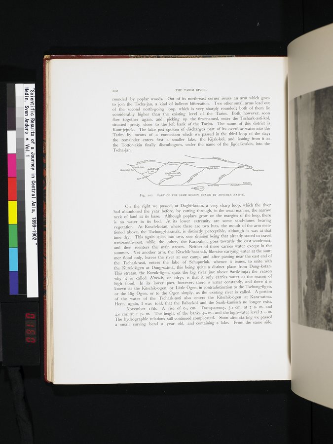 |
| 別の現地人が描いた同じ地域の部分図。PART OF THE SAME REGION DRAWN BY ANOTHER NATIVE. |
I 1 THE TARIM RIVER.
rounded by poplar woods. Out of its north-east corner issues an arm which goes to join the Tscha jan, a kind of indirect bifurcation. Two other small arms lead out of the second north-going loop, which is very sharply rounded; both of them lie considerably higher than the existing level of the Tarim. Both, however, soon flow together again, and, picking up the first-named, enter the Tschark-asti-köl, situated pretty close to the left bank of the Tarim. The name of this district is Kum-jejnek. The lake just spoken of discharges part of its overflow water into the Tarim by means of a connection which we passed in the third loop of the day; the remainder enters first a smaller lake, the Kijak-köl, and issuing from it as the Töttör-akin finally disembogues, under the name of the Jigdelik-akin, into the Tscha-jan.
Fig. IO2. PART OF THE SAME REGION DRAWN BY ANOTHER NATIVE.
On the right we passed, at Daghi-kotan, a very sharp loop, which the river had abandoned the year before, by cutting through, in the usual manner, the narrow neck of land at its base. Although poplars grow on the margins of the loop, there is no water in its bed. At its lower extremity are some sand-dunes bearing vegetation. At Kosch-kotan, where there are two huts, the mouth of the arm mentioned above, the Tschong-hasanak, is distinctly perceptible, although it was at that time dry. This again splits into two, one division being that already stated to travel west-south-west, while the other, the Kara-akin, goes towards the east-south-east, and then reenters the main stream. Neither of these carries water except in the summer. Yet another arm, the Kitschik-hasanak, likewise carrying water at the summer flood only, leaves the river at our camp, and after passing near the east end of the Tschark-asti, enters the lake of Schupurluk, whence it issues, to unite with the Kuruk-ögen at Dung-satma, this being quite a distinct place from Dung-kotan. This stream, the Kuruk-ögen, quits the big river just above Sarik-buja; the reason why it is called Kuruk, or »dry», is that it only carries water at the season of high flood. In its lower part, however, there is water constantly, and there it is known as the Kitschik-ögen, or Little ()gen, in contradistinction to the Tschong-ögen, or the Big Ögen, or to the ()gen simply, as the existing river is called. A portion of the water of the Tschark-asti also enters the Kitschik-ögen at Kara-satma. Here, again, I was told, that the Baba-köl and the Sarik-kamisch no longer exist.
November 18th. A rise of o.5 cm. Transparency, 5.1 cm. at 7 a. m. and 4.6 cm. at I p. m. The height of the banks 4.0 m., and the high-water level 3.I0 m. The hydrographic relations still continued complicated. Soon after starting we passed a small curving bend a year old, and containing a lake. From the same side,
|
Copyright (C) 2003-2019
National Institute of Informatics(国立情報学研究所)
and
The Toyo Bunko(東洋文庫). All Rights Reserved.
本ウェブサイトに掲載するデジタル文化資源の無断転載は固くお断りいたします。