国立情報学研究所 - ディジタル・シルクロード・プロジェクト
| |||||||||
|
| Scientific Results of a Journey in Central Asia, 1899-1902 : vol.1 | |
| 1899-1902年の中央アジア旅行における科学的成果 : vol.1 |
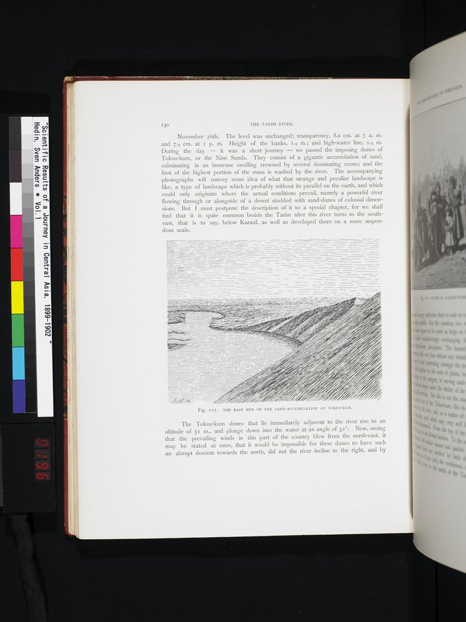 |
| トクス・クムの堆積砂の東端。THE EAST END OF THE SAND-ACCUMULATION AT TOKUS-KUM. |
I 30 THE TARIM RIVER.
November 26th. The level was unchanged; transparency, 8.8 cm. at 7 a. m. and 7.9 cm. at I p. m. Height of the banks, 1.9 m.; and high-water line, 1.5 m. During the day — it was a short journey — we passed the imposing dunes of Tokus-kum, or the Nine Sands. They consist of a gigantic accumulation of sand, culminating in an immense swelling crowned by several dominating crests; and the foot of the highest portion of the mass is washed by the river. The accompanying photographs will convey some idea of what that strange and peculiar landscape is like, a type of landscape which is probably without its parallel on the earth, and which could only originate where the actual conditions prevail, namely a powerful river flowing through or alongside of a desert studded with sand-dunes of colossal dimensions. But I must postpone the description of it to a special chapter, for we shall find that it is quite common beside the Tarim after this river turns to the southeast, that is to say, below Karaul, as well as developed there on a more stupen-
dous scale.
The Tokus-kum dunes that lie immediately adjacent to the river rise to an altitude of 51 m., and plunge down into the water at an angle of 32°. Now, seeing that the prevailing winds in this part of the country blow from the north-east, it may be stated at once, that it would be impossible for these dunes to have such an abrupt descent towards the north, did not the river incline to the right, and by
Fig. i I 7. THE EAST END OF THE SAND-ACCUMULATION AT TOKUS-KUM.
|
Copyright (C) 2003-2019
National Institute of Informatics(国立情報学研究所)
and
The Toyo Bunko(東洋文庫). All Rights Reserved.
本ウェブサイトに掲載するデジタル文化資源の無断転載は固くお断りいたします。