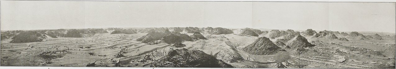
| [Photo] 6. |
PANORAMIC VIEW TAKEN IN SOUTHERN PORTION OF NIYA SITE (SEE PP. 105-6), SHOWING REMAINDS OF RUINED DWELLING AFTER EXCAVATION (A), ANCIENT TANK WITH SURROUNDING ARBOUR (B), FOOTBRIDGE STRETCHED ACOSS DRY RIVER-BED (C), AND DEAD ORCHARDS BEYOND (D). The panorama was taken from the tamarisk-covered top of a sandy ridge. The view extends from the S. E. (left) to W. (right). In the foreground behind the ruined dwelling (A) and tank (B) are seen the remains of dead trees and fences marking lines of ancient avenues and gardens. The height of the trestles, still upright, which once supported the bridge (C), is shown by the figure of a man. Beyond the left bank of the dry river-bed are remains of dead orchards (D), and in the distance those of an ancient vineyard (E); see Fig. 49. In near background, to south and south-west, rise tamarisk-cones, and in the distance high ridges of dunes. |