| [Figure] |
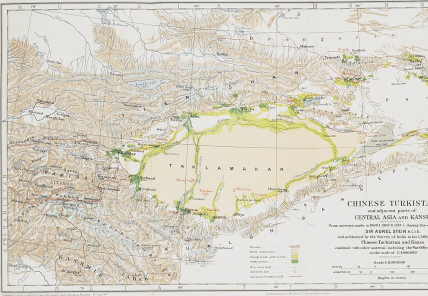
中国領トルキスタンと中央アジアの隣接部および甘粛。1900-1年,1906-8年, 1913-5年のオーレル・スタイン卿(インド帝国勲章上級爵士)による探検中に作成された測量図,およびその中国領トルキスタンと甘粛の1/500,000の地図中でインド測量局から公刊されたもの。なおこれは1/4,000,000のアジア陸軍省地図を含む他の資料と組み合わされている。CHINEZE TURKISTAN and adjacent parts of CENTRAL ASIA AND KANSU From surveys made in 1900-1,1906-8, 1913-5 during the explorations of SIR AUREL STEIN, K. C. I. E. and published by the Survey of India in his 1/500,000 map of Chinese Turkistan and Kansu combined with other material, including the War Office map of Asia on the scale of 1/4,000,000
|