国立情報学研究所 - ディジタル・シルクロード・プロジェクト
| |||||||||
|
| Sand-Buried Ruins of Khotan : vol.1 | |
| 砂に埋もれたコータンの遺跡 : vol.1 |
 |
58 ON THE TAGHDUMBASH PAMIR [CHAP. IV.
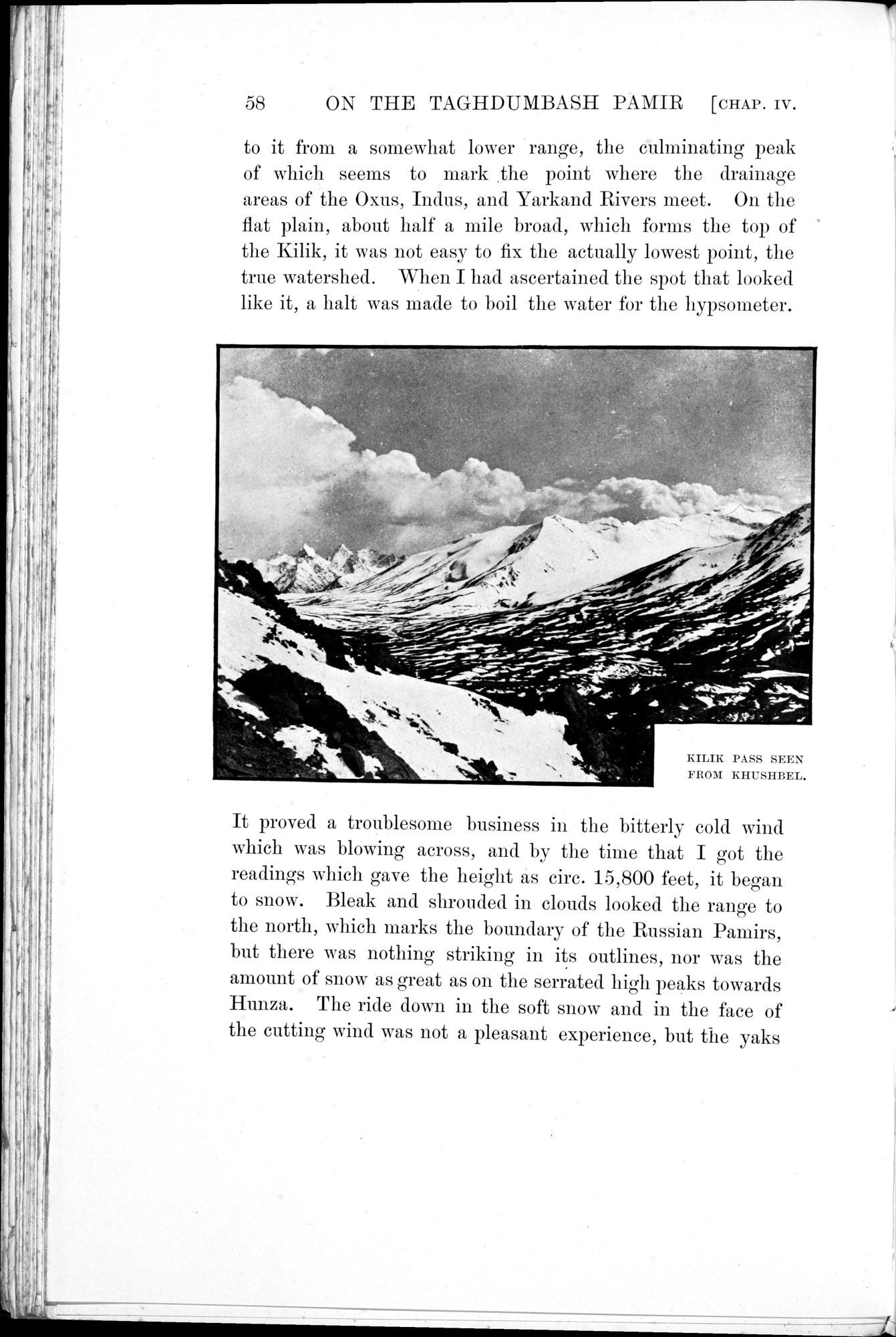
to it from a somewhat lower range, the culminating peak of which seems to mark .the point where the drainage areas of the Oxus, Indus, and Yarkand Rivers meet. On the flat plain, about half a mile broad, which forms the top of the Kilik, it was not easy to fix the actually lowest point, the true watershed. When I had ascertained the spot that looked like it, a halt was made to boil the water for the hypsometer.
It proved a troublesome business in the bitterly cold wind which was blowing across, and by the time that I got the readings which gave the height as cire. 15,800 feet, it began to snow. Bleak and shrouded in clouds looked the range to the north, which marks the boundary of the Russian Pamirs, but there was nothing striking in its outlines, nor was the amount of snow as great as on the serrated high peaks towards Hunza. The ride down in the soft snow and in the face of the cutting wind was not a pleasant experience, but the yaks
KILIK PASS SEEN FROM KHUSHBEL.
|
Copyright (C) 2003-2019
National Institute of Informatics(国立情報学研究所)
and
The Toyo Bunko(東洋文庫). All Rights Reserved.
本ウェブサイトに掲載するデジタル文化資源の無断転載は固くお断りいたします。