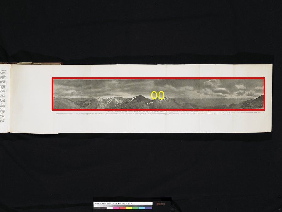
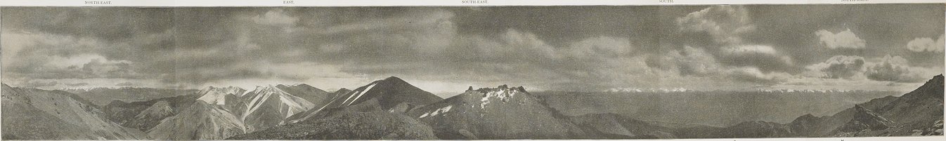
| [Photo] X. |
PANORAMIC VIEW TAKEN FROM CREST OF WATERSHED ABOVE HUO-NING-TO PASS, SHOWING PORTIONS OF THE RICHTHOFEN, TO-LAI-SHAN AND ALEXANDER III RANGES OF NAN-SHAN. The panorama was taken at an elevation of circ. 15,500 feet to the north-west of the pass, which itself is hidden by rocky foreground (D; see ii pp. 314 sqq. and Map III.). The view extends from north-east (left) to south-west (right); the entries above the panorama indicate only the approximate bearings. It shows portions of the Richthofen Range west (A) and east (B) of Hung-shui-pa Ho, rising to peaks of over 18,000 feet. The high peaks of the To-lai-shan Range, over which the pass leads, are masked by neighbouring ridges (C). Across the wide valley of the Pei-ta Ho are seen in the distance the Uge-shan group (E), rising to close on 19,000 feet, and other snowy portions of the Alexander III. Range (F to H). The approximate position of the pass by which we crossed this renge is indicated by (G). For a view from the same point to the north-west see Fig. 237. |