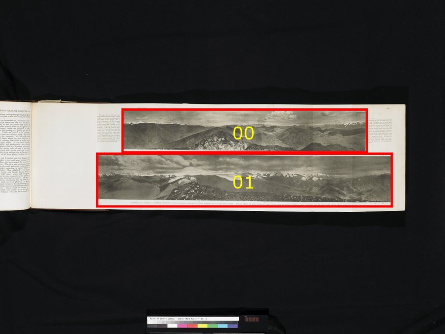
| [Photo] XII |
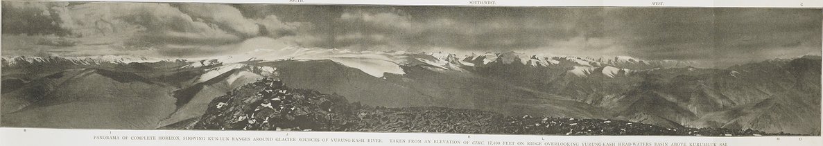
PANORAMA OF COMPLETE HORIZON, SHOWING KUN-LUN RANGES AROUND GLACIER SOURCES OF YURUNG-KASH RIVER. TAKEN FROM AN ELEVATION OF CIRC. 17,400 FEET ON RIDGE OVERLOOKING YURUNG-KASH HEAD-WATERS BASIN ABOVE KURUMLUK SAI. |
| [Photo] XII.〜t |
The upper portion of the panorama extends from north-west (left) to east (right); the lower portion from south-east (left) to west (right). For a brief description of the general features see ii. pp. 454 sqq. The entries above each portion of the panorama indicate only approximate bearings. A B, C D mark the lines where the lower portion overlaps the upper one. In the latter the view ranges from the snowy massif (E), dividing the Yurung-kash head-waters and the Seghiz-köl basin, to the distant peaks of the Northern Kun-lun chain above Keriya and Niya (F), and to the uppermost Yurung-kash course (G) and the Gügrüge Glacier (H). |
| [Photo] XII.〜b |
In the lower portion are seen successively the ice-crowned range (l), rising to heights of over 22,000 feet, which separates the Yurung-kash and Keriya River sources; the great ice mantle (J) which covers the main Kun-lun range south and feeds the easternmost head-waters of the Yurung-kash; the Tu-sai and other great ice-streams (K) descending from the high watershed between Lake Lighten and the Yurung-kash River; the deep-cut gorge of the latter (L; see ii. pp. 451 sqq.); and the Tar-kol spur (M; see ii. p. 450) with our triangulation station. |