National Institute of Informatics - Digital Silk Road Project
| |||||||||
|
| The Pulse of Asia : vol.1 |
 |
THE WAXING AND WANING OF LOP-NOR 285
of the Tarim River is in part due to another cause, which also explains the sudden bend to the east in the lower part of the Cherchen and old Kara Muran rivers.
During an extremely dry inter-glacial epoch, the river probably withered to nothing far upstream. On recovering
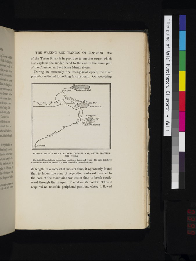
. MODERN EDITION OF AN ANCIENT CHINESE MAP, AFTER WAGNER
AND HIMLY
The dotted lines indicate the modern location of lakes and rivers. The solid dot shows where Lulan would be located if it were inserted in the ancient map.
its length, in a somewhat moister time, it apparently found that to follow the zone of vegetation eastward parallel to the base of the mountains was easier than to break southward through the rampart of sand on its border. Thus it acquired an unstable peripheral position, where it flowed
|
Copyright (C) 2003-2019 National Institute of Informatics and The Toyo Bunko. All Rights Reserved.