国立情報学研究所 - ディジタル・シルクロード・プロジェクト
| |||||||||
|
| Innermost Asia : vol.1 | |
| 極奥アジア : vol.1 |
 |
| メサL.Jの略地図SKETCH PLAN OF MASE L. J. |
286 THE SEARCH FOR THE ANCIENT CHINESE HIGH ROAD [Chap. VIII
XXVI). Here as elsewhere in the Lou-lan area, erosion had brought objects of the Stone Age and of the early centuries of our era into close juxtaposition on the surface.
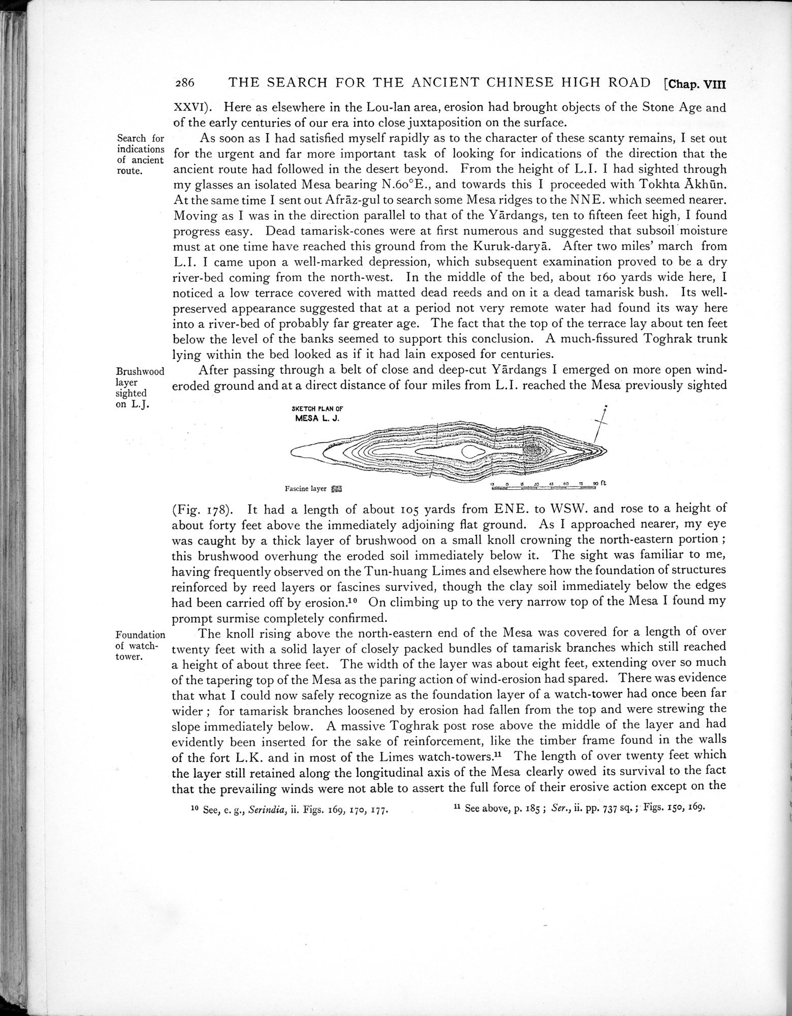
As soon as I had satisfied myself rapidly as to the character of these scanty remains, I set out for the urgent and far more important task of looking for indications of the direction that the ancient route had followed in the desert beyond. From the height of L.I. I had sighted through my glasses an isolated Mesa bearing N.6o°E., and towards this I proceeded with Tokhta Akhtin. At the same time I sent out Afraz-gul to search some Mesa ridges to the NNE. which seemed nearer. Moving as I was in the direction parallel to that of the Yàrdangs, ten to fifteen feet high, I found progress easy. Dead tamarisk-cones were at first numerous and suggested that subsoil moisture must at one time have reached this ground from the Kuruk-darya. After two miles' march from L.I. I came upon a well-marked depression, which subsequent examination proved to be a dry river-bed coming from the north-west. In the middle of the bed, about 160 yards wide here, I noticed a low terrace covered with matted dead reeds and on it a dead tamarisk bush. Its well-preserved appearance suggested that at a period not very remote water had found its way here into a river-bed of probably far greater age. The fact that the top of the terrace lay about ten feet below the level of the banks seemed to support this conclusion. A much-fissured Toghrak trunk lying within the bed looked as if it had lain exposed for centuries.
After passing through a belt of close and deep-cut Yardangs I emerged on more open wind-eroded ground and at a direct distance of four miles from L.I. reached the Mesa previously sighted
SKETCH PLAN OF
MESA L. J.
| Fascine layer Pa | o u eo ü f0 —~90 ft |
(Fig. 178). It had a length of about 105 yards from ENE. to WSW. and rose to a height of about forty feet above the immediately adjoining flat ground. As I approached nearer, my eye was caught by a thick layer of brushwood on a small knoll crowning the north-eastern portion ; this brushwood overhung the eroded soil immediately below it. The sight was familiar to me, having frequently observed on the Tun-huang Limes and elsewhere how the foundation of structures reinforced by reed layers or fascines survived, though the clay soil immediately below the edges had been carried off by erosion.10 On climbing up to the very narrow top of the Mesa I found my prompt surmise completely confirmed.
The knoll rising above the north-eastern end of the Mesa was covered for a length of over twenty feet with a solid layer of closely packed bundles of tamarisk branches which still reached a height of about three feet. The width of the layer was about eight feet, extending over so much of the tapering top of the Mesa as the paring action of wind-erosion had spared. There was evidence that what I could now safely recognize as the foundation layer of a watch-tower had once been far wider ; for tamarisk branches loosened by erosion had fallen from the top and were strewing the slope immediately below. A massive Toghrak post rose above the middle of the layer and had evidently been inserted for the sake of reinforcement, like the timber frame found in the walls of the fort L.K. and in most of the Limes watch-towers.lr The length of over twenty feet which the layer still retained along the longitudinal axis of the Mesa clearly owed its survival to the fact that the prevailing winds were not able to assert the full force of their erosive action except on the
10 See, e. g., Serindia, ii. Figs. 169, 17o, 177. 11 See above, p. r85 ; Ser., ii. pp. 737 sq, ; Figs. iso, 169.
ti
Search for indications of ancient route.
Brushwood layer sighted on L.J.
Foundation of watchtower.
|
Copyright (C) 2003-2019
National Institute of Informatics(国立情報学研究所)
and
The Toyo Bunko(東洋文庫). All Rights Reserved.
本ウェブサイトに掲載するデジタル文化資源の無断転載は固くお断りいたします。