National Institute of Informatics - Digital Silk Road Project
| |||||||||
|
| In Tibet and Chinese Turkestan : vol.1 |
 |
ATISH PASS 175
•
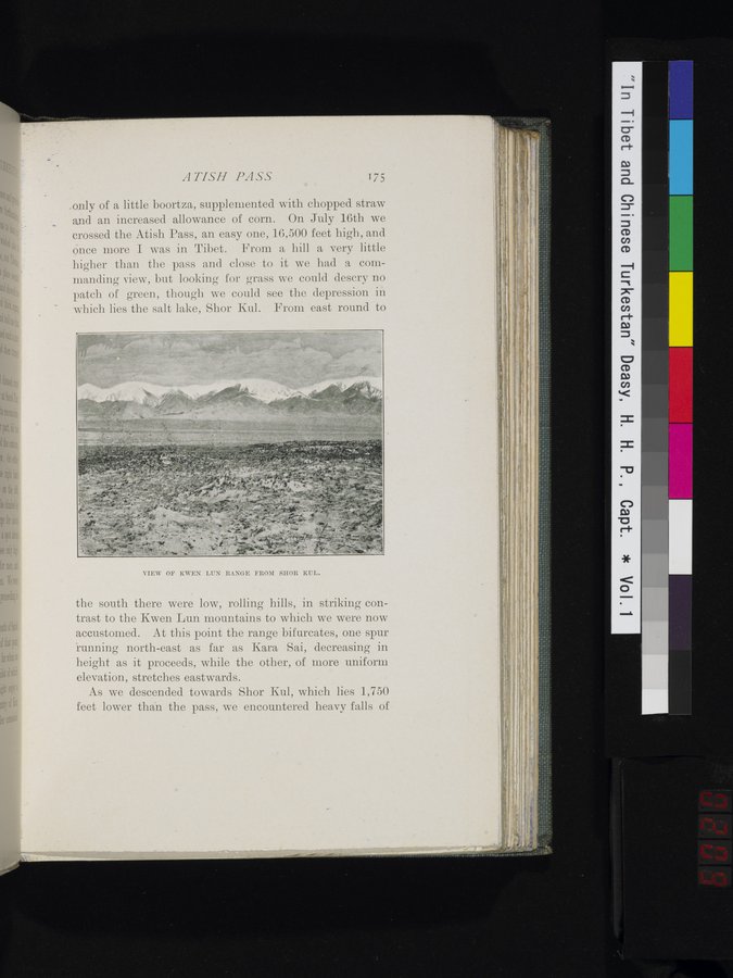
.only of a little boortza, supplemented with chopped straw and an increased allowance of corn. On July 16th we crossed the Atish Pass, an easy one, 16,500 feet high, and ônce more I was in Tibet. From a hill a very little higher than the pass and close to it we had a commanding view, but looking for grass we could descry no patch of green, though we could see the depression in which lies the salt lake, Shor Kul. From east round to
VIEW OF KWEN LUN RANGE FROM SHOR KUL.
the south there were low, rolling hills, in striking contrast to the Kwen Lun mountains to which we were now accustomed. At this point the range bifurcates, one spur 'running north-east as far as Kara Sai, decreasing in height as it proceeds, while the other, of more uniform elevation, stretches eastwards.
As we descended towards Shor Kul, which lies 1,750 feet lower than the pass, we encountered heavy falls of
|
Copyright (C) 2003-2019 National Institute of Informatics and The Toyo Bunko. All Rights Reserved.