国立情報学研究所 - ディジタル・シルクロード・プロジェクト
| |||||||||
|
| Explorations in Turkestan 1903 : vol.1 | |
| トルキスタンの調査 1903年 : vol.1 |
 |
| Kach-kar盆地を横切る15マイルの断面 東向きFifteen-mile section across the Kach-kar Basin, looking east. |
EXPLORATIONS IN TURKESTAN.
96
RIVERS OF THE ISSIK KUL DISTRICT.
The rivers in the Issik Kul district proclaim their association with new-made ranges by their habit of (until recently) aggrading the longitudinal valleys and of eroding the transverse valleys. This is notably the case in the members of the Chu system. The lower Tuluk Valley contains in its longitudinal portion several hundred feet of yellowish clays, interstratified with lenses and layers of coarse gravels and cobbles, all now dissected. The stream turns abruptly northward from this aggraded and dissected trough to a deep and narrow gorge through the eastern extension of the Chalai range, and then joins the Juvan-arik. The gorge is passable at low water, but at the time of our visit the Tuluk-su was too high to permit us to follow it, and we had to make a detour over a low pass. The upper (western) part of the Tuluk Valley, where we first came to it north of Son Kul, did not present any sure signs of being a valley of recent deformation ; its sides were well dissected ; its lower spurs were well graded ; its present flood plain was eroded 5o feet or more below an earlier valley floor ; yet all this is consistent with the origin of the valley by subrecent deformation, followed by dissection of its sides, accumulation in its most depressed part, and erosion of its transverse
KOK-TAL RANGE
il-1 ~•1
~kl '
ALEXANDER RANGE
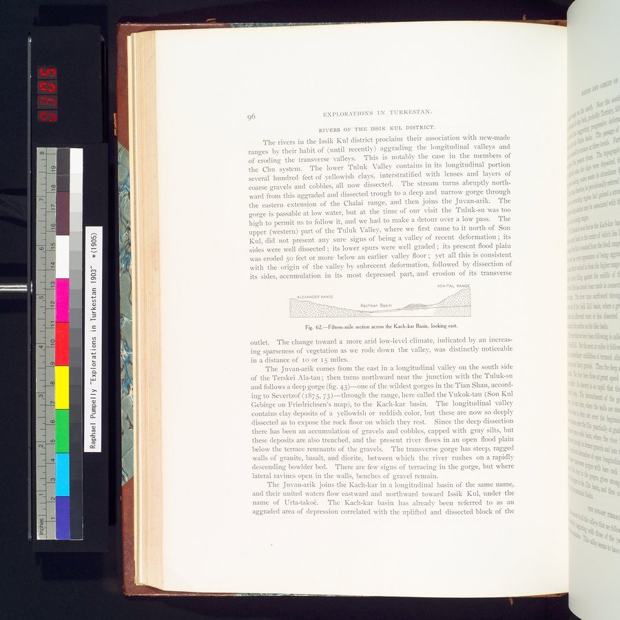
Fig. 62.—Fifteen-mile section across the Kach-kar Basin, looking east.
outlet. The change toward a more arid low-level climate, indicated by an increasing sparseness of vegetation as we rode down the valley, was distinctly noticeable in a distance of io or 15 miles.
The Juvan-arik comes from the east in a longitudinal valley on the south side of the Terskei Ala-tau ; then turns northward near the junction with the Tuluk-su and follows a deep gorge (fig. 43)—one of the wildest gorges in the Tian Shan, according to Severtzof (1875, 73 )—through the range, here called the Yukok-tau (Son Kul Gebirge on Friedrichsen's map), to the Kach-kar basin. The longitudinal valley contains clay deposits of a yellowish or reddish color, but these are now so deeply dissected as to expose the rock floor on which they rest. Since the deep dissection there has been an accumulation of gravels and cobbles, capped with gray silts, but these deposits are also trenched, and the present river flows in an open flood plain below the terrace remnants of the gravels. The transverse gorge has steep, ragged walls of granite, basalt, and diorite, between which the river rushes on a rapidly descending bowlder bed. There are few signs of terracing in the gorge, but where lateral ravines open in the walls, benches of gravel remain.
The Juvan-arik joins the Kach-kar in a longitudinal basin of the same name, and their united waters flow eastward and northward toward Issik Kul, under the name of Urta-takoë. The Kach-kar basin has already been referred to as an aggraded area of depression correlated with the uplifted and dissected block of the
|
Copyright (C) 2003-2019
National Institute of Informatics(国立情報学研究所)
and
The Toyo Bunko(東洋文庫). All Rights Reserved.
本ウェブサイトに掲載するデジタル文化資源の無断転載は固くお断りいたします。