国立情報学研究所 - ディジタル・シルクロード・プロジェクト
| |||||||||
|
| Explorations in Turkestan 1903 : vol.1 | |
| トルキスタンの調査 1903年 : vol.1 |
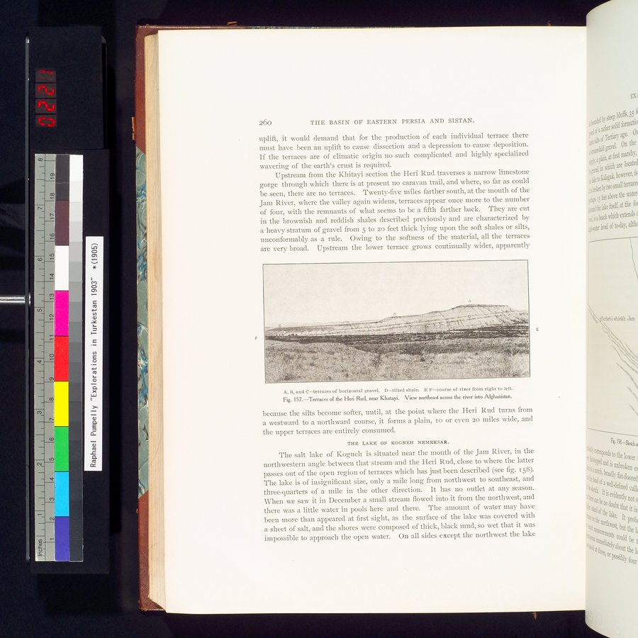 |
| Khatayi近郊のHeri Rudの段丘 川を横切ってアフガニスタンまでの北東の眺望Terraces of the Heri Rud, near Khatayi. View northeast across the river into Afghanistan. |
| 260 | THE BASIN OF EASTERN PERSIA AND SISTAN. |
uplift, it would demand that for the production of each individual terrace there must have been an uplift to cause dissection and a depression to cause deposition. If the terraces are of climatic origin no such complicated and highly specialized wavering of the earth's crust is required.
Upstream from the Khitayi section the Heri Rud traverses a narrow limestone gorge through which there is at present no caravan trail, and where, so far as could be seen, there are no terraces. Twenty-five miles farther south, at the mouth of the Jaen River, where the valley again widens, terraces appear once more to the number of four, with the remnants of what seems to be a fifth farther back. They are cut in the brownish and reddish shales described previously and are characterized by a heavy stratum of gravel from 5 to 20 feet thick lying upon the soft shales or silts, unconformably as a rule. Owing to the softness of the material, all the terraces are very broad. Upstream the lower terrace grows continually wider, apparently
A, B, and C=terraces of horizontal gravel. D=tilted shale. E F=course of river from right to left. Fig. 157.—Terraces of the Heri Rud, near Khatayi. View northeast across the river into Afghanistan.
because the silts become softer, until, at the point where the Heri Rud turns from a westward to a northward course, it forms a plain, io or even 20 miles wide, and the upper terraces are entirely consumed.
THE LAKE OF KOGNEH N$1â$KSAR.
The salt lake of Kogneh is situated near the mouth of the Jam River, in the northwestern angle between that stream and the Heri Rud, close to where the latter passes out of the open region of terraces which has just been described (see fig. 158). The lake is of insignificant size, only a mile long from northwest to southeast, and three-quarters of a mile in the other direction. It has no outlet at any season. When we saw it in December a small stream flowed into it from the northwest, and there was a little water in pools here and there. The amount of water may have been more than appeared at first sight, as the surface of the lake was covered with a sheet Of salt, and the shores were composed of thick, black mud, so wet that it was impossible to approach the open water. On all sides except the northwest the lake
|
Copyright (C) 2003-2019
National Institute of Informatics(国立情報学研究所)
and
The Toyo Bunko(東洋文庫). All Rights Reserved.
本ウェブサイトに掲載するデジタル文化資源の無断転載は固くお断りいたします。