National Institute of Informatics - Digital Silk Road Project
| |||||||||
|
| Across Asia : vol.1 |
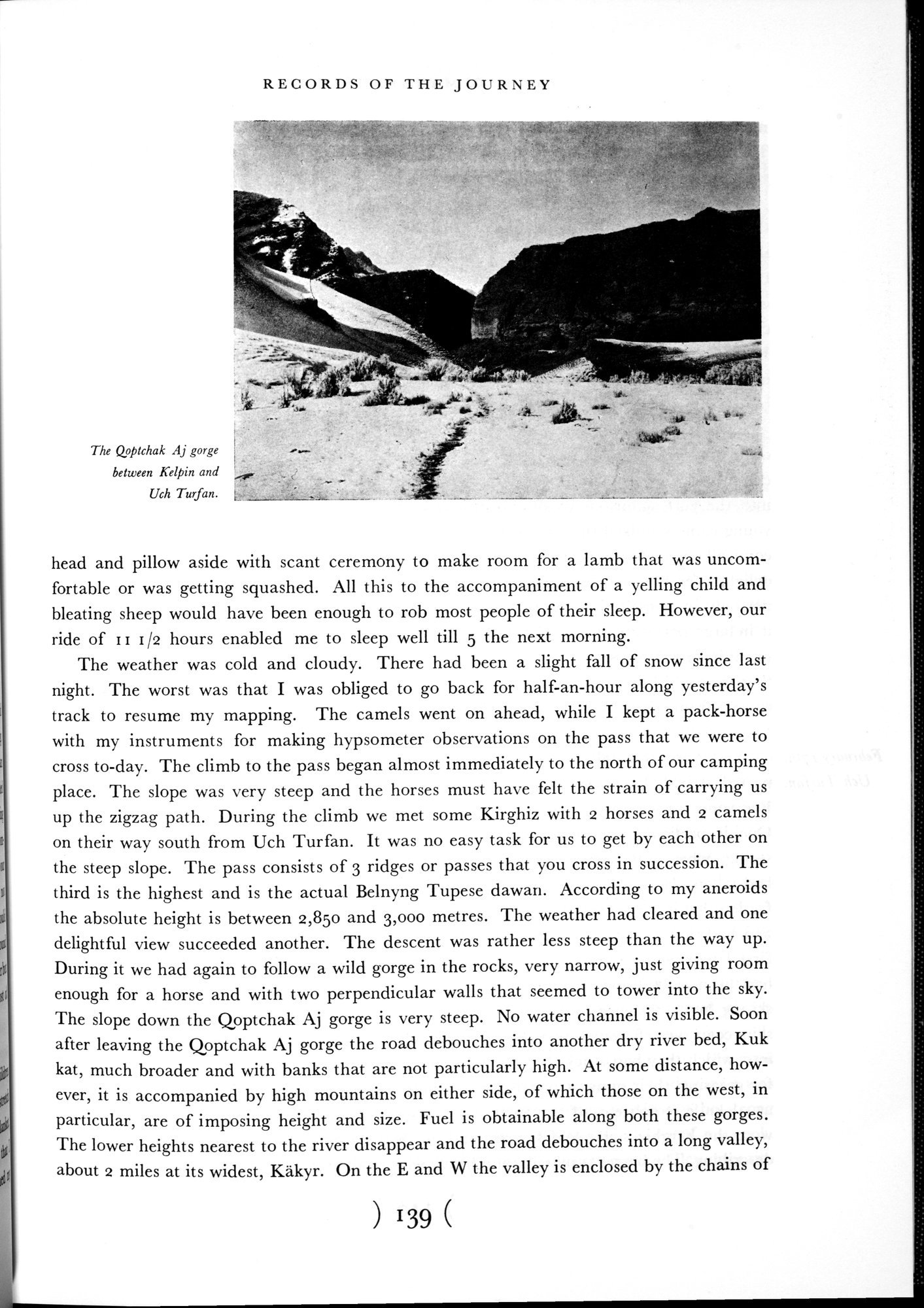 |
| The Qoptchak Aj gorge between Kelpin and Uch Turfan. |
RECORDS OF THE JOURNEY
head and pillow aside with scant ceremony to make room for a lamb that was uncomfortable or was getting squashed. All this to the accompaniment of a yelling child and bleating sheep would have been enough to rob most people of their sleep. However, our ride of II I /2 hours enabled me to sleep well till 5 the next morning.
The weather was cold and cloudy. There had been a slight fall of snow since last night. The worst was that I was obliged to go back for half-an-hour along yesterday's track to resume my mapping. The camels went on ahead, while I kept a pack-horse with my instruments for making hypsometer observations on the pass that we were to cross to-day. The climb to the pass began almost immediately to the north of our camping place. The slope was very steep and the horses must have felt the strain of carrying us up the zigzag path. During the climb we met some Kirghiz with 2 horses and 2 camels on their way south from Uch Turfan. It was no easy task for us to get by each other on the steep slope. The pass consists of 3 ridges or passes that you cross in succession. The third is the highest and is the actual Belnyng Tupese dawari. According to my aneroids the absolute height is between 2,850 and 3,000 metres. The weather had cleared and one delightful view succeeded another. The descent was rather less steep than the way up. During it we had again to follow a wild gorge in the rocks, very narrow, just giving room enough for a horse and with two perpendicular walls that seemed to tower into the sky. The slope down the Qoptchak Aj gorge is very steep. No water channel is visible. Soon after leaving the Qoptchak Aj gorge the road debouches into another dry river bed, Kuk kat, much broader and with banks that are not particularly high. At some distance, however, it is accompanied by high mountains on either side, of which those on the west, in particular, are of imposing height and size. Fuel is obtainable along both these gorges. The lower heights nearest to the river disappear and the road debouches into a long valley, about 2 miles at its widest, Käkyr. On the E and W the valley is enclosed by the chains of
) 139 (
The Qoptchak Aj gorge between Kelpin and
Uch Turfan.
|
Copyright (C) 2003-2019 National Institute of Informatics and The Toyo Bunko. All Rights Reserved.