国立情報学研究所 - ディジタル・シルクロード・プロジェクト
| |||||||||
|
| Southern Tibet : vol.7 | |
| 南チベット : vol.7 |
 |
a
334
RI CHTHOFEN.
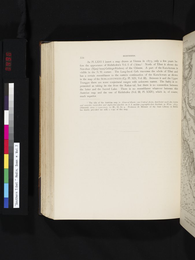
As Pl. LXVI I insert a map drawn at Vienna in 1873, only a few years before the appearance of Richthofen's Vol. I of China.' North of Tibet it shows the Nan-shan (Njanj-Szanj-Gebirgs-Rücken) of the Chinese. A part of the Kara-korum is visible in the N. W. corner. The Lang-bu-zi Geb. traverses the whole of Tibet and has a certain resemblance to the eastern continuation of the Kara-korum as shown in the map of the SCHLAGINTWEITS (Cp. Pl. XIX, Vol. III). Between it and the Upper Tsangpo there are some conjectural ranges with unknown names. The Satlej is represented as taking its rise from the Rakas - tal , but there is no connection between the latter and the Sacred Lake. There is no resemblance whatever between this Austrian map and the one of Richthofen (Vol. III, Pl. XXIV), which is, of course, much superior.
1 The title of the Austrian map is : General-Karte von Central-Asien, bearbeitet nach den besten und neuesten russischen und englischen Quellen im k. k. militär-geographischen Institute in Wien. 1873. (Massstab circa i :2 900 000), i 2 Bl., B1. Nr. 9. Professor H. Meisner of the State Library in Berlin has kindly provided me with a copy of this map.
|
Copyright (C) 2003-2019
National Institute of Informatics(国立情報学研究所)
and
The Toyo Bunko(東洋文庫). All Rights Reserved.
本ウェブサイトに掲載するデジタル文化資源の無断転載は固くお断りいたします。