国立情報学研究所 - ディジタル・シルクロード・プロジェクト
| |||||||||
|
| Explorations in Turkestan : Expedition of 1904 : vol.1 | |
| トルキスタンの調査 1904年 : vol.1 |
 |
| 上層発掘現場の平面図Plan of Upper Digging. |
IO6 THE ARCHEOLOGICAL EXCAVATIONS IN ANAU.
declivity near terrace B, where the lowest culture-strata were found to the level of — 22 feet; and lastly by shaft D, which began at — 5 feet in the outer digging, and was sunk to a depth of — 31 feet, exposing culture-strata to a depth of — 23 feet.
These shafts, as well as some óthers at the northeast corner of the kurgan, were intended chiefly for physiographic purposes; but the culture material which was raised from them was of archeological value, even though it furnished only a meager basis for understanding the character of the lowest culture-strata.
EXCAVATIONS AND FINDS AT DIFFERENT LOCALITIES.
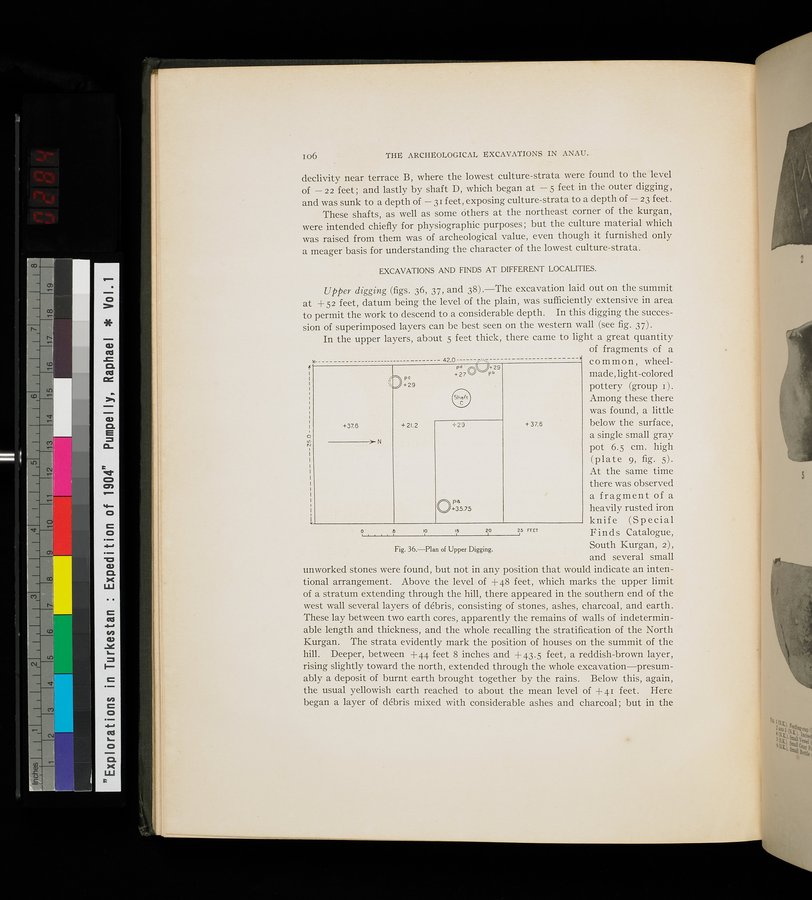
Upper digging (figs. 36, 37, and 38).—The excavation laid out on the summit at + 52 feet, datum being the level of the plain, was sufficiently extensive in area to permit the work to descend to a considerable depth. In this digging the succession of superimposed layers can be best seen on the western wall (see fig. 37).
In the upper layers, about 5 feet thick, there came to light a great quantity of fragments of a
common, wheel-
made, light-colored pottery (group 1) . Among these there was found, a little below the surface, a single small gray
" pot 6.5 cm. high
(plate 9, fig. 5). At the same time there was observed a fragment of a heavily rusted iron
! knife (Special
0 Finds Catalogue,
South Kurgan, 2) , and several small
unworked stones were found, but not in any position that would indicate an intentional arrangement. Above the level of +48 feet, which marks the upper limit of a stratum extending through the hill, there appeared in the southern end of the west wall several layers of débris, consisting of stones, ashes, charcoal, and earth. These lay between two earth cores, apparently the remains of walls of indeterminable length and thickness, and the whole recalling the stratification of the North Kurgan. The strata evidently mark the position of houses on the summit of the hill. Deeper, between +44 feet 8 inches and +43.5 feet, a reddish-brown layer, rising slightly toward the north, extended through the whole excavation—presumably a deposit of burnt earth brought together by the rains. Below this, again, the usual yellowish earth reached to about the mean level of +41 feet. Here began a layer of débris mixed with considerable ashes and charcoal; but in the
+37.6
N
p+29
+21.2 +29
pd
+27
I+29 Pb
+ 37.6
Opa +35.75
.0
15
2,0
25 rrET
Fig. 36.—Plan of Upper Digging.
|
Copyright (C) 2003-2019
National Institute of Informatics(国立情報学研究所)
and
The Toyo Bunko(東洋文庫). All Rights Reserved.
本ウェブサイトに掲載するデジタル文化資源の無断転載は固くお断りいたします。