国立情報学研究所 - ディジタル・シルクロード・プロジェクト
| |||||||||
|
| Scientific Results of a Journey in Central Asia, 1899-1902 : vol.3 | |
| 1899-1902年の中央アジア旅行における科学的成果 : vol.3 |
 |
,
I ?,
•
76 MY FIRST JOURNEY IN NORTH-EASTERN TIBET.
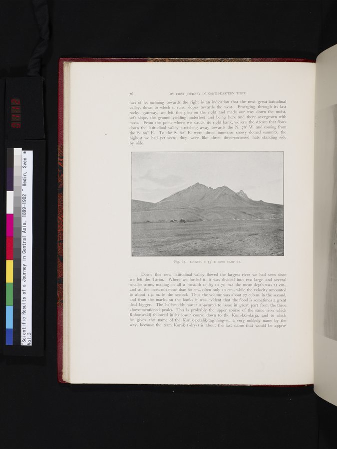
fact of its inclining towards the right is an indication that the next great latitudinal valley, down to which it runs, slopes towards the west. Emerging through its last rocky gateway, we left this glen on the right and made our way down the moist, soft slope, the ground yielding underfoot and being here and there overgrown with moss. From the point where we struck its right bank, we saw the stream that flows down the latitudinal valley stretching away towards the N. 78° W. and coming from the S. 69° E. To the S. 62° E. were three immense snowy domed summits, the highest we had yet seen; they were like three three-cornered hats standing side
by side.
Down this new latitudinal valley flowed the largest river we had seen since we left the Tarim. Where we forded it, it was divided into two large and several smaller arms, making in all a breadth of 65 to 7o m. ; the mean depth was 25 cm., and at the most not more than 6o cm., often only I o cm., while the velocity amounted to about 1.50 m. in the second. Thus the volume was about 27 cub.m. in the second, and from the marks on the banks it was evident that the flood is sometimes a great deal bigger. The half-muddy water appeared to issue in great part from the three above-mentioned peaks. This is probably the upper course of the same river which Roborovskij followed in its lower_ course down to the Kum-köl-darja, and to which he gives the name of the Kuruk-petelik-taghning-su, a very unlikely name by the way, because the term Kuruk (»dry») is about the last name that would be appro-
Fig. 63. LOOKING S 75- E FROM CAMP XX.
|
Copyright (C) 2003-2019
National Institute of Informatics(国立情報学研究所)
and
The Toyo Bunko(東洋文庫). All Rights Reserved.
本ウェブサイトに掲載するデジタル文化資源の無断転載は固くお断りいたします。