国立情報学研究所 - ディジタル・シルクロード・プロジェクト
| |||||||||
|
| Ruins of Desert Cathay : vol.2 | |
| 中国砂漠地帯の遺跡 : vol.2 |
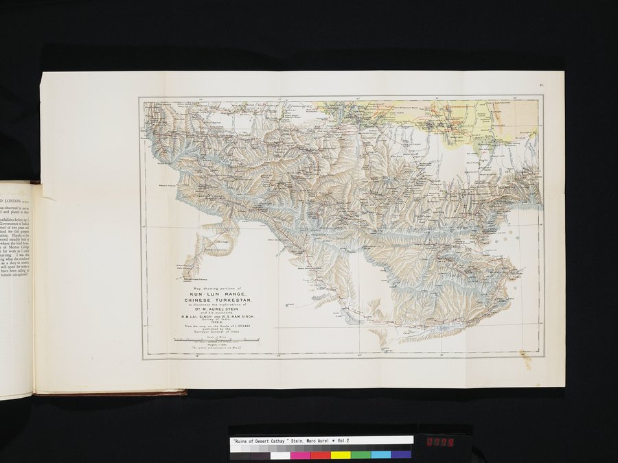 |
| 地図は東トルキスタンのクンルン山脈の一部を示し、M. オーレル=スタイン博士と彼の助手であるR. B. ラル=シンとR. S. ラム=シンの探検を図示している.インド測量局主任.1906-8年.Map showing portions of KUN-LUN RANGE, CHINESE TURKESTAN, to illustrate the explorations of DR. M. AUREL STEIN and his assistants R. B. LAL SINGH AND R.S. RAM SINGH. Surveyor General of India. 1906-8. |
¢.
| .1,••• ;•.••, |
\ .~✓«:/,.
i '.s:;3-i1dd\~•~~
m•.At Sae
Map showing port,onn of
KUN - LUN RANGE.
CHINESE TURKESTAN,
to IIv strate the explorations of
D^ M. AUREL STEIN
and his assistants
R.S.LAL SINGH AND R.S.RAM SINGH.
Survey of India.
1906-8.
From the map en the Scale of h 253,440
published by the
Surveyor G I of India.
4_• Saal..aâ Adel. .e
1.1n. fa. i I: ••p00..
Heights ,n net
(6.symbols and.Yl....pe•• see Map l)
|
Copyright (C) 2003-2019
National Institute of Informatics(国立情報学研究所)
and
The Toyo Bunko(東洋文庫). All Rights Reserved.
本ウェブサイトに掲載するデジタル文化資源の無断転載は固くお断りいたします。