国立情報学研究所 - ディジタル・シルクロード・プロジェクト
| |||||||||
|
| Scientific Results of a Journey in Central Asia, 1899-1902 : vol.4 | |
| 1899-1902年の中央アジア旅行における科学的成果 : vol.4 |
 |
THE LAKOR-TSO AND ITS BEACH-LINES.
159
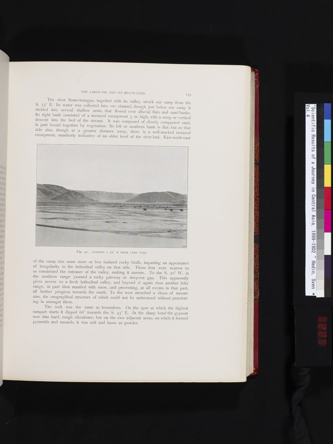
The river Some-tsangpo, together with its valley, struck our camp from the S. 73° E. Its water was collected into one channel, though just below our camp it divided into several shallow arms, that flowed over alluvial flats and sand-banks. Its right bank consisted of a terraced escarpment 3 m. high, with a steep or vertical descent into the bed of the stream. It was composed of closely compacted sand, in part bound together by vegetation. Its left or southern bank is flat; but on that side also, though at a greater distance away, there is a well-marked terraced escarpment, manifestly indicative of an older level of the river-bed. East-north-east
Fig. 92. LOOKING S 200 W FROM CAMP CVIII.
of the camp rise some more or less isolated rocky bluffs, imparting an appearance of irregularity to the latitudinal valley on that side. Those that were nearest to us constricted the entrance of the valley, making it narrow. To the S. 2o° W. in the southern range yawned a rocky gateway or deep-cut gap. This apparently gives access to a fresh latitudinal valley, and beyond it again rises another lofty range, in part then mantled with snow, and preventing, at all events in that part, all further progress towards the south. To the west stretched a chaos of mountains, the orographical structure of which could not be understood without penetrat-
ing in amongst them.
The rock was the same as heretofore. On the spur at which the highest rampart starts it dipped 66° towards the S. 43° E. At the sharp bend the gypsum rose into hard, rough elevations; but on the two adjacent areas, on which it formed pyramids and mounds, it was soft and loose as powder.
|
Copyright (C) 2003-2019
National Institute of Informatics(国立情報学研究所)
and
The Toyo Bunko(東洋文庫). All Rights Reserved.
本ウェブサイトに掲載するデジタル文化資源の無断転載は固くお断りいたします。