国立情報学研究所 - ディジタル・シルクロード・プロジェクト
| |||||||||
|
| Scientific Results of a Journey in Central Asia, 1899-1902 : vol.4 | |
| 1899-1902年の中央アジア旅行における科学的成果 : vol.4 |
 |
270 WESTWARDS TO LADAK.
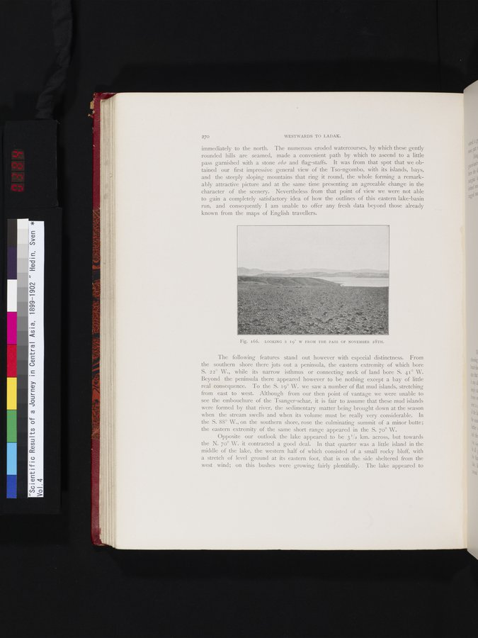
immediately to the north. The numerous eroded watercourses, by which these gently rounded hills are seamed, made a convenient path by which to ascend to a little pass garnished with a stone obo and flag-staffs. It was from that spot that we obtained our first impressive general view of the Tso-ngombo, with its islands, bays, and the steeply sloping mountains that ring it round, the whole forming a remarkably attractive picture and at the same time presenting an agreeable change in the character of the scenery. Nevertheless from that point of view we were not able to gain a completely satisfactory idea of how the outlines of this eastern lake-basin run, and consequently I am unable to offer any fresh data beyond those already known from the maps of English travellers.
The following features stand out however with especial distinctness. From the southern shore there juts out a peninsula, the eastern extremity of which bore S. 22° W., while its narrow isthmus or connecting neck of land bore S. 41° W. Beyond the peninsula there appeared however to be nothing except a bay of little real consequence. To the S. 19° W. we saw a number of flat mud islands, stretching from east to west. Although from our then point of vantage we were unable to see the embouchure of the Tsanger-schar, it is fair to assume that these mud islands were formed by that river, the sedimentary matter being brought down at the season when the stream swells and when its volume must be really very considerable. In the S. 88° W., on the southern shore, rose the culminating summit of a minor butte; the eastern extremity of the same short range appeared in the S. 70° W.
Opposite our outlook the lake appeared to be 3'/2 km. across, but towards the N. 7o° W. it contracted a good deal. In that quarter was a little island in the middle of the lake, the western half of which consisted of a small rocky bluff, with a stretch of level ground at its eastern foot, that is on the side sheltered from the west wind; on this bushes were growing fairly plentifully. The lake appeared to
Fig. 166. LOOKING S 19° W FROM THE PASS OF NOVEMBER 28TH.
|
Copyright (C) 2003-2019
National Institute of Informatics(国立情報学研究所)
and
The Toyo Bunko(東洋文庫). All Rights Reserved.
本ウェブサイトに掲載するデジタル文化資源の無断転載は固くお断りいたします。