National Institute of Informatics - Digital Silk Road Project
| |||||||||
|
| Memoir on Maps of Chinese Turkistan and Kansu : vol.1 |
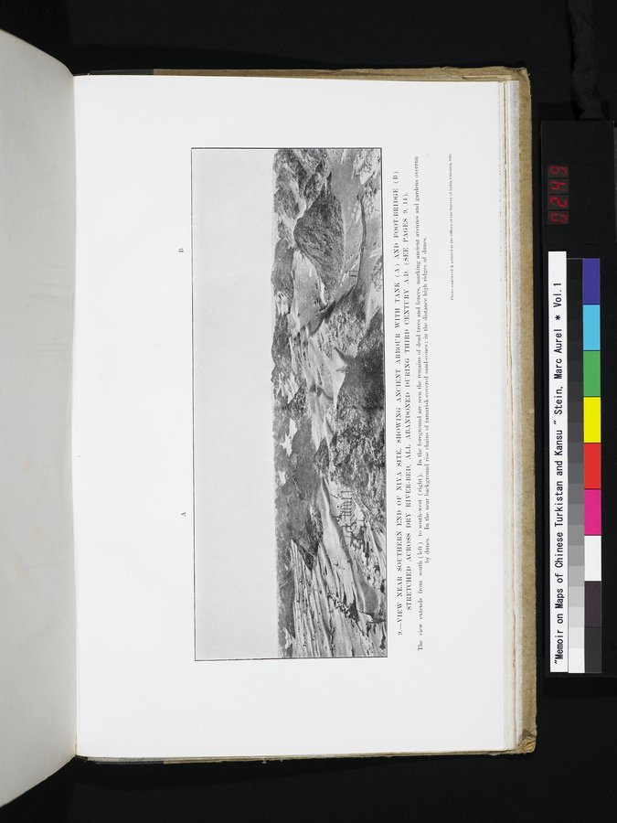 |
| VIEW NEAR SOUTHERN END OF NIYA SITE, SHOWING ANCIENT ARBOUR WITH TANK (A) AND FOOT-BRIDGE (B) STRETCHED ACROSS DRY RIVER-BED, ALL ABANDONED DURING THIRD CENTURY A.D. (SEE PAGES 9, 14). The view extends from south (left) to south-west (right). In the foreground are seen the remains of dead trees and fences, marking ancient avenues and gardens overrun by dunes. In the near background rise chains of tamarisk-coverd sand-cones; in the distance high ridges of dunes. |
I;
9.—VIEW NEAR SOUTHERN END OF NINA SITE, SHOWING ANCIENT ARBOUR. WITH TANI: ) ANI) Foot-BRIDGE (B)
STRETCHED ACROSS DRY RIVER-BED, ALL ABANDONED DURING THIRD CENTURY A. D. (SEE PAGES 9, 14).
The view extends from south (left) to south-west (right). In the foreground are seen the remains of dead trees and fences, marking ancient avenues and gardens overrun by dunes. In the near background rise chains of tamarisk-covered sand-cones; in the distance high ridges of dunes.
Phutu.-euKntred &Printed at. the• Utlleeu of the Survey ut Iudin. Unlcutta, 192:1
|
Copyright (C) 2003-2019 National Institute of Informatics and The Toyo Bunko. All Rights Reserved.