国立情報学研究所 - ディジタル・シルクロード・プロジェクト
| |||||||||
|
| Scientific Results of a Journey in Central Asia, 1899-1902 : vol.1 | |
| 1899-1902年の中央アジア旅行における科学的成果 : vol.1 |
 |
| 右岸の砂地。Sand on the River-bank |
THE STRUGGLE BETWEEN THE RIVER AND THE SAND. 167
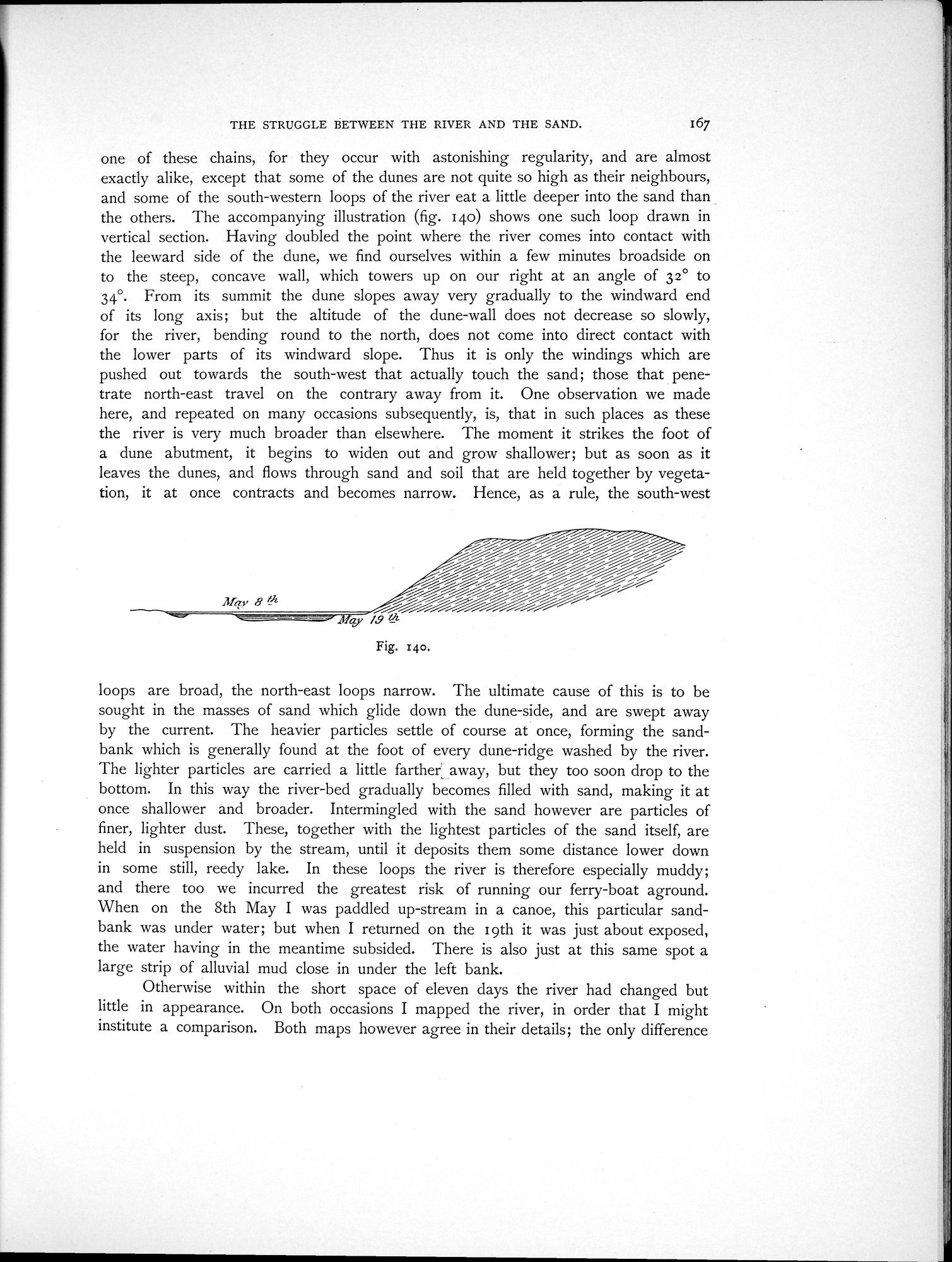
one of these chains, for they occur with astonishing regularity, and are almost exactly alike, except that some of the dunes are not quite so high as their neighbours, and some of the south-western loops of the river eat a little deeper into the sand than the others. The accompanying illustration (fig. 140) shows one such loop drawn in vertical section. Having doubled the point where the river comes into contact with the leeward side of the dune, we find ourselves within a few minutes broadside on to the steep, concave wall, which towers up on our right at an angle of 32° to 34°• From its summit the dune slopes away very gradually to the windward end of its long axis; but the altitude of the dune-wall does not decrease so slowly, for the river, bending round to the north, does not come into direct contact with the lower parts of its windward slope. Thus it is only the windings which are pushed out towards the south-west that actually touch the sand; those that penetrate north-east travel on the contrary away from it. One observation we made here, and repeated on many occasions subsequently, is, that in such places as these the river is very much broader than elsewhere. The moment it strikes the foot of a dune abutment, it begins to widen out and grow shallower; but as soon as it leaves the dunes, and flows through sand and soil that are held together by vegetation, it at once contracts and becomes narrow. Hence, as a rule, the south-west
loops are broad, the north-east loops narrow. The ultimate cause of this is to be sought in the masses of sand which glide down the dune-side, and are swept away by the current. The heavier particles settle of course at once, forming the sandbank which is generally found at the foot of every dune-ridge washed by the river. The lighter particles are carried a little farther away, but they too soon drop to the bottom. In this way the river-bed gradually becomes filled with sand, making it at once shallower and broader. Intermingled with the sand however are particles of finer, lighter dust. These, together with the lightest particles of the sand itself, are held in suspension by the stream, until it deposits them some distance lower down in some still, reedy lake. In these loops the river is therefore especially muddy; and there too we incurred the greatest risk of running our ferry-boat aground. When on the 8th May I was paddled up-stream in a canoe, this particular sandbank was under water; but when I returned on the 1 gth it was just about exposed, the water having in the meantime subsided. There is also just at this same spot a large strip of alluvial mud close in under the left bank.
Otherwise within the short space of eleven days the river had changed but little in appearance. On both occasions I mapped the river, in order that I might institute a comparison. Both maps however agree in their details; the only difference
t3fav B Ui
-.s
Fig. 14o.
|
Copyright (C) 2003-2019
National Institute of Informatics(国立情報学研究所)
and
The Toyo Bunko(東洋文庫). All Rights Reserved.
本ウェブサイトに掲載するデジタル文化資源の無断転載は固くお断りいたします。