国立情報学研究所 - ディジタル・シルクロード・プロジェクト
| |||||||||
|
| Scientific Results of a Journey in Central Asia, 1899-1902 : vol.1 | |
| 1899-1902年の中央アジア旅行における科学的成果 : vol.1 |
 |
| 河川の開口部の横断面。TRANSVERSE SECTION OF OPEN PART OF THE RIVER. | |
| ハラディガン・クテク、9月30日。Haradighan-kötäk, Sept. 30. |
28 THE TARIM RIVER.
which sometimes reached 8 m. At the same time the velocity was proportionally diminished. The subjoined illustration (Fig. 31) shows a transverse section of the stream at one of the sharp bends. In other places the banks on both sides are
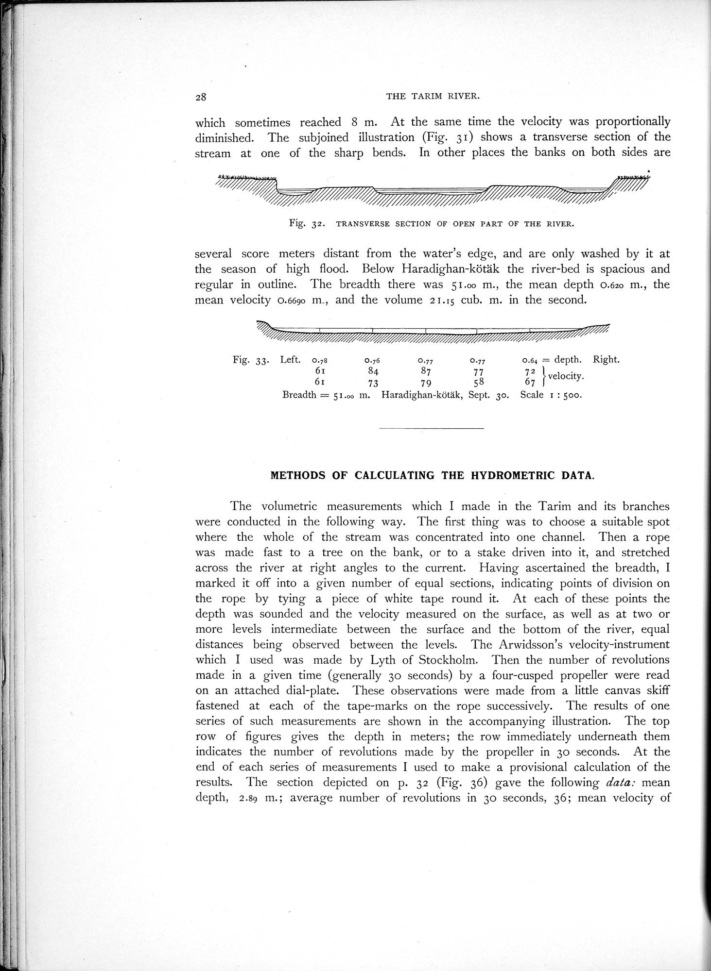
Fig. 32. TRANSVERSE SECTION OF OPEN PART OF THE RIVER.
several score meters distant from the water's edge, and are only washed by it at the season of high flood. Below Haradighan-kötäk the river-bed is spacious and regular in outline. The breadth there was 51.00 m., the mean depth 0.620 m., the mean velocity 0.6690 m., and the volume 21.15 cub. m. in the second.
Fig. 33. Left. 0.78 0.76 0.77 0.77 0.64 = depth. Right.
61 84 87 77 72 velocity.
61 73 79 58 67
Breadth = 51.00 m. Haradighan-kötäk, Sept. 3o. Scale 1 : 500.
METHODS OF CALCULATING THE HYDROMETRIC DATA.
The volumetric measurements which I made in the Tarim and its branches were conducted in the following way. The first thing was to choose a suitable spot where the whole of the stream was concentrated into one channel. Then a rope was made fast to a tree on the bank, or to a stake driven into it, and stretched across the river at right angles to the current. Having ascertained the breadth, I marked it off into a given number of equal sections, indicating points of division on the rope by tying a piece of white tape round it. At each of these points the depth was sounded and the velocity measured on the surface, as well as at two or more levels intermediate between the surface and the bottom of the river, equal distances being observed between the levels. The Arwidsson's velocity-instrument which I used was made by Lyth of Stockholm. Then the number of revolutions made in a given time (generally 3o seconds) by a four-cusped propeller were read on an attached dial-plate. These observations were made from a little canvas skiff fastened at each of the tape-marks on the rope successively. The results of one series of such measurements are shown in the accompanying illustration. The top row of figures gives the depth in meters; the row immediately underneath them indicates the number of revolutions made by the propeller in 3o seconds. At the end of each series of measurements I used to make a provisional calculation of the results. The section depicted on p. 32 (Fig. 36) gave the following data: mean depth, 2.89 m.; average number of revolutions in 3o seconds, 36; mean velocity of
|
Copyright (C) 2003-2019
National Institute of Informatics(国立情報学研究所)
and
The Toyo Bunko(東洋文庫). All Rights Reserved.
本ウェブサイトに掲載するデジタル文化資源の無断転載は固くお断りいたします。