国立情報学研究所 - ディジタル・シルクロード・プロジェクト
| |||||||||
|
| Scientific Results of a Journey in Central Asia, 1899-1902 : vol.1 | |
| 1899-1902年の中央アジア旅行における科学的成果 : vol.1 |
 |
| 第35キャンプ地のイレク川。4月25日。Ilek at Camp XXXV; April 25. |
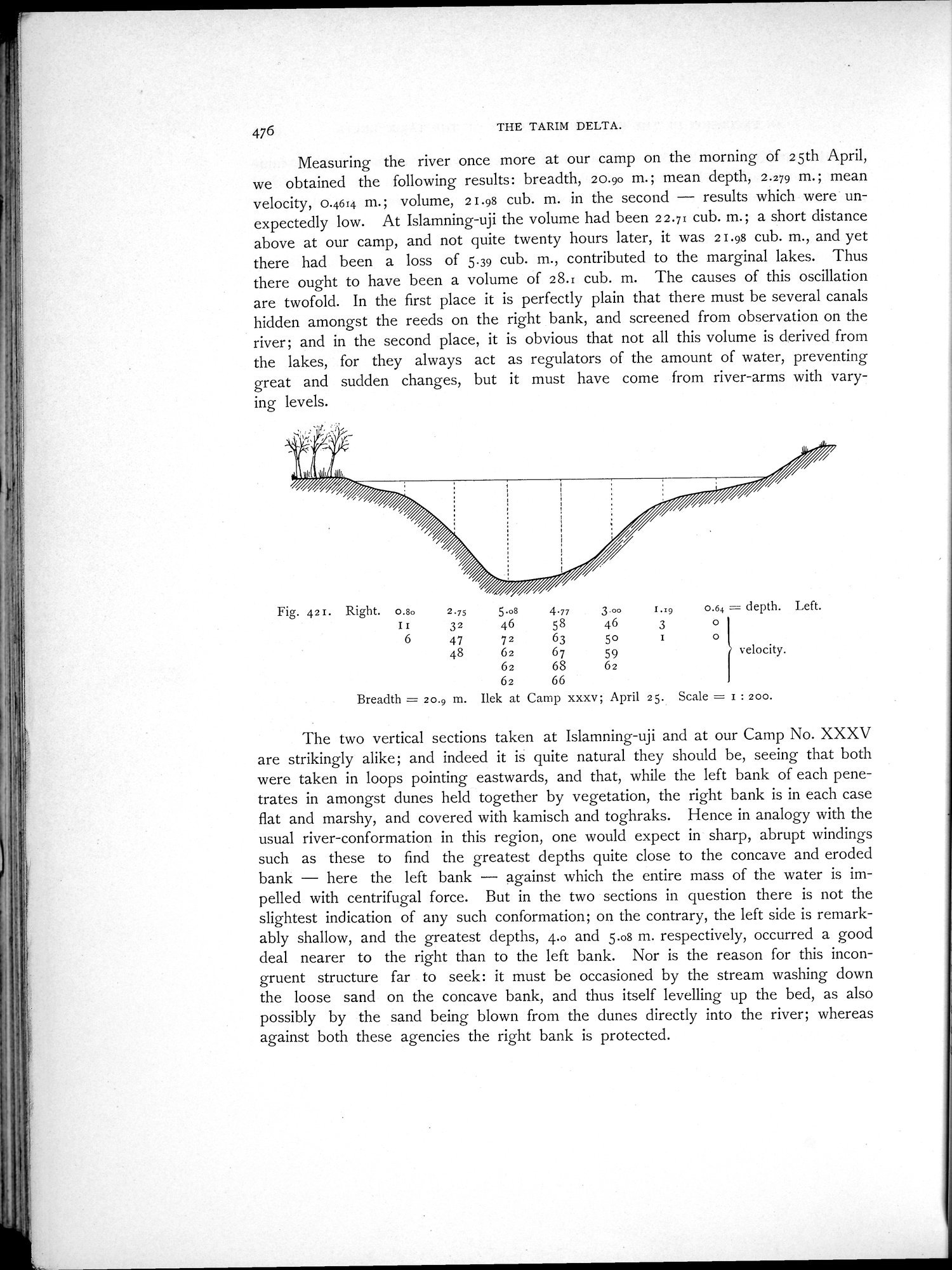
476 THE TARIM DELTA.
Measuring the river once more at our camp on the morning of 25th April, we obtained the following results: breadth, 20.90 m.; mean depth, 2.279 m.; mean velocity, 0.464 m.; volume, 21.98 cub. m. in the second — results which were unexpectedly low. At Islamning-uji the volume had been 22.71 cub. In.; a short distance above at our camp, and not quite twenty hours later, it was 21.98 cub. m., and yet there had been a loss of 5.39 cub. m., contributed to the marginal lakes. Thus there ought to have been a volume of 28.E cub. m. The causes of this oscillation are twofold. In the first place it is perfectly plain that there must be several canals hidden amongst the reeds on the right bank, and screened from observation on the river; and in the second place, it is obvious that not all this volume is derived from the lakes, for they always act as regulators of the amount of water, preventing great and sudden changes, but it must have come from river-arms with varying levels.
Fig. 42 r. Right. 0.8o
II
6
2.75 5.o8 4.77
32 46 58
47 72 63
48 62 67
62 68
62 66
3.00 1.19 0.64 _= depth. Left.
46 30I
5o 1 0
59 velocity.
62
Breadth = 20.9 m. Ilck at Camp xxxv; April 25. Scale = I : 200.
The two vertical sections taken at Islamning-uji and at our Camp No. XXXV are strikingly alike; and indeed it is quite natural they should be, seeing that both were taken in loops pointing eastwards, and that, while the left bank of each penetrates in amongst dunes held together by vegetation, the right bank is in each case flat and marshy, and covered with kamisch and toghraks. Hence in analogy with the usual river-conformation in this region, one would expect in sharp, abrupt windings such as these to find the greatest depths quite close to the concave and eroded bank — here the left bank — against which the entire mass of the water is impelled with centrifugal force. But in the two sections in question there is not the slightest indication of any such conformation; on the contrary, the left side is remarkably shallow, and the greatest depths, 4.0 and 5.o8 m. respectively, occurred a good deal nearer to the right than to the left bank. Nor is the reason for this incongruent structure far to seek: it must be occasioned by the stream washing down the loose sand on the concave bank, and thus itself levelling up the bed, as also possibly by the sand being blown from the dunes directly into the river; whereas against both these agencies the right bank is protected.
|
Copyright (C) 2003-2019
National Institute of Informatics(国立情報学研究所)
and
The Toyo Bunko(東洋文庫). All Rights Reserved.
本ウェブサイトに掲載するデジタル文化資源の無断転載は固くお断りいたします。