322 THE TSCHERTSCHEN DESERT.
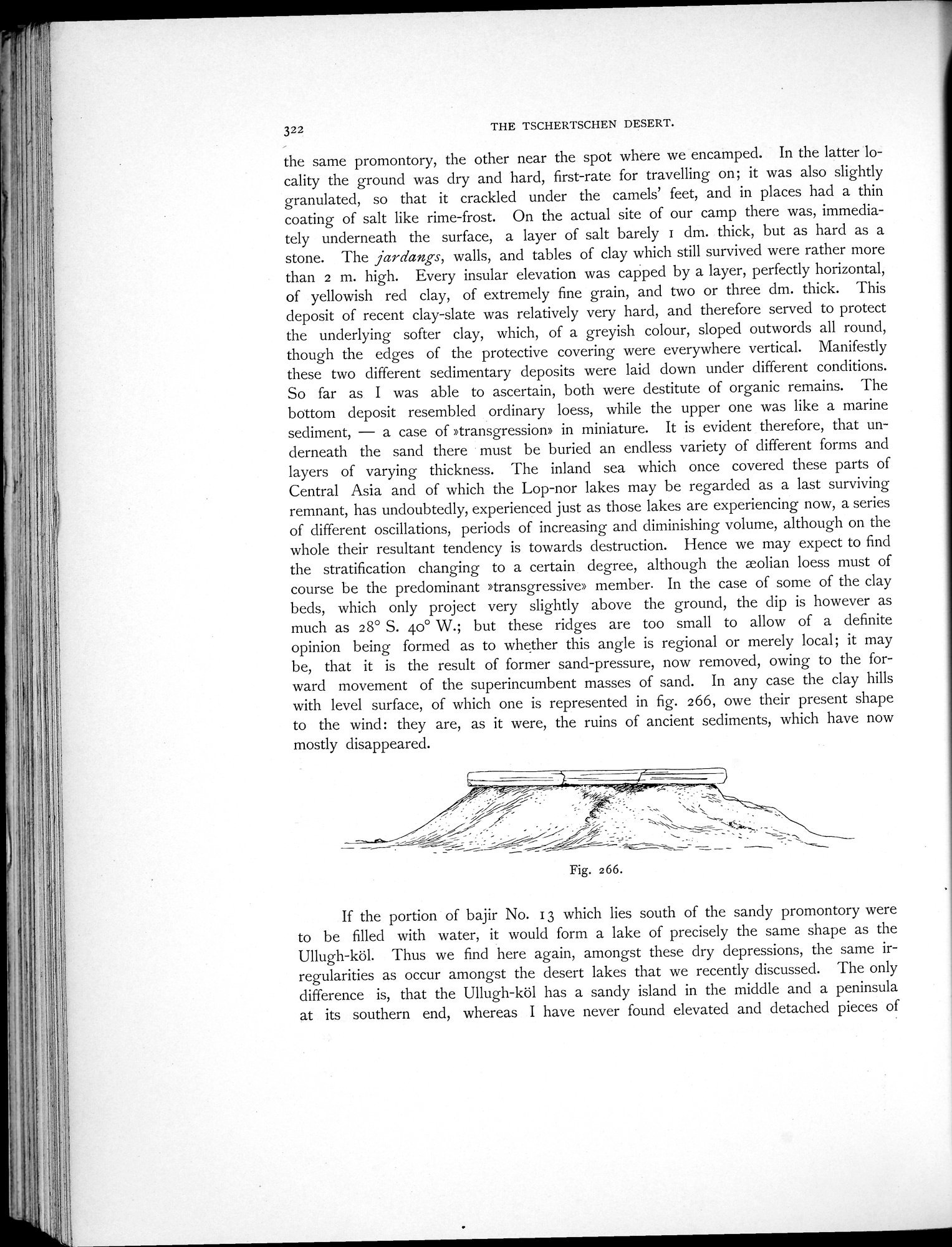
the same promontory, the other near the spot where we encamped. In the latter locality the ground was dry and hard, first-rate for travelling on; it was also slightly granulated, so that it crackled under the camels' feet, and in places had a thin coating of salt like rime-frost. On the actual site of our camp there was, immediately underneath the surface, a layer of salt barely i dm. thick, but as hard as a stone. The jardangs, walls, and tables of clay which still survived were rather more than 2 m. high. Every insular elevation was capped by a layer, perfectly horizontal, of yellowish red clay, of extremely fine grain, and two or three dm. thick. This deposit of recent clay-slate was relatively very hard, and therefore served to protect the underlying softer clay, which, of a greyish colour, sloped outwords all round, though the edges of the protective covering were everywhere vertical. Manifestly these two different sedimentary deposits were laid down under different conditions. So far as I was able to ascertain, both were destitute of organic remains. The bottom deposit resembled ordinary loess, while the upper one was like a marine sediment, — a case of »transgression» in miniature. It is evident therefore, that underneath the sand there must be buried an endless variety of different forms and layers of varying thickness. The inland sea which once covered these parts of Central Asia and of which the Lop-nor lakes may be regarded as a last surviving remnant, has undoubtedly, experienced just as those lakes are experiencing now, a series of different oscillations, periods of increasing and diminishing volume, although on the whole their resultant tendency is towards destruction. Hence we may expect to find the stratification changing to a certain degree, although the wolian loess must of course be the predominant »transgressive» member. In the case of some of the clay beds, which only project very slightly above the ground, the dip is however as much as 28° S. 4o° W.; but these ridges are too small to allow of a definite opinion being formed as to whether this angle is regional or merely local; it may be, that it is the result of former sand-pressure, now removed, owing to the forward movement of the superincumbent masses of sand. In any case the clay hills with level surface, of which one is represented in fig. 266, owe their present shape to the wind: they are, as it were, the ruins of ancient sediments, which have now mostly disappeared.
If the portion of bajir No. 13 which lies south of the sandy promontory were to be filled with water, it would form a lake of precisely the same shape as the Ullugh-köl. Thus we find here again, amongst these dry depressions, the same irregularities as occur amongst the desert lakes that we recently discussed. The only difference is, that the Ullugh-köl has a sandy island in the middle and a peninsula at its southern end, whereas I have never found elevated and detached pieces of