国立情報学研究所 - ディジタル・シルクロード・プロジェクト
| |||||||||
|
| Scientific Results of a Journey in Central Asia, 1899-1902 : vol.1 | |
| 1899-1902年の中央アジア旅行における科学的成果 : vol.1 |
 |
| 湖の深さ。Depth of a lake. |
256 THE LAKES BESIDE THE LOWER TARIM.
the west side of the lake encourages the growth of reeds, which, owing to their thicker, closer growth, are less susceptible to the wind than poplars standing solitary and alone. Sedge (jäkän) occurs in the water near the west side of the sound, as well as immediately around the mouth of the canal. But we did not see any Alg, the lake-bottom being covered throughout with sand. The fauna was confined to hares, wagtails, and terns, though these were all seen singly. Beside the canal one of my Cossacks shot a wild-boar. There were very numerous signs of these last, in their rootings amongst the reeds.
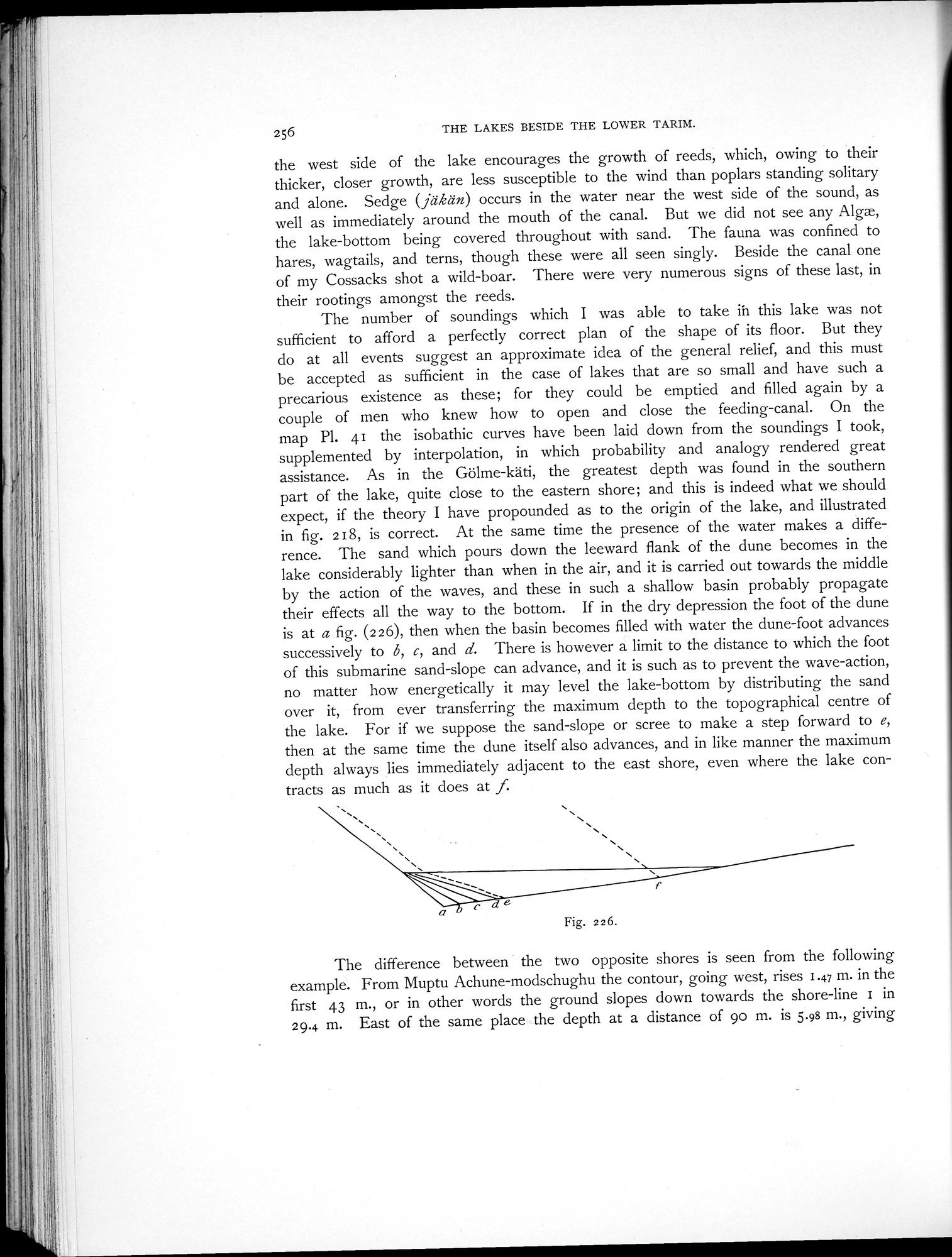
The number of soundings which I was able to take ih this lake was not sufficient to afford a perfectly correct plan of the shape of its floor. But they do at all events suggest an approximate idea of the general relief, and this must be accepted as sufficient in the case of lakes that are so small and have such a precarious existence as these; for they could be emptied and filled again by a couple of men who knew how to open and close the feeding-canal. On the map PI. 41 the isobathic curves have been laid down from the soundings I took, supplemented by interpolation, in which probability and analogy rendered great assistance. As in the Gölme-käti, the greatest depth was found in the southern part of the lake, quite close to the eastern shore; and this is indeed what we should expect, if the theory I have propounded as to the origin of the lake, and illustrated in fig. 218, is correct. At the same time the presence of the water makes a difference. The sand which pours down the leeward flank of the dune becomes in the lake considerably lighter than when in the air, and it is carried out towards the middle by the action of the waves, and these in such a shallow basin probably propagate their effects all the way to the bottom. If in the dry depression the foot of the dune is at a fig. (226), then when the basin becomes filled with water the dune-foot advances successively to b, c, and d. There is however a limit to the distance to which the foot of this submarine sand-slope can advance, and it is such as to prevent the wave-action, no matter how energetically it may level the lake-bottom by distributing the sand over it, from ever transferring the maximum depth to the topographical centre of the lake. For if we suppose the sand-slope or scree to make a step forward to e, then at the same time the dune itself also advances, and in like manner the maximum depth always lies immediately adjacent to the east shore, even where the lake contracts as much as it does at f.
The difference between the two opposite shores is seen from the following example. From Muptu Achune-modschughu the contour, going west, rises 1.47 m. in the first 43 m., or in other words the ground slopes down towards the shore-line 1 in 29.4 m. East of the same place the depth at a distance of 90 m. is 5.98 m., giving
Fig. 226.
|
Copyright (C) 2003-2019
National Institute of Informatics(国立情報学研究所)
and
The Toyo Bunko(東洋文庫). All Rights Reserved.
本ウェブサイトに掲載するデジタル文化資源の無断転載は固くお断りいたします。