国立情報学研究所 - ディジタル・シルクロード・プロジェクト
| |||||||||
|
| Scientific Results of a Journey in Central Asia, 1899-1902 : vol.1 | |
| 1899-1902年の中央アジア旅行における科学的成果 : vol.1 |
 |
| 浸食された地峡。Eroded neck | |
| 浸食された地峡。Eroded neck |
198 THE TARIM RIVER.
to its being interlaced with tree-roots. Hence on each side of the neck of land it is lateral erosion which is the more energetic, but in the deep places bottom erosion.
Lower down the Tarim there do however occur many abandoned loops, resembling a ring drawn round a flourishing patch of forest. Here, in spite of the protection afforded by the network of roots, the neck has nevertheless been cut through. Probably the only difference has been that the process of breaching the isthmus has been spread over a longer period; the result is equally the same, and the river, in effecting the breach, has wrenched away some of the trees. Drift-wood, self-anchored to the alluvial deposits, is quite common in the lower Tarim.
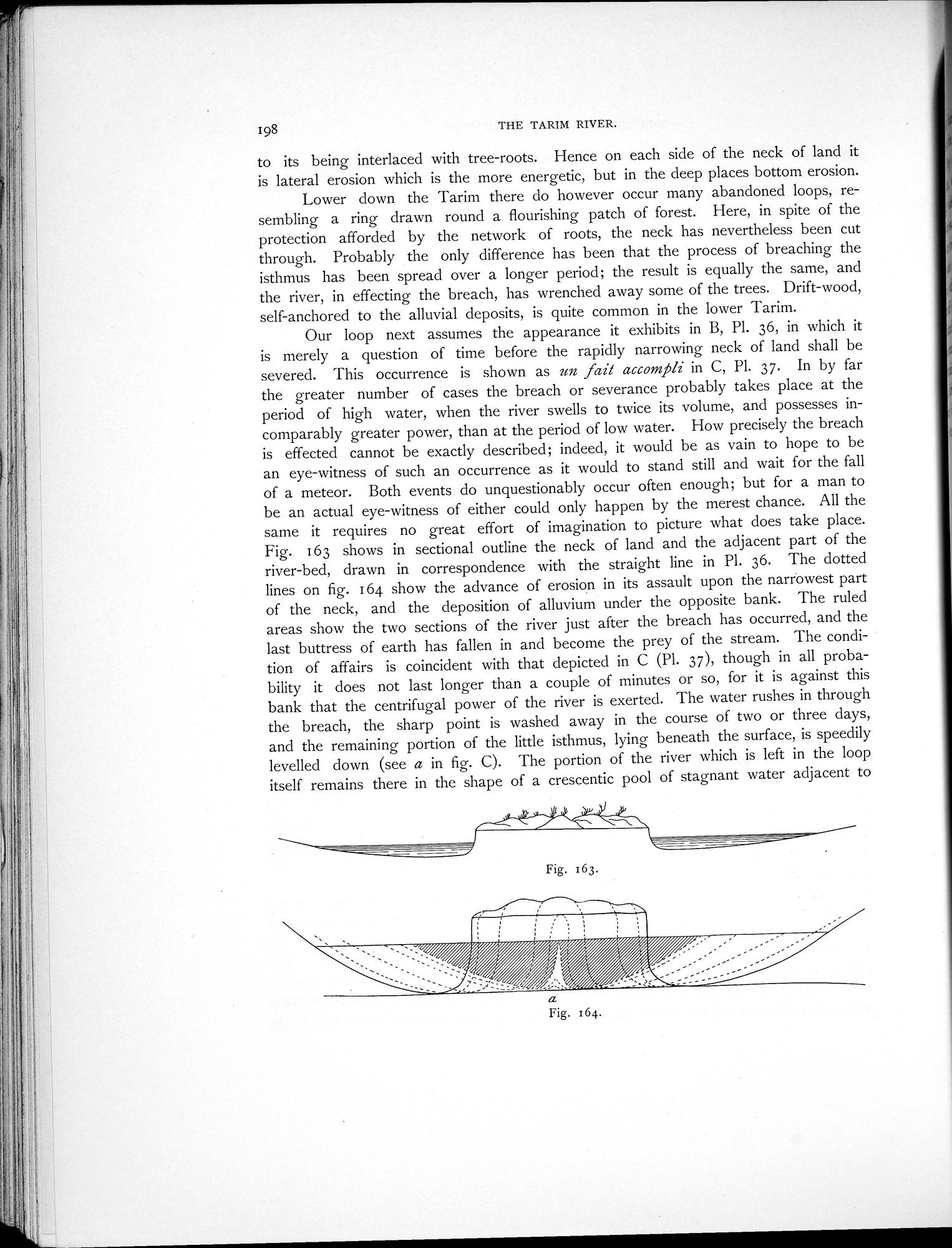
Our loop next assumes the appearance it exhibits in B, Pl. 36, in which it is merely a question of time before the rapidly narrowing neck of land shall be severed. This occurrence is shown as un fail accompli in C, PI. 37. In by far the greater number of cases the breach or severance probably takes place at the period of high water, when the river swells to twice its volume, and possesses incomparably greater power, than at the period of low water. How precisely the breach is effected cannot be exactly described; indeed, it would be as vain to hope to be an eye-witness of such an occurrence as it would to stand still and wait for the fall of a meteor. Both events do unquestionably occur often enough; but for a man to be an actual eye-witness of either could only happen by the merest chance. All the same it requires no great effort of imagination to picture what does take place. Fig. 163 shows in sectional outline the neck of land and the adjacent part of the river-bed, drawn in correspondence with the straight line in Pl. 36. The dotted lines on fig. 164 show the advance of erosion in its assault upon the narrowest part of the neck, and the deposition of alluvium under the opposite bank. The ruled areas show the two sections of the river just after the breach has occurred, and the last buttress of earth has fallen in and become the prey of the stream. 1'he condition of affairs is coincident with that depicted in C (Pl. J7), though in all probability it does not last longer than a couple of minutes or so, for it is against this bank that the centrifugal power of the river is exerted. The water rushes in through the breach, the sharp point is washed away in the course of two or three days, and the remaining portion of the little isthmus, lying beneath the surface, is speedily levelled clown (see a in fig. C). The portion of the river which is left in the loop itself remains there in the shape of a crescentic pool of stagnant water adjacent to
/ j~% / /~__%~:.%~
a
Fig. 164.
Fig. 163.
|
Copyright (C) 2003-2019
National Institute of Informatics(国立情報学研究所)
and
The Toyo Bunko(東洋文庫). All Rights Reserved.
本ウェブサイトに掲載するデジタル文化資源の無断転載は固くお断りいたします。