国立情報学研究所 - ディジタル・シルクロード・プロジェクト
| |||||||||
|
| Scientific Results of a Journey in Central Asia, 1899-1902 : vol.1 | |
| 1899-1902年の中央アジア旅行における科学的成果 : vol.1 |
 |
| カルマク・オトゴの橋、新しいティケンリク付近。BRIDGE OF KALMAK-OTTOGHO, NEAR NEW TIKENLIK. | |
| カルマク・オトゴの合流地点より上流にあるクンチェキシュ・タリム、5月5日。Kuntschekisch-tarim above the confluence of Kalmak-ottogho; May 5th. |
506 THE TARIM DELTA.
last was at that time pretty high. The containing banks were here 3 to 4 m. high and very distinctly marked. Thus, notwithstanding the diminution of volume, the bed still retained its character as the passage-way of a big river.
After a dry watercourse was passed, we came to the Koj-tutuni-kok-alasi, which likewise brings water from the Kontsche-darja. Then followed four other emissaries from the same river, all irregular, winding streams which traverse numerous marshes and lakes. The first of these, the Tangsok-tägirmän-kok-alasi and the Tokta Chodscha-tägirmän-kok-alasi, both coming through the Süstik-köl, join the Kuntschekisch-tarim behind the old deserted village of Tikenlik, the huts of which (I sheltered in them in 1896) still stand uninjured on the bank. The other two, the Kirghuj Pavan-tägirmän-kok-alasi and the Ismail Achun-kok-alasi, drive mills.
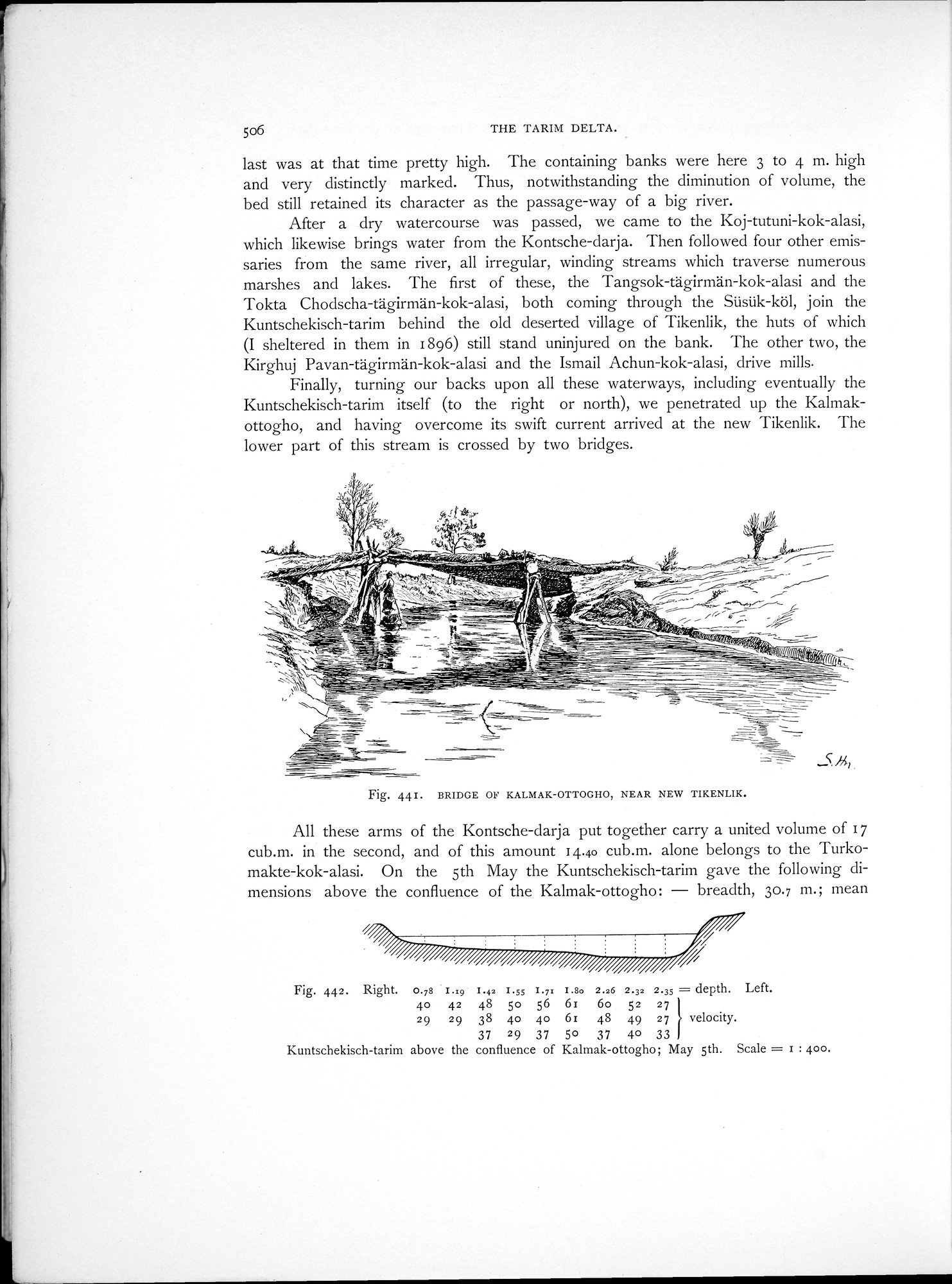
Finally, turning our backs upon all these waterways, including eventually the Kuntschekisch-tarim itself (to the right or north), we penetrated up the Kalmakottogho, and having overcome its swift current arrived at the new Tikenlik. The lower part of this stream is crossed by two bridges.
Fig. 44i. BRIDGE OF KALMAK-OTTOGHO, NEAR NEW TIKENLIK.
All these arms of the Kontsche-darja put together carry a united volume of 17 cub.m. in the second, and of this amount 14.40 cub.m. alone belongs to the Turkomakte-kok-alasi. On the 5th May the Kuntschekisch-tarim gave the following dimensions above the confluence of the Kalmak-ottogho: — breadth, 30.7 m.; mean
Fig. 442. Right. 0.78 • t.:9 1.42 1.5$ I.7: 1.8e 2.26 2.32 2.35 = depth. Left.
4o 42 48 5o 56 6r 6o 52 27
29 29 38 4o 4o 6z 48 49 27 velocity.
37 29 37 50 37 40 33
Kuntschekisch-tarim above the confluence of Kalmak-ottogho; May 5th. Scale = I : 400.
|
Copyright (C) 2003-2019
National Institute of Informatics(国立情報学研究所)
and
The Toyo Bunko(東洋文庫). All Rights Reserved.
本ウェブサイトに掲載するデジタル文化資源の無断転載は固くお断りいたします。