National Institute of Informatics - Digital Silk Road Project
| |||||||||
|
| Ruins of Desert Cathay : vol.2 |
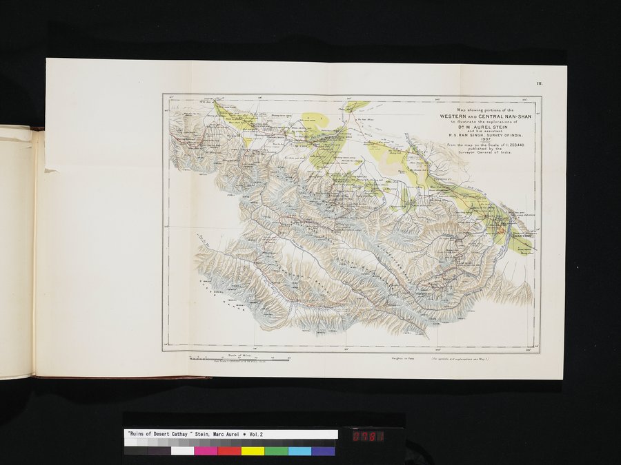 |
| Map showing portions of the WESTERN AND CENTRAL NAN-SHAN to illustrate the explorations of DR. M. AUREL STEIN and his assistant R.S. RAM SINGH, SURVEY OF INDIA. 1907. |
iu.
Map showing portions of the
WESTERN AND CENTRAL NAN-SHAN to Illustrate the explorations of
DR M . AUREL STEIN
and his assistant
R.S.RAM SINGH, SURVEY OF INDIA.
1907..
From the map on the Scale of 1:253.440.
published by the
Surveyor General of India.
i"p.4`,aapl.
K....u..) vk,
4
h
O c
mibk'laci.~.
aee
se•
as'
6 0 Seale of Wes
.t. ..I :1 . o. 3 n. .
Heights in feet
f fo, •>n.DOl• •nd explana6ons see .Nap ) J
|
Copyright (C) 2003-2019 National Institute of Informatics and The Toyo Bunko. All Rights Reserved.