National Institute of Informatics - Digital Silk Road Project
| |||||||||
|
| Peking to Lhasa : vol.1 |
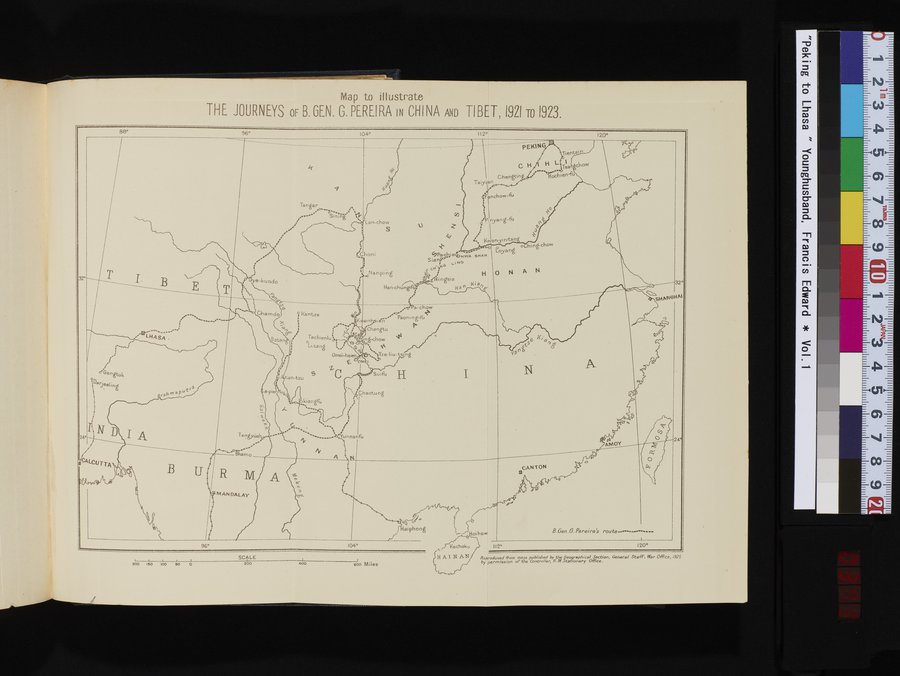 |
Map to illustrate
THE JOURNEYS OF B. GEN. G. PEREIRA IN CHINA AND TIBET,1921 To 1923.
| 88° | 36° | 104° | 112° |
120°
k
PEKING
Tientsi
C H H L Tsa
Chen
Taiyÿan
•
, nchow-îu
"Pi .
P
~a.~~~...~ ...
' LHASA .
;••. ..
f, i
°•Gangtok Darjeeling
Brah`naPu
.! -••••
~ b
i
Tachienlu0
o ~
Li-tang „,
Omei-hsien
zri
S
Tangar
.a--.
°.~ Sining
~
'
,~.
.•
:
Oye-kundo
U+
N
Chamdo ° Kantze
Bata n
,a ikiangfu
°•..,.
.
'-0Nanping
Han•chungful .' i•
,.et~Pa-chow ~,. Paon ng-fu
ng-chow 41-
OM „ ~'tiTze-liu-tsSng
.,)0 j
H
1
`kÇhaotu ng
a-
Lan-chow
S
6 Choni
Suifu
P
i ~
.' •Z`w intan
~ Kwany
0 0 o hing-chow
~
Loyan
Ha
ia
32°
sHANeHAI
I
N
A
4,Pa-ch~a~'sHWA SHAN
Sian `1N0
cN
c yNO H 0 N A N
ZVingsia
:.
D
i
24°
CALCUTTA
A
B
~
Tengyiiehy.
hamo
i
/
""' ........... •1'unnanfu
H
nCANTON
rA
AMOY
24°
O
MANDALAY
11'
aiphong
oihow
B.Gen.G.Pereire's route
I12°
Reproduced from maps published by the eogrophicef Section, General Ste-A. War OfFce,1925 by permission of the Controller, H.M.. tationery Office.
120°
| 96° | 104° | Kacheko n. HAIN AN | ||||||
| i ~ ~ ~ 200 iso i0o eo 0 | SCALE 200 | |||||||
| 400 | soo Miles | |||||||
|
Copyright (C) 2003-2019 National Institute of Informatics and The Toyo Bunko. All Rights Reserved.