National Institute of Informatics - Digital Silk Road Project
| |||||||||
|
| Explorations in Turkestan : Expedition of 1904 : vol.2 |
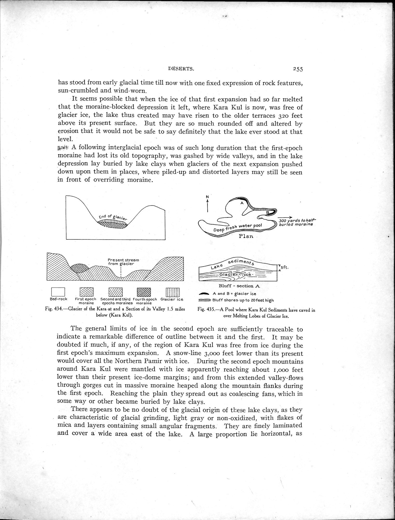 |
| Glacier of the Kara at and a Section of its Valley 1.5 miles below (Kara Kul). | |
| A Pool where Kara Kul Sediments have caved in over Melting Lobes of Glacier Ice. |
DESERTS. 255
has stood from early glacial time till now with one fixed expression of rock features, sun-crumbled and wind-worn.
It seems possible that when the ice of that first expansion had so far melted that the moraine-blocked depression it left, where Kara Kul is now, was free of glacier ice, the lake thus created may have risen to the older terraces 320 feet above its present surface. But they are so much rounded off and altered by erosion that it would not be safe to say definitely that the lake ever stood at that level.
A following interglacial epoch was of such long duration that the first-epoch moraine had lost its old topography, was gashed by wide valleys, and in the lake depression lay buried by lake clays when glaciers of the next expansion pushed down upon them in places, where piled-up and distorted layers may still be seen in front of overriding moraine.
t.nd of glac%e.- .,ou11111111UUb.
3yards to half buried moraine
Deep „ ................. ,...,......
000 0"" Plan
yedi r^ent
Lake 75ft.
~\~\\
Bed-rock First epoch Second and third Fourth epoch Glacier ice
moraine epochs moraines moraine
Fig. 434.—Glacier of the Kara•at and a Section of its Valley 1.5 miles below (Kara Kul).
Bluff - section A
..r A and B = glacier ice
iniaMx Bluff shores up to 20feet high
Fig. 435.—A Pool where Kara Kul Sediments have caved in over Melting Lobes of Glacier Ice.
The general limits of ice in the second epoch are sufficiently traceable to indicate a remarkable difference of outline between it and the first. It may be doubted if much, if any, of the region of Kara Kul was free from ice during the first epoch's maximum expansion. A snow-line 3,000 feet lower than its present would cover all the Northern Pamir with ice. During the second epoch mountains around Kara Kul were mantled with ice apparently reaching about l,000 feet lower than their present ice-dome margins; and from this extended valley-flows through gorges cut in massive moraine heaped along the mountain flanks during the first epoch. Reaching the plain they spread out as coalescing fans, which in some way or other became buried by lake clays.
There appears to be no doubt of the glacial origin of these lake clays, as they are characteristic of glacial grinding, light gray or non-oxidized, with flakes of mica and layers containing small angular fragments. They are finely laminated and cover a wide area east of the lake. A large proportion lie horizontal, as
|
Copyright (C) 2003-2019 National Institute of Informatics and The Toyo Bunko. All Rights Reserved.