National Institute of Informatics - Digital Silk Road Project
| |||||||||
|
| Explorations in Turkestan : Expedition of 1904 : vol.2 |
 |
| Map of the Aralo-Caspion Expansions (Konshin). |
DESERTS. 293
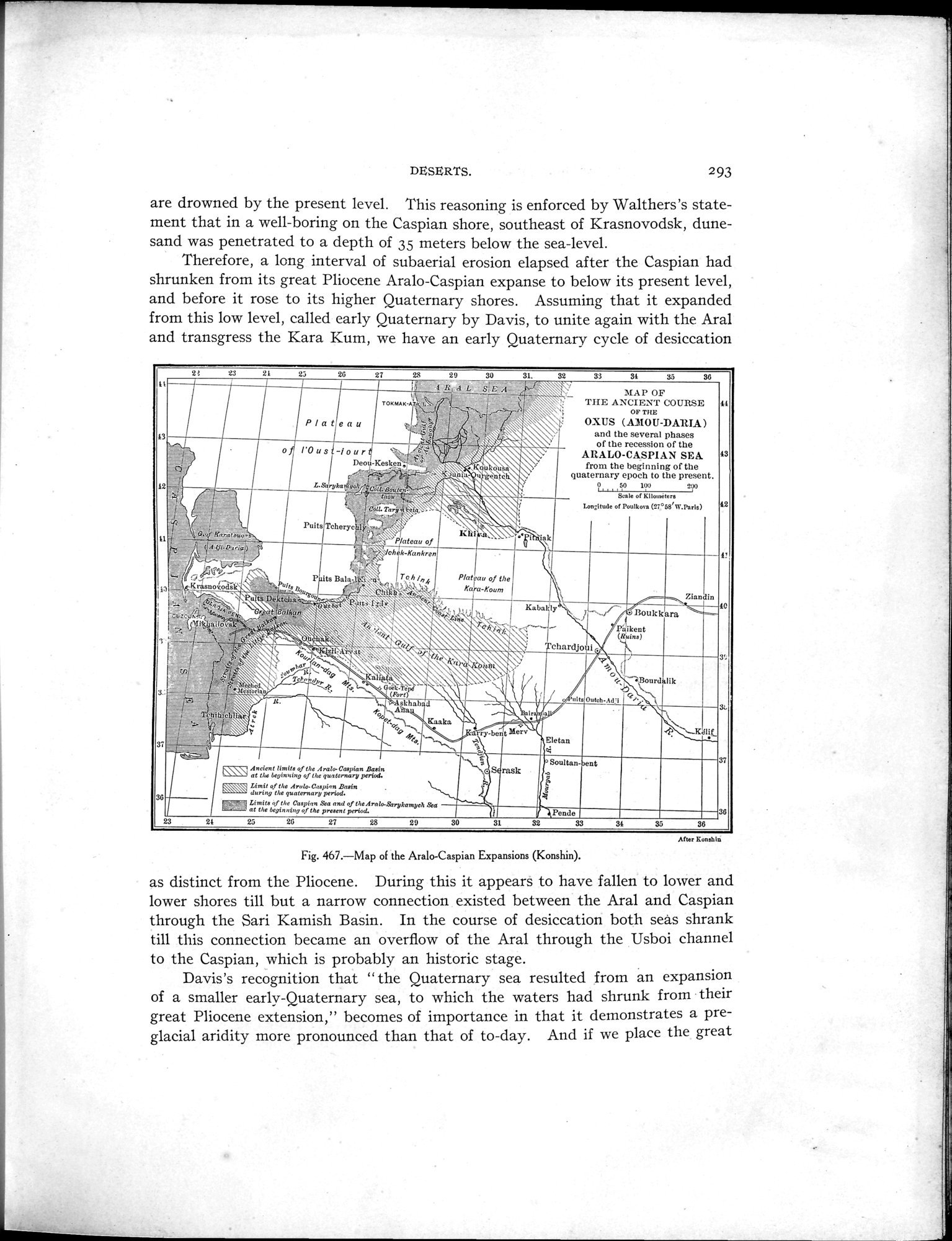
are drowned by the present level. This reasoning is enforced by Walthers's statement that in a well-boring on the Caspian shore, southeast of Krasnovodsk, dune-sand was penetrated to a depth of 35 meters below the sea-level.
Therefore, a long interval of subaerial erosion elapsed after the Caspian had shrunken from its great Pliocene Aralo-Caspian expanse to below its present level, and before it rose to its higher Quaternary shores. Assuming that it expanded from this low level, called early Quaternary by Davis, to unite again with the Aral and transgress the Kara Kum, we have an early Quaternary cycle of desiccation
After Konshln
Fig. 467.—Map of the Aralo-Caspian Expansions (Konshin).
as distinct from the Pliocene. During this it appears to have fallen to lower and lower shores till but a narrow connection existed between the Aral and Caspian through the Sari Kamish Basin. In the course of desiccation both seas shrank till this connection became an overflow of the Aral through the Usboi channel to the Caspian, which is probably an historic stage.
Davis's recognition that " the Quaternary sea resulted from an expansion of a smaller early-Quaternary sea, to which the waters had shrunk from their great Pliocene extension," becomes of importance in that it demonstrates a pre-glacial aridity more pronounced than that of to-day. And if we place the great
2! 23 21 23 2G 27 28 29
1-R,.A L
d
gk ~
Om Tart
~É
~ ~5--~ \\ •
~ `-~r.T~ljj~.~a !".`f.
ti~~
_plateau of
~~ 7,; ,7.1.02„,w,~
\` oh k-Rankren
~ ~. ~
1i'i11. P tsBala *~~ Toh/nk `:~
31. 32 33 34 35 36
MAP OF
THE ANCIENT COURSE 41
OF TEE
OXUS (ADIOU-DAltIA)
and the several phases
of the recession of the ARALO-CASPIAN SEA 43 from the beginning of the quaternary epoch to the present.
? 50 100 _.Nl
Seale of Kllométere
Loneltude of Poulkmn (27°58'R.Paris) 42
40
3'.
®®Ann nl !Omit* eJ the Arala Cospfan Basin at 114 is innb p of the gwternary period. Ltmit o-f the Arrdo-C.;pAn Basin dnrtng the quaternary period.
21 25 26 27 28 29 30 31 32
36 36
|
Copyright (C) 2003-2019 National Institute of Informatics and The Toyo Bunko. All Rights Reserved.