National Institute of Informatics - Digital Silk Road Project
| |||||||||
|
| Explorations in Turkestan : Expedition of 1904 : vol.2 |
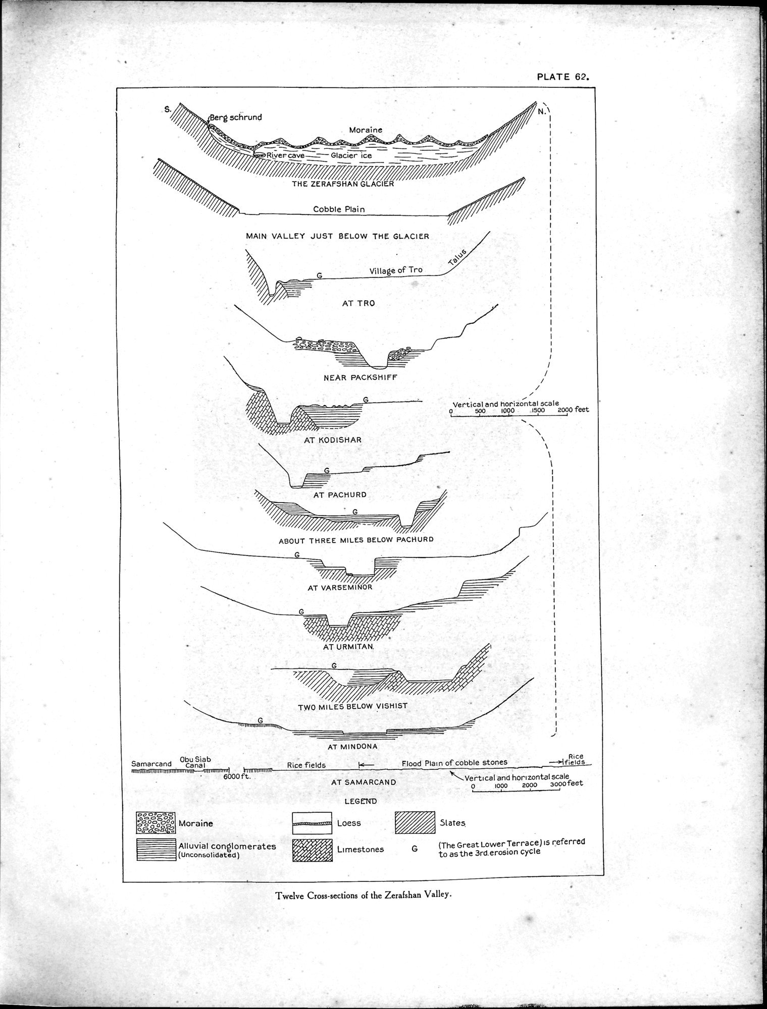 |
| Twelve Cross-sections of the Zerafshan Valley. |
PLATE 62.
Moraine
Riyercave—~Glacierice r `~'
Berg schrund
N.
THE ZERAFSHAN GLACIER Cobble Plain
MAIN VALLEY JUST BELOW THE GLACIER
Village of Tro
/
/
i
•
Vertical and horizontal scale
o 500 1000 1500 2000 feet
NEAR PACKSHIFF
AT KODISHAR
G
AT PACHURD
i
ABOUT THREE MILES BELOW PACHURD
AT VARSE MINOR
,~~/— ,~%%//I ,~~~j~%
*Ì~Ì/I~I%I/~Ì~~
AT URMITAN.
G ~/~I#
'7ltfl/n. ii~i ii/,~%Ì~
~ .i/~
TWO MILES BELOW VISHIST
AT MIN DONA
Alluvial conglomerates
(Unconsolidated)
r:w~jI
~i~.
!%!i
(The Great Lower Terrace) Is referred to as the 3rd.erosion cycle
Samarcand Obu Siab
Canal
mmllttifl(Illnuunmimmaimr--Rmhrtmnrt} lmiummuP
6000 ft.
00 oóóó 000o000ó0
ooóoggo
k— Flood Plain of cobble stones
.Vertical and horizontal scale
0 1000 2000 a000feet
Slates
Rice fields
Rice
—>Ifields
Limestones G
AT SAMARCAND
LEGEND
Loess
Moraine
Twelve Cross-sections of the Zerafshan Valley.
|
Copyright (C) 2003-2019 National Institute of Informatics and The Toyo Bunko. All Rights Reserved.