National Institute of Informatics - Digital Silk Road Project
| |||||||||
|
| Scientific Results of a Journey in Central Asia, 1899-1902 : vol.2 |
 |
| Jardangs |
THE AUTHOR'S OWN JOURNEY IN THE KURUK-TAGH. I15
again from the interior of the mass. We did not see any such salt-coated clay-formations amongst the jardangs of the Kuruk-darja and the old Lop-nor, the reason being that the western part of the lake, as well as the river, contained fresh water, whereas the eastern parts of the lake were filled with salt water, just as we find to be the case to-day with the Kara-koschun.
This zone is bordered on the west by another zone which lies a couple of meters lower, and has the appearance of a distinct depression or bed along the middle of the bay already alluded to. The ground here again was pretty hard and strewn with gravel. In all probability therefore this more deeply eroded depression is the channel along which the transient stream of the great latitudinal valley finds its exit, or at all events formerly sought a passage, bringing this gravel down with it.
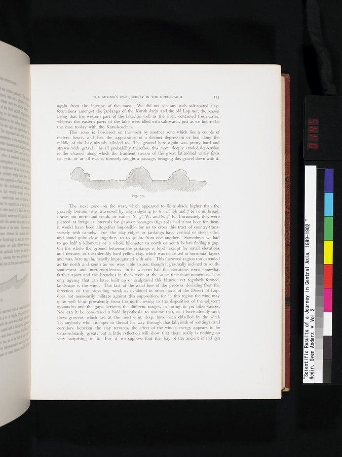
The next zone on the west, which appeared to lie a shade higher than the gravelly bottom, was traversed by clay ridges 4 to 6 m. high and 7 to to m. broad, drawn out north and south, or rather N. 5° W. and S. 5° E. Fortunately they were pierced at irregular intervals by gaps or passages (fig. 79); had it not been for them, it would have been altogether impossible for us to cross this tract of country transversely with camels. For the clay ridges or jardangs have vertical or steep sides, and stand quite close together, Io to 4o m. from one another. Sometimes we had to go half a kilometer or a whole kilometer to north or south before finding a gap. On the whole the ground between the jardangs is ley el, except for small elevations and terraces in the tolerably hard yellow clay, which was deposited in horizontal layers and was, here again, heavily impregnated with salt. This furrowed region too extended as far north and south as we were able to see; though it gradually inclined to south-south-west and north-north-east. In its western half the elevations were somewhat farther apart and the breaches in them were at the same time more numerous. The only agency that can have built up or sculptured this bizarre, yet regularly formed, landscape is the wind. The fact of the axial line of the grooves deviating from the direction of the prevailing wind, as exhibited in other parts of the Desert of Lop, does not necessarily militate against this supposition, for in this region the wind may quite well blow prevalently from the north, owing to the disposition of the adjacent mountains and the gaps between the different ranges, or owing to yet other causes. Nor can it be considered a bold hypothesis, to assume that, as I have already said, these grooves, which are at the most 6 m. deep, have been chiselled by the wind. To anybody who attempts to thread his way through that labyrinth of »cuttings» and corridors between the clay terraces, the effect of the wind's energy appears to be extraordinarily great; but a little reflection will show that there really is nothing so very surprising in it. For if we suppose that this bay of the ancient inland sea
Fig. 79.
|
Copyright (C) 2003-2019 National Institute of Informatics and The Toyo Bunko. All Rights Reserved.