FROM THE DESERT RANGES TO THE KURUK-TAGH. 493
sand now began to close in upon us. The country still presented the same appearance as before, that is it was arranged in terraces and tabular masses. One such mass, which stood quite alone, resembled a gigantic yellow-washed ruin (Pl. 54). It was built up of an endless number of horizontal layers, varying in consistency, but all containing large percentages of sand. It appeared to stand on the hard, level ground and to be almost detachable from it. Immediately north of it we entered a belt of high sand, or else an offshoot from it. The dunes were, it is true, not more than 15 m. high, but they were irregular and difficult to travel over. Most of their crests seemed to stretch S. 53° W., with their steep faces turned towards the north-west, though in other individual dunes the leeward versant was turned more directly towards the west. On the other side of this belt of dunes, we found that the connected sand advanced quite close to us on our left, though to the east its contours were lost in the far distance. The surface still consisted of sand arranged in long, gently swelling undulations. In places the hard, coarse sand was covered by a thin layer of small, round polished stones, not bigger than peas and all of the same size. Although they lay as close to one another as it was possible for them to do, they were all in one plane, none were piled upon the others; yet they were quite sufficient to prevent the underlying drift-sand from moving. In a few places there were solitary dunes resting upon this substratum.
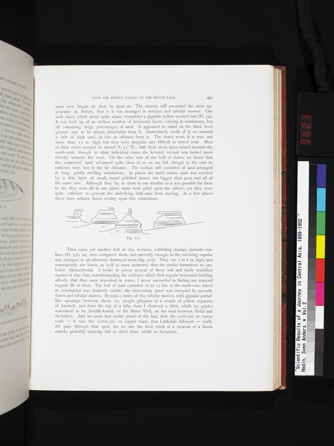
Then came yet another belt of clay terraces, exhibiting strange, fantastic out lines (Pl. S5); my men compared them, and correctly enough, to the surviving cupolas and mosques in an otherwise destroyed town (fig. 222). They are 7 to 8 m. high, and consequently are lower, as well as more scattered, than the similar formations we saw below Altmischbulak. I broke to pieces several of these soft and easily crumbled masses of clay; but, notwithstanding the evidence which their regular horizontal bedding affords, that they were deposited in water, I never succeeded in finding any tracesof organic life in them. The belt of sand extended I o to 15 km. to the north-east, where its termination was distinctly visible; the intervening space was occupied by sporadic dunes and tabular masses. Beyond a series of clay tabular masses, with gigantic portal-like openings between them, we caught glimpses of a couple of yellow expanses of kamisch, and from the top of a lofty dune I observed a third, which my guides announced to be Atschik-kuduk, or the Bitter Well, on the road between Abdal and Sa-tscheo. And we soon had ocular proof of the fact, that the astin jol, or »lower road» — it was the iistiin jol, or »upper road», that Littledale followed — really did pass through that spot, for we saw the fresh track of a caravan of a dozen camels, probably carrying fish or silver from Abdal to Sa-tscheo.