VOLUMES OF THE TARIM, JURT-TSCHAPGHAN AND KUM-TSCHAPGHAN. 155
only to the cross-section where the measurements were made, as depicted in the accompanying figure (I oo). From the same figure we may also see, that there is an elevation or bank in the middle of the stream, with only 0.86 m. depth. Just below the place of measurement the left bank is lined by a string of alluvial mud islands, forming a sort of temporary barrier against the big marsh which extends immediately north of it, and is fed by the canals that issue from the left bank of the Tarim between Kum-tschapghan and Jurt-tschapghan. The volume of the two arms thus amounted to 27.97 cub.m., as compared with 26.24 cub.m. in the undivided main channel higher up. Consequently there is a difference between the two sets of measurements of 1.73 cub.m. The results obtained at the twenty points in the two arms are no doubt more reliable than those obtained at the nine points in the main undivided stream. There is however this difference, that in the former case the result is affected by four banks, whereas in the latter case there are only two concerned. We may take the mean between the two measured volumes, or 27.10 cub.m., as being the actual volume at the moment of measurement (see vol. I p. 32).
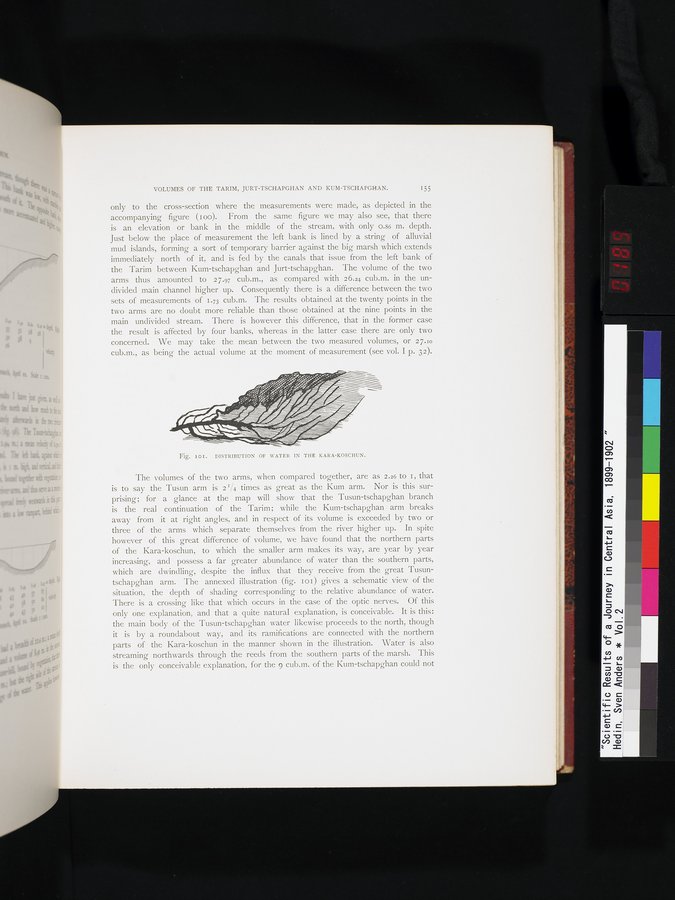
Fig. I o i . DISTRIBUTION OF WATER IN THE KARA-KOSCHUN.
The volumes of the two arms, when compared together, are as 2.26 to I, that is to say the Tusun arm is 21%4 times as great as the Kum arm. Nor is this surprising; for a glance at the map will show that the Tusun-tschapghan branch is the real continuation of the Tarim; while the Kum-tschapghan arm breaks away from it at right angles, and in respect of its volume is exceeded by two or three of the arms which separate themselves from the river higher up. In spite however of this great difference of volume, we have found that the northern parts of the Kara-koschun, to which the smaller arm makes its way, are year by year increasing, and possess a far greater abundance of water than the southern parts, which are dwindling, despite the influx that they receive from the great Tusuntschapghan arm. The annexed illustration (fig. I o I ) gives a schematic view of the situation, the depth of shading corresponding to the relative abundance of water. There is a crossing like that which occurs in the case of the optic nerves. Of this only one explanation, and that a quite natural explanation, is conceivable. It is this: the main body of the Tusun-tschapghan water likewise proceeds to the north, though it is by a roundabout way, and its ramifications are connected with the northern parts of the Kara-koschun in the manner shown in the illustration. Water is also streaming northwards through the reeds from the southern parts of the marsh. This is the only conceivable explanation, for the 9 cub.m. of the Kum-tschapghan could not