国立情報学研究所 - ディジタル・シルクロード・プロジェクト
| |||||||||
|
| Explorations in Turkestan 1903 : vol.1 | |
| トルキスタンの調査 1903年 : vol.1 |
 |
| ボスポラス海峡を横断する高地の略図 コンスタンチノープル北部のロバート・カレッジから東向きSketch of the Uplands across the Bosporus, looking eastward from near Robert College, north of Constantinople. | |
| 黒海側の出口から見たボスポラス海峡の鳥瞰図Bird's-eye Diagram of Bosporus at its exit from the Black Sea. |
26 EXPLORATIONS IN TURKESTAN.
THE BOSPORUS.
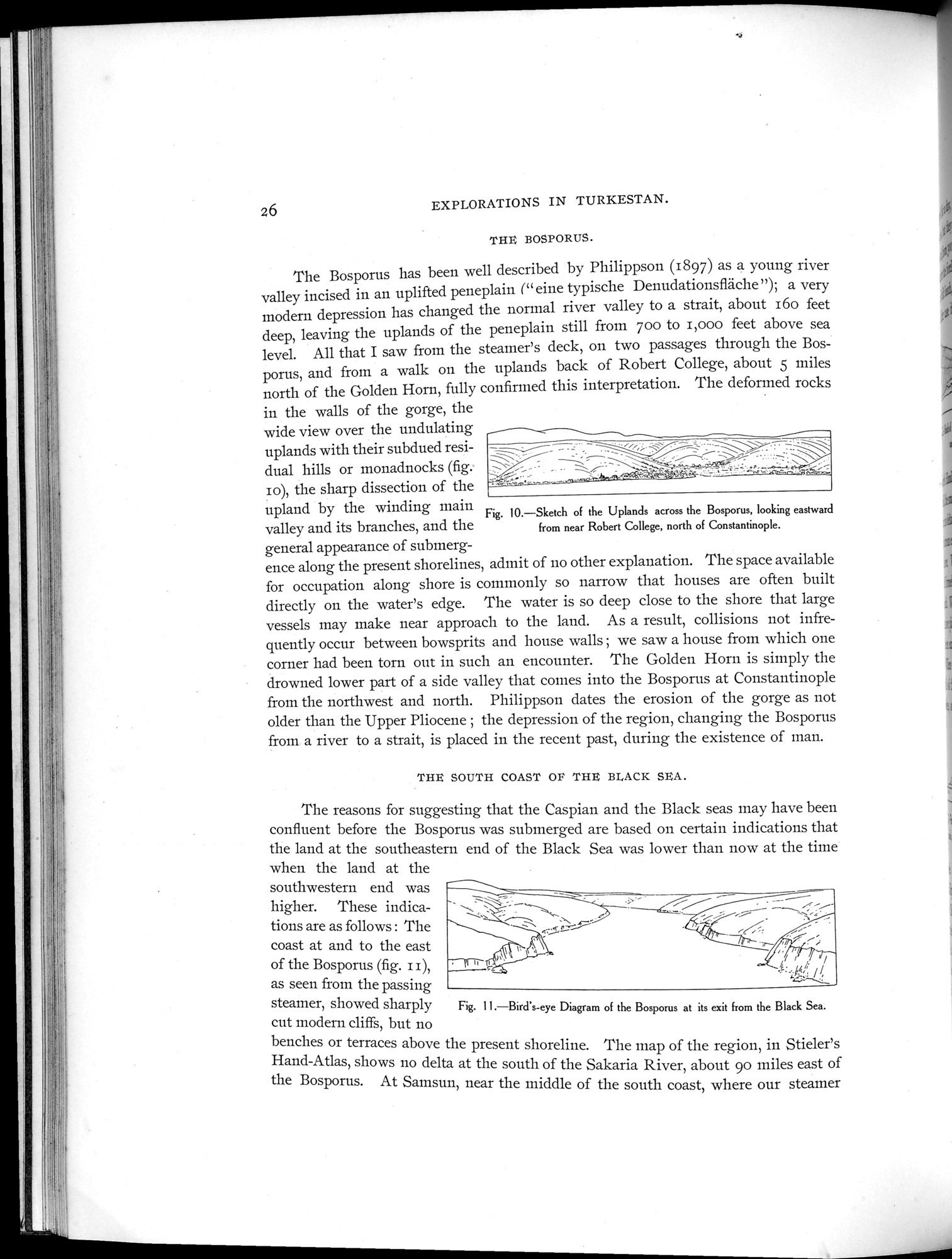
The Bosporus has been well described by Philippson (1897) as a young river valley incised in an uplifted peneplain (" eine typische Denudationsfläche "); a very modern depression has changed the normal river valley to a strait, about i6o feet deep, leaving the uplands of the peneplain still from boo to i,000 feet above sea level. All that I saw from the steamer's deck, on two passages through the Bosporus, and from a walk on the uplands back of Robert College, about 5 miles north of the Golden Horn, fully confirmed this interpretation. The deformed rocks
in the walls of the gorge, the
wide view over the undulating
uplands with their subdued resi-
dual hills or monadnocks (fig.
I o), the sharp dissection of the T
upland by the winding main
Fig. 10.—Sketch of the Uplands across the Bosporus, looking eastward
valley and its branches, and the from near Robert College, north of Constantinople.
general appearance of submerg-
ence along the present shorelines, admit of no other explanation. The space available for occupation along shore is commonly so narrow that houses are often built directly on the water's edge. The water is so deep close to the shore that large vessels may make near approach to the land. As a result, collisions not infrequently occur between bowsprits and house walls ; we saw a house from which one corner had been torn out in such an encounter. The Golden Horn is simply the drowned lower part of a side valley that comes into the Bosporus at Constantinople from the northwest and north. Philippson dates the erosion of the gorge as not older than the Upper Pliocene ; the depression of the region, changing the Bosporus from a river to a strait, is placed in the recent past, during the existence of roan.
THE SOUTH COAST OF THE BLACK SEA.
The reasons for suggesting that the Caspian and the Black seas may have been confluent before the Bosporus was submerged are based on certain indications that the land at the southeastern end of the Black Sea was lower than now at the time
when the land at the southwestern end was
higher. These indica-
tions are as follows : The
coast at and to the east•
of the Bosporus (fig. i i),
as seen from the passing
steamer, showed sharply Fig. 11.—Bird's-eye Diagram of the Bosporus at its exit from the Black Sea.
cut modern cliffs, but no
benches or terraces above the present shoreline. The map of the region, in Stieler's Hand-Atlas, shows no delta at the south of the Sakaria River, about 90 miles east of the Bosporus. At Samsun, near the middle of the south coast, where our steamer
|
Copyright (C) 2003-2019
National Institute of Informatics(国立情報学研究所)
and
The Toyo Bunko(東洋文庫). All Rights Reserved.
本ウェブサイトに掲載するデジタル文化資源の無断転載は固くお断りいたします。