国立情報学研究所 - ディジタル・シルクロード・プロジェクト
| |||||||||
|
| Explorations in Turkestan 1903 : vol.1 | |
| トルキスタンの調査 1903年 : vol.1 |
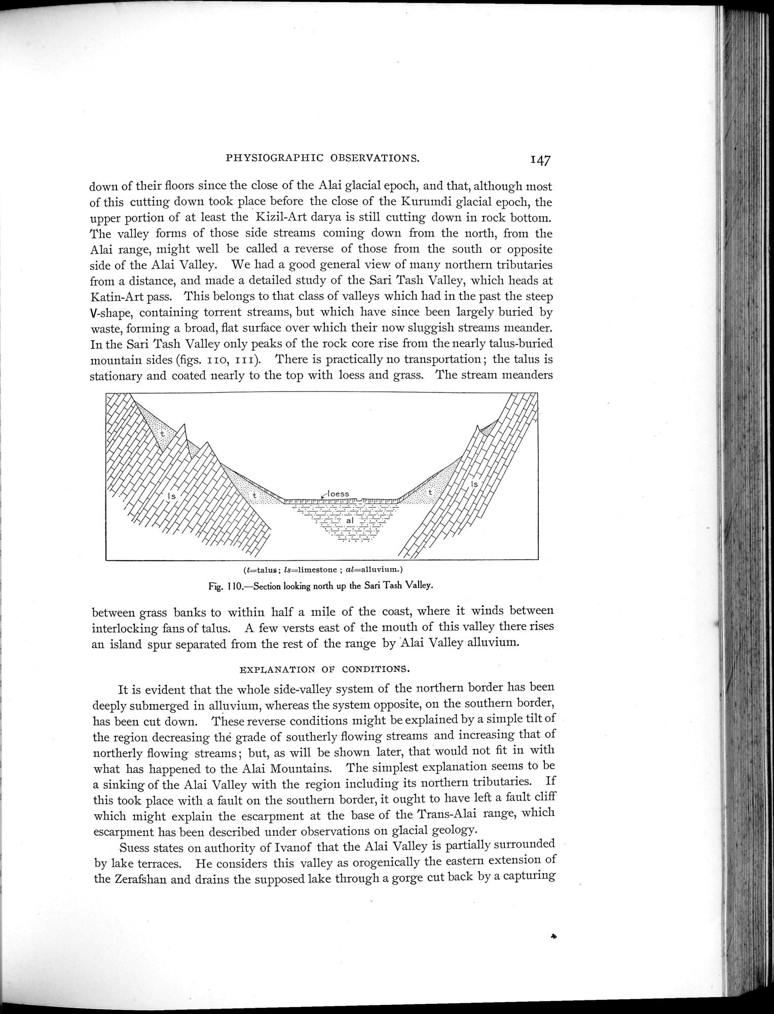 |
| Sari Tash渓谷の北側に面する断面Section looking north up the Sari Tash Valley. |
PHYSIOGRAPHIC OBSERVATIONS. 147
down of their floors since the close of the Alai glacial epoch, and that, although most of this cutting down took place before the close of the Kurumdi glacial epoch, the upper portion of at least the Kizil-Art darya is still cutting down in rock bottom. The valley forms of those side streams coming down from the north, from the Alai range, might well be called a reverse of those from the south or opposite side of the Alai Valley. We had a good general view of many northern tributaries from a distance, and made a detailed study of the Sari Tash Valley, which heads at Katin-Art pass. This belongs to that class of valleys which had in the past the steep V-shape, containing torrent streams, but which have since been largely buried by waste, forming a broad, flat surface over which their now sluggish streams meander. In the Sari Tash Valley only peaks of the rock core rise from the nearly talus-buried mountain sides (figs. II o, I I I). There is practically no transportation ; the talus is stationary and coated nearly to the top with loess and grass. The stream meanders
(l=talus; ls=limestone ; a1=a11uviurn.)
Fig. 110.—Section looking north up the Sari Tash Valley.
between grass banks to within half a mile of the coast, where it winds between interlocking fans of talus. A few versts east of the mouth of this valley there rises an island spur separated from the rest of the range by Alai Valley alluvium.
EXPLANATION OF CONDITIONS.
It is evident that the whole side-valley system of the northern border has been deeply submerged in alluvium, whereas the system opposite, on the southern border, has been cut down. These reverse conditions might be explained by a simple tilt of the region decreasing the grade of southerly flowing streams and increasing that of northerly flowing streams ; but, as will be shown later, that would not fit in with what has happened to the Alai Mountains. The simplest explanation seems to be a sinking of the Alai Valley with the region including its northern tributaries. If this took place with a fault on the southern border, it ought to have left a fault cliff which might explain the escarpment at the base of the Trans-Alai range, which escarpment has been described under observations on glacial geology.
Suess states on authority of Ivanof that the Alai Valley is partially surrounded by lak e terraces. He considers this valley as orogenically the eastern extension of the Zerafshan and drains the supposed lake through a gorge cut back by a capturing
~
|
Copyright (C) 2003-2019
National Institute of Informatics(国立情報学研究所)
and
The Toyo Bunko(東洋文庫). All Rights Reserved.
本ウェブサイトに掲載するデジタル文化資源の無断転載は固くお断りいたします。