国立情報学研究所 - ディジタル・シルクロード・プロジェクト
| |||||||||
|
| Explorations in Turkestan 1903 : vol.1 | |
| トルキスタンの調査 1903年 : vol.1 |
 |
| Yak_Tash盆地の光景 天山山脈の北部にある 北西向き 最前面の盆地底は、多数の池がある平らな氷堆積で覆われている;その向こうには頂上が平坦な山々と氷河の渓谷があるScene in the Yak_Tash_Basin, in the northern part of the Tian Shan plateau, looking northwest. In the foreground the basin-floor is covered with a flat moraine holding numerous ponds; beyond are smooth-topped mountains cut by glacial valleys. |
RECONNAISSANCE IN CENTRAL TURKESTAN. 173
the Jukuchak pass, is full of old moraines spread in a broad, uneven sheet and enclosing numerous lifeless ponds and lakes. In other basins the moraines have not advanced so far and the streams have cut slight terraces in the gravel silt or the Tertiary strata which lie on the floor of the depressions and form the plains. Such in general are the basins and ridges of the most typical portion of the Tian Shan plateau.
In the very center of the plateau is a valley of erosion of quite a different character. South of Chakur Korum pass the Kara Kul River, one of the main branches of the Narin, flows in a young valley i,000 or z,000 feet deep, with a narrow bottom and steep walls like those which characterize the valleys on the north slope -oh the plateau. The road descends from the pass to the river by a narrow side valley with walls a thousand or more feet high, and in some places perpendicular
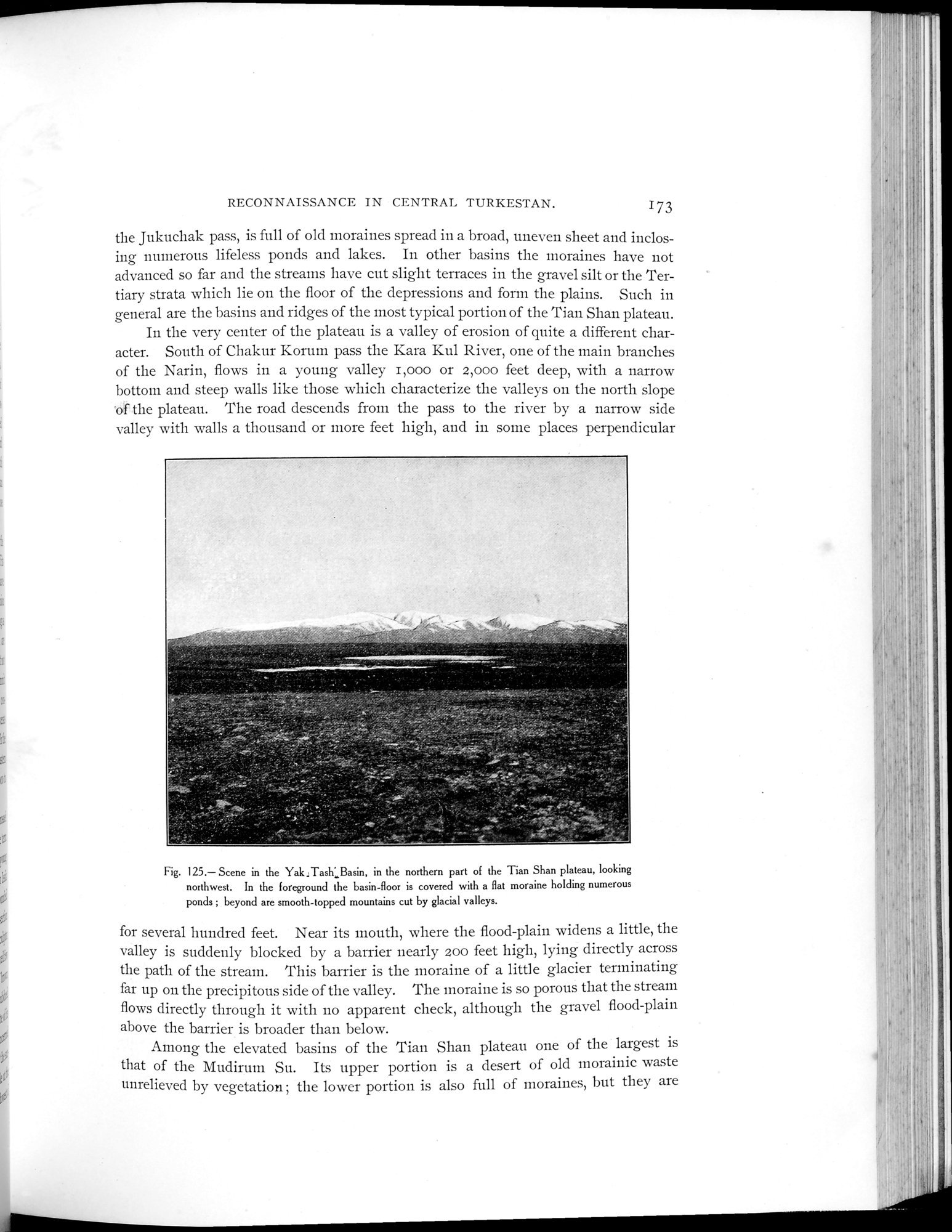
Fig. 125.— Scene in the Yak,Tash;,Basin, in the northern part of the Tian Shan plateau, looking northwest. In the foreground the basin-floor is covered with a flat moraine holding numerous ponds ; beyond are smooth-topped mountains cut by glacial valleys.
for several hundred feet. Near its mouth, where the flood-plain widens a little, the valley is suddenly blocked by a barrier nearly 200 feet high, lying directly across the path of the stream. This barrier is the moraine of a little glacier terminating far up on the precipitous side of the valley. The moraine is so porous that the stream flows directly through it with no apparent check, although the gravel flood-plain above the barrier is broader than below.
Among the elevated basins of the Tian Shan plateau one of the largest is that of the Mudirum Su. Its upper portion is a desert of old morainic waste unrelieved by vegetation ; the lower portion is also full of moraines, but they are
•
|
Copyright (C) 2003-2019
National Institute of Informatics(国立情報学研究所)
and
The Toyo Bunko(東洋文庫). All Rights Reserved.
本ウェブサイトに掲載するデジタル文化資源の無断転載は固くお断りいたします。