国立情報学研究所 - ディジタル・シルクロード・プロジェクト
| |||||||||
|
| Explorations in Turkestan 1903 : vol.1 | |
| トルキスタンの調査 1903年 : vol.1 |
 |
| Katin-Art峠のおよそ5ベルスタ下から見たSari Tash渓谷の西側The eastern side of the Sari Tash Valley from about 5 versts below Katin-Art Pass. | |
| 下盤Aの断片 Taldic峠のすぐ下から見下ろしたものRemnants of Floor A, as seen looking down from just below Taldic Pass. |
148 EXPLORATIONS IN TURKESTAN.
branch of the Ainu darya, which is the present outlet of the Kizil Su. It seems highly probable that the Alai Valley, with its great transverse moraines, may have held one, or even several, lakes during glacial epochs ; but a lake reaching to the height of our escarpment terraces would be high above the lower passes over the Alai range, and, moreover, we observed no lake sediments.
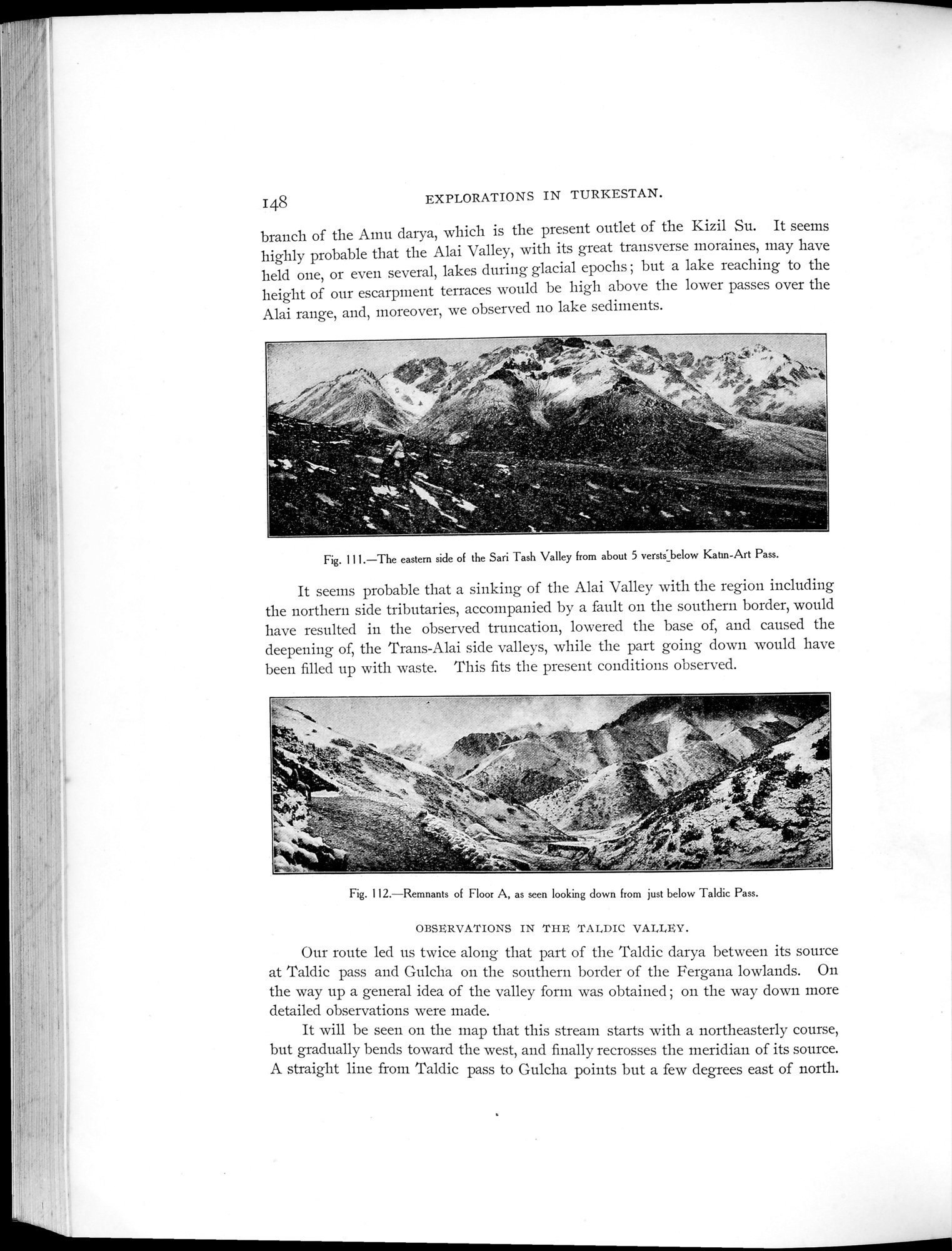
Fig. 111.—The eastern side of the Sari Tash Valley from about 5 versts_below Katin-Art Pass.
It seems probable that a sinking of the Alai Valley with the region including the northern side tributaries, accompanied by a fault on the southern border, would have resulted in the observed truncation, lowered the base of, and caused the deepening of, the Trans-Alai side valleys, while the part going down would have been filled up with waste. This fits the present conditions observed.
Fig. 112.—Remnants of Floor A, as seen looking down from just below Taldic Pass.
OBSERVATIONS IN THE TALDIC VALLEY.
Our route led us twice along that part of the Taldic darya between its source at Taldic pass and Gulcha on the southern border of the Fergana lowlands. On the way up a general idea of the valley form was obtained ; on the way down more detailed observations were made.
It will be seen on the map that this stream starts with a northeasterly course, but gradually bends toward the west, and finally recrosses the meridian of its source. A straight line from Taldic pass to Gulcha points but a few degrees east of north.
|
Copyright (C) 2003-2019
National Institute of Informatics(国立情報学研究所)
and
The Toyo Bunko(東洋文庫). All Rights Reserved.
本ウェブサイトに掲載するデジタル文化資源の無断転載は固くお断りいたします。