国立情報学研究所 - ディジタル・シルクロード・プロジェクト
| |||||||||
|
| Explorations in Turkestan 1903 : vol.1 | |
| トルキスタンの調査 1903年 : vol.1 |
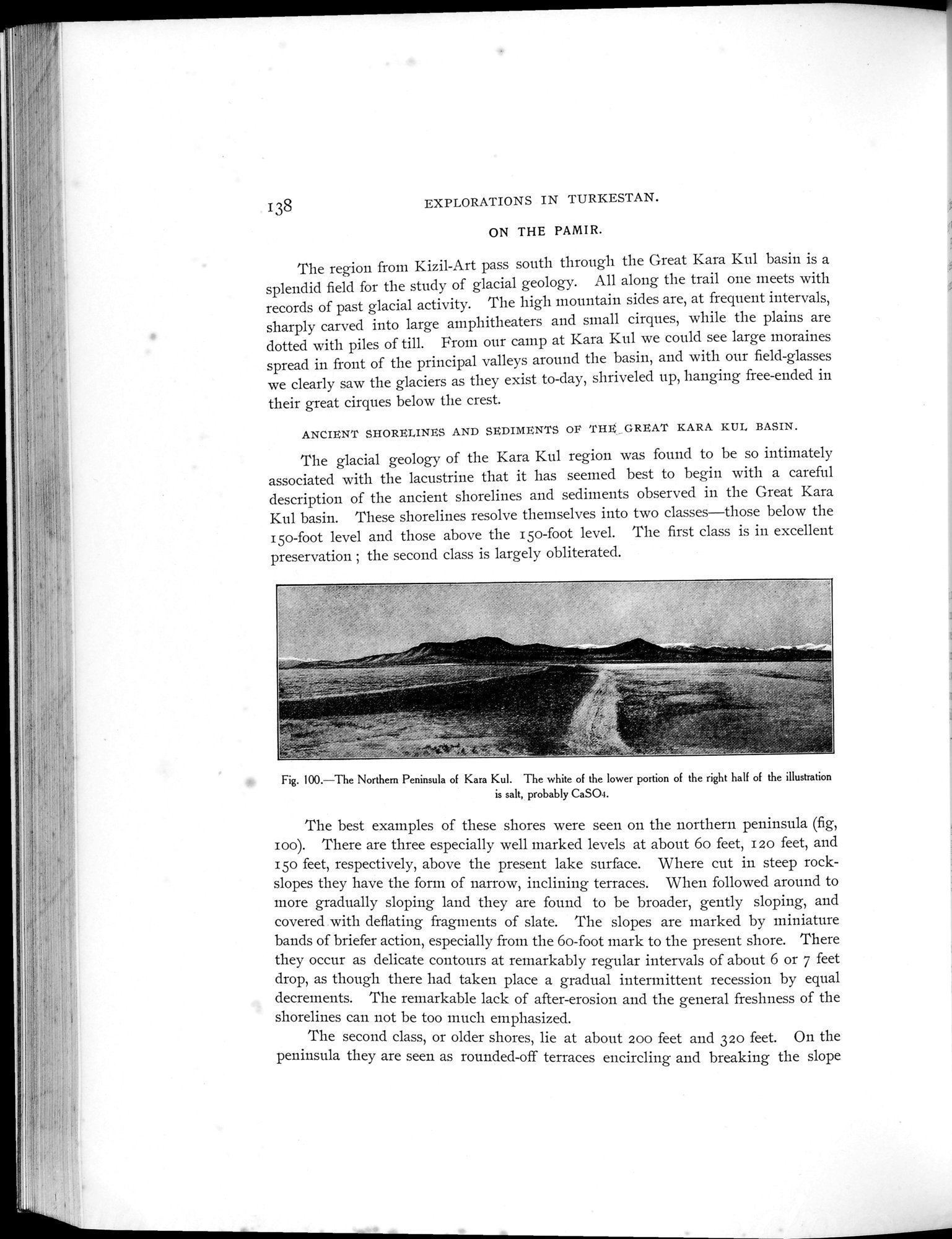 |
| カラクルの北部半島 図の右半分の下部にある白い物は塩、恐らくCaSO4The Northern Peninsula of Kara Kul. The white of the lower portion of the right half of the illustration is salt, probably CaSO4. |
| 138 | EXPLORATIONS IN TURKESTAN. |
ON THE PAMIR.
The region from Kizil-Art pass south through the Great Kara Kul basin is a splendid field for the study of glacial geology. All along the trail one meets with records of past glacial activity. The high mountain sides are, at frequent intervals, sharply carved into large amphitheaters and small cirques, while the plains are dotted with piles of till. From our camp at Kara Kul we could see large moraines spread in front of the principal valleys around the basin, and with our field-glasses we clearly saw the glaciers as they exist to-day, shriveled up, hanging free-ended in their great cirques below the crest.
ANCIENT SHORELINES AND SEDIMENTS OF THE _GREAT KARA KUL BASIN.
The glacial geology of the Kara Kul region was found to be so intimately associated with the lacustrine that it has seemed best to begin with a careful description of the ancient shorelines and sediments observed in the Great Kara Kul basin. These shorelines resolve themselves into two classes—those below the I5o-foot level and those above the i so-foot level. The first class is in excellent preservation ; the second class is largely obliterated.
Fig. 100.—The Northern Peninsula of Kara Kul. The white of the lower portion of the right half of the illustration is salt, probably CaSO4.
The best examples of these shores were seen on the northern peninsula (fig, zoo). There are three especially well marked levels at about 6o feet, 120 feet, and 150 feet, respectively, above the present lake surface. Where cut in steep rock-slopes they have the form of narrow, inclining terraces. When followed around to more gradually sloping land they are found to be broader, gently sloping, and covered with deflating fragments of slate. The slopes are marked by miniature bands of briefer action, especially from the 6o-foot mark to the present shore. There they occur as delicate contours at remarkably regular intervals of about 6 or 7 feet drop, as though there had taken place a gradual intermittent recession by equal decrements. The remarkable lack of after-erosion and the general freshness of the shorelines can not be too much emphasized.
The second class, or older shores, lie at about 200 feet and 32o feet. On the peninsula they are seen as rounded-off terraces encircling and breaking the slope
,r
|
Copyright (C) 2003-2019
National Institute of Informatics(国立情報学研究所)
and
The Toyo Bunko(東洋文庫). All Rights Reserved.
本ウェブサイトに掲載するデジタル文化資源の無断転載は固くお断りいたします。