国立情報学研究所 - ディジタル・シルクロード・プロジェクト
| |||||||||
|
| Explorations in Turkestan 1903 : vol.1 | |
| トルキスタンの調査 1903年 : vol.1 |
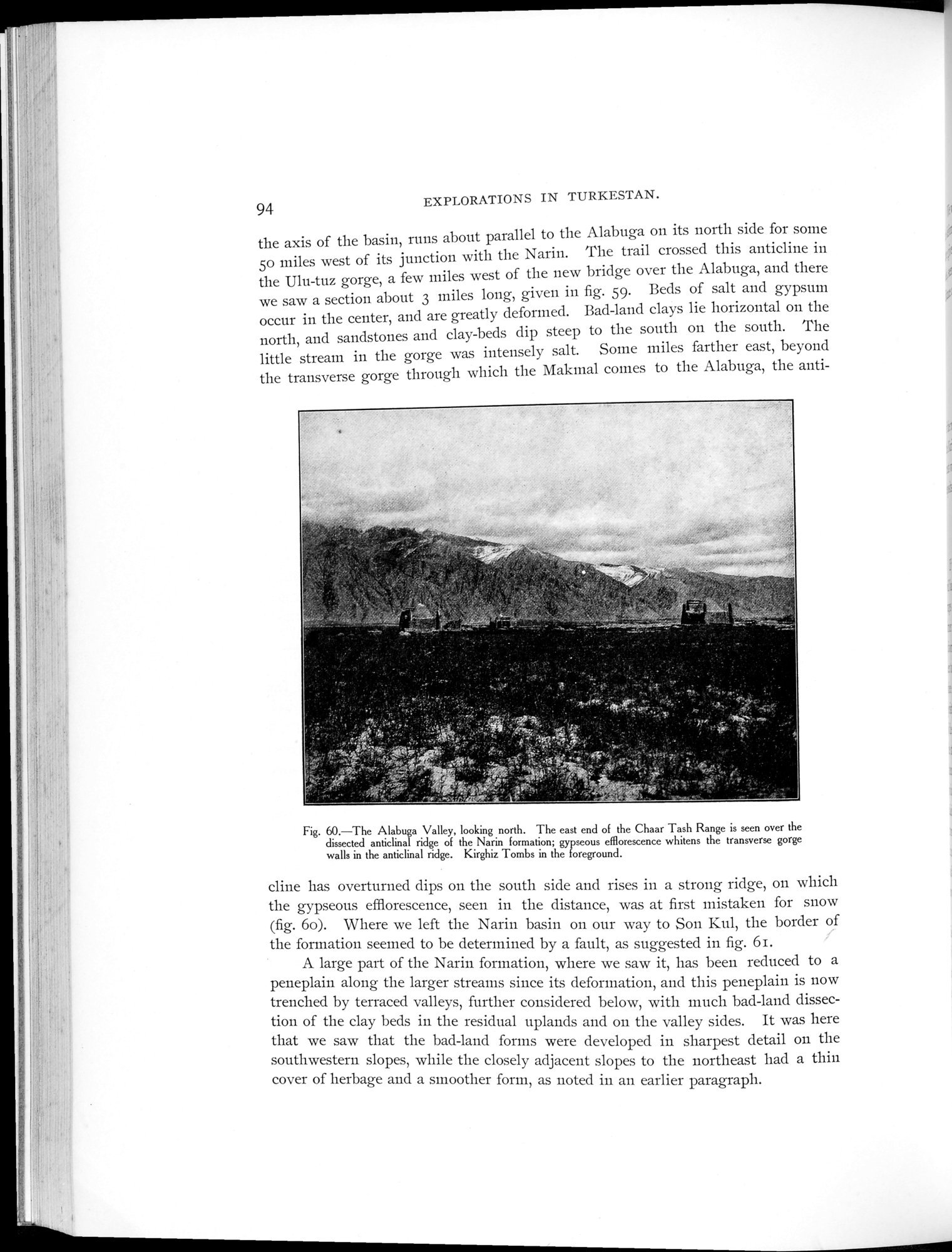 |
| Alabuga渓谷 北向き ナリン地層の切り開かれた背斜の尾根の向こうにChaar Tash山脈の東端が見える;ypseousの花が背斜の尾根にある峡谷の壁面を水平方向に白く染めている 最前面にあるのはキルギスの墓The Alabuga Valley, looking north. The east end of the Chaar Tash Range is seen over the dissected anticlinal ridge of the Narin formation; gypseous efflorescence whitens the transverse gorge walls in the anticlinal ridge. Kirghiz Tombs in the foreground. |
94 EXPLORATIONS IN TURKESTAN.
the axis of the basin, runs about parallel to the Alabuga on its north side for some 5o miles west of its junction with the Narin. The trail crossed this anticline in the Ulu-tuz gorge, a few miles west of the new bridge over the Alabuga, and there we saw a section about 3 miles long, given in fig. S9. Beds of salt and gypsum occur in the center, and are greatly deformed. Bad-land clays lie horizontal on the north, and sandstones and clay-beds dip steep to the south on the south. The little stream in the gorge was intensely salt. Some miles farther east, beyond the transverse gorge through which the Makmal cornes to the Alabuga, the anti-
Fig. 60.—The Alabuga Valley, looking north. The east end of the Chaar Tash Range is seen over the dissected anticlinal ridge of the Narin formation; gypseous efflorescence whitens the transverse gorge walls in the anticlinal ridge. Kirghiz Tombs in the foreground.
cline has overturned dips on the south side and rises in a strong ridge, on which the gypseous efflorescence, seen in the distance, was at first mistaken for snow (fig. 6o). Where we left the Narin basin on our way to Son Kul, the border of the formation seemed to be determined by a fault, as suggested in fig. 6i.
A large part of the Narin formation, where we saw it, has been reduced to a peneplain along the larger streams since its deformation, and this peneplain is now trenched by terraced valleys, further considered below, with much bad-land dissection of the clay beds in the residual uplands and on the valley sides. It was here that we saw that the bad-land forms were developed in sharpest detail on the southwestern slopes, while the closely adjacent slopes to the northeast had a thin cover of herbage and a smoother form, as noted in an earlier paragraph.
|
Copyright (C) 2003-2019
National Institute of Informatics(国立情報学研究所)
and
The Toyo Bunko(東洋文庫). All Rights Reserved.
本ウェブサイトに掲載するデジタル文化資源の無断転載は固くお断りいたします。