国立情報学研究所 - ディジタル・シルクロード・プロジェクト
| |||||||||
|
| Explorations in Turkestan 1903 : vol.1 | |
| トルキスタンの調査 1903年 : vol.1 |
 |
| Abukumof駅近郊の山脈の略図 南向きRough Sketch of a Range near Abukumof Station looking south. |
78 EXPLORATIONS IN TURKESTAN.
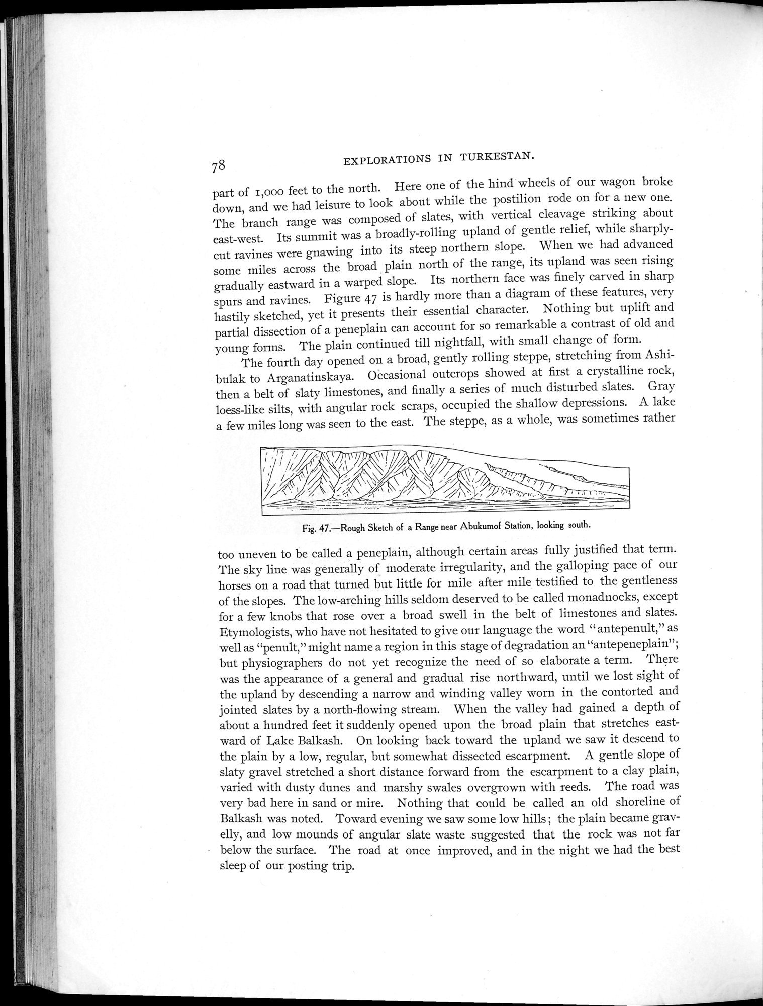
part of i,000 feet to the north. Here one of the hind wheels of our wagon broke down, and we had leisure to look about while the postilion rode on for a new one. The branch range was composed of slates, with vertical cleavage striking about east-west. Its summit was a broadly-rolling upland of gentle relief, while sharply-cut ravines were gnawing into its steep northern slope. When we had advanced some miles across the broad plain north of the range, its upland was seen rising gradually eastward in a warped slope. Its northern face was finely carved in sharp spurs and ravines. Figure 47 is hardly more than a diagram of these features, very hastily sketched, yet it presents their essential character. Nothing but uplift and partial dissection of a peneplain can account for so remarkable a contrast of old and young forms. The plain continued till nightfall, with small change of form.
The fourth day opened on a broad, gently rolling steppe, stretching from Ashibulak to Arganatinskaya. Occasional outcrops showed at first a crystalline rock, then a belt of slaty limestones, and finally a series of much disturbed slates. Gray loess-like silts, with angular rock scraps, occupied the shallow depressions. A lake a few miles long was seen to the east. The steppe, as a whole, was sometimes rather
Fig. 47.—Rough Sketch of a Range near Abukumof Station, looking south.
too uneven to be called a peneplain, although certain areas fully justified that term. The sky line was generally of moderate irregularity, and the galloping pace of our horses on a road that turned but little for mile after mile testified to the gentleness of the slopes. The low-arching hills seldom deserved to be called monadnocks, except for a few knobs that rose over a broad swell in the belt of limestones and slates. Etymologists, who have not hesitated to give our language the word " antepenult," as well as "penult," might naine a region in this stage of degradation an "antepeneplain"; but physiographers do not yet recognize the need of so elaborate a term. There was the appearance of a general and gradual rise northward, until we lost sight of the upland by descending a narrow and winding valley worn in the contorted and jointed slates by a north-flowing stream. When the valley had gained a depth of about a hundred feet it suddenly opened upon the broad plain that stretches eastward of bake Balkash. On looking hack toward the upland we saw it descend to the plain by a low, regular, but somewhat dissected escarpment. A gentle slope of slaty gravel stretched a short distance forward from the escarpment to a clay plain, varied with dusty dunes and marshy swales overgrown with reeds. The road was very bad here in sand or mire. Nothing that could be called an old shoreline of Balkash was noted. Toward evening we saw some low hills ; the plain became gravelly, and low mounds of angular slate waste suggested that the rock was not far below the surface. The road at once improved, and in the night we had the best sleep of our posting trip.
|
Copyright (C) 2003-2019
National Institute of Informatics(国立情報学研究所)
and
The Toyo Bunko(東洋文庫). All Rights Reserved.
本ウェブサイトに掲載するデジタル文化資源の無断転載は固くお断りいたします。