国立情報学研究所 - ディジタル・シルクロード・プロジェクト
| |||||||||
|
| Explorations in Turkestan 1903 : vol.1 | |
| トルキスタンの調査 1903年 : vol.1 |
 |
| Kogneh湖とジャム盆地の略地図Sketch-map of Kogneh Lake and the Jam Basin. |
EXAMPLES OF TERRACES. 261
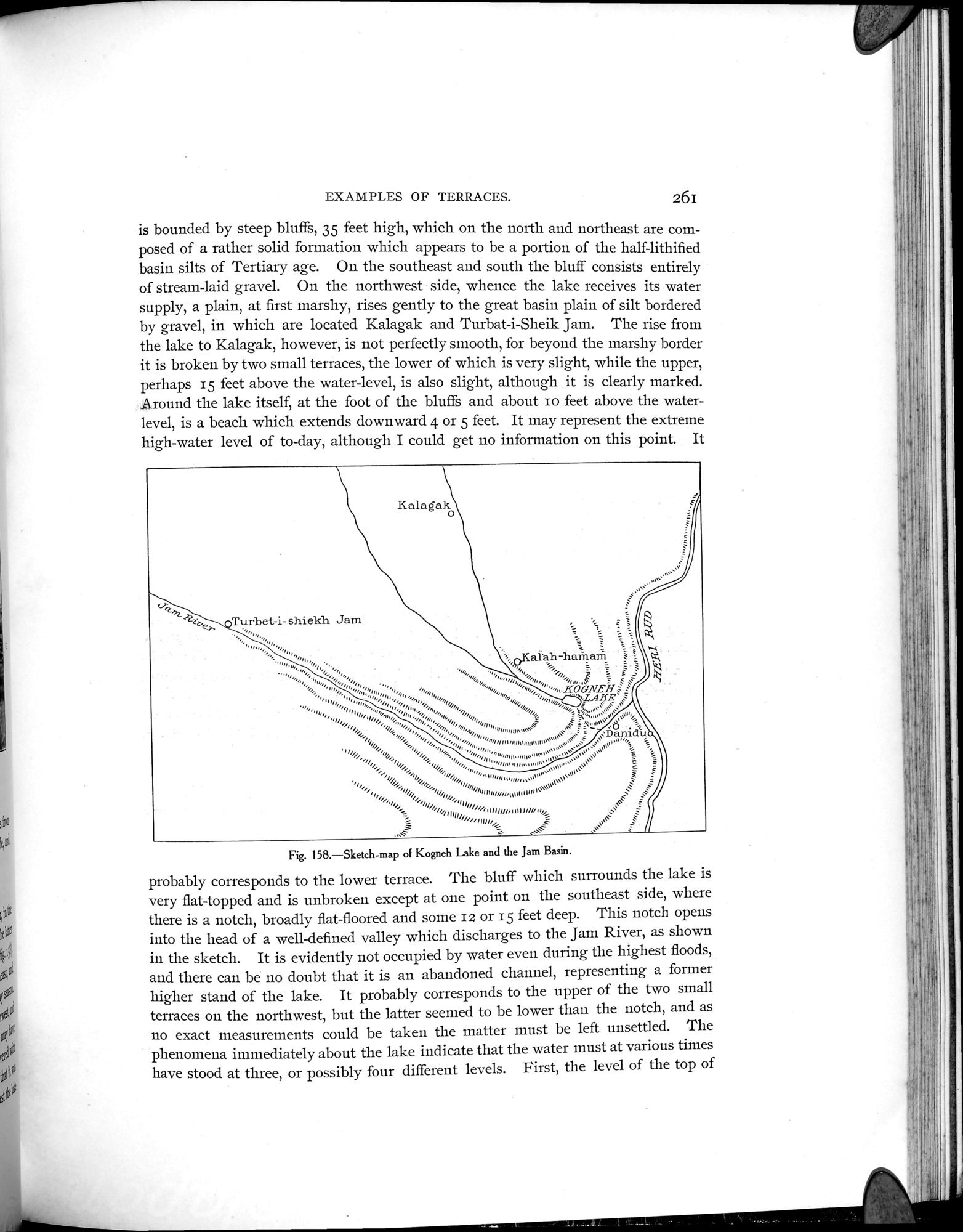
is bounded by steep bluffs, 35 feet high, which on the north and northeast are composed of a rather solid formation which appears to be a portion of the half-lithified basin silts of Tertiary age. On the southeast and south the bluff consists entirely of stream-laid gravel. On the northwest side, whence the lake receives its water supply, a plain, at first marshy, rises gently to the great basin plain of silt bordered by gravel, in which are located Kalagak and Turbat-i-Sheik Jam. The rise from the lake to Kalagak, however, is not perfectly smooth, for beyond the marshy border it is broken by two small terraces, the lower of which is very slight, while the upper, perhaps 15 feet above the water-level, is also slight, although it is clearly marked. Around the lake itself, at the foot of the bluffs and about io feet above the water-level, is a beach which extends downward 4 or 5 feet. It may represent the extreme high-water level of to-day, although I could get no information on this point. It
Kalagako
~ZLes
Turbet- i-shielch Jam
/'111qU,u1UNUe,o„.
b//1/4"111U4=
...~ ~ •
Fig. 158.—Sketch-map of Kogneh Lake and the Jam Basin.
probably corresponds to the lower terrace. The bluff which surrounds the lake is very flat-topped and is unbroken except at one point on the southeast side, where there is a notch, broadly flat-floored and some i 2 or 15 feet deep. This notch opens into the head of a well-defined valley which discharges to the Jam River, as shown in the sketch. It is evidently not occupied by water even during the highest floods, and there can be no doubt that it is an abandoned channel, representing a former higher stand of the lake. It probably corresponds to the upper of the two small terraces on the northwest, but the latter seemed to be lower than the notch, and as no exact measurements could be taken the matter must be left unsettled. The phenomena immediately about the lake indicate that the water must at various times have stood at three, or possibly four different levels. First, the level of the top of
|
Copyright (C) 2003-2019
National Institute of Informatics(国立情報学研究所)
and
The Toyo Bunko(東洋文庫). All Rights Reserved.
本ウェブサイトに掲載するデジタル文化資源の無断転載は固くお断りいたします。