国立情報学研究所 - ディジタル・シルクロード・プロジェクト
| |||||||||
|
| Explorations in Turkestan 1903 : vol.1 | |
| トルキスタンの調査 1903年 : vol.1 |
 |
| 山脈CからDの典型的な断面 図43 東向きIdeal Section from Range C to D, Figure 43, looking east. |
| 76 | EXPLORATIONS IN TURKESTAN. |
as well as many smaller fans at the base of other ranges, showed no signs of faulting. Their radial slopes were smooth and unbroken. The small range or block
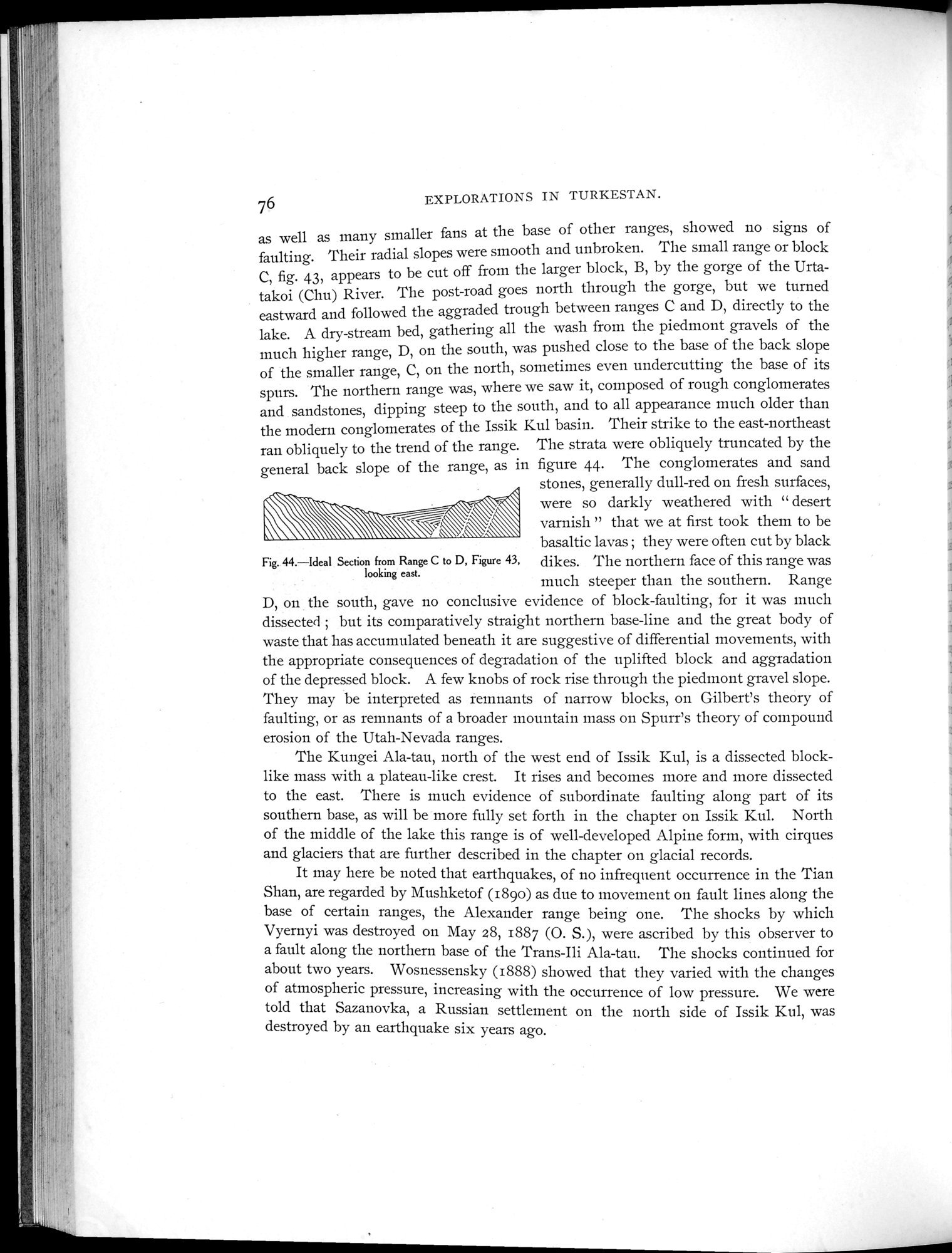
fig. 43, appears to be cut off from the larger block, B, by the gorge of the Urtatakoi (Chu) River. The post-road goes north through the gorge, but we turned eastward and followed the aggraded trough between ranges C and D, directly to the lake. A dry-stream bed, gathering all the wash from the piedmont gravels of the much higher range, D, on the south, was pushed close to the base of the back slope of the smaller range, C, on the north, sometimes even undercutting the base of its spurs. The northern range was, where we saw it, composed of rough conglomerates and sandstones, dipping steep to the south, and to all appearance much older than the modern conglomerates of the Issik Kul basin. Their strike to the east-northeast ran obliquely to the trend of the range. The strata were obliquely truncated by the general back slope of the range, as in figure 44. The conglomerates and sand
stones, generally dull-red on fresh surfaces, were so darkly weathered with " desert varnish " that we at first took them to be basaltic lavas ; they were often cut by black
Fig. 44.—Ideal Section from Range C to D, Figure 43, dikes. The northern face of this range was looking east.
much steeper than the southern. Range
on the south, gave no conclusive evidence of block-faulting, for it was much dissected ; but its comparatively straight northern base-line and the great body of waste that has accumulated beneath it are suggestive of differential movements, with the appropriate consequences of degradation of the uplifted block and aggradation of the depressed block. A few knobs of rock rise through the piedmont gravel slope. They may be interpreted as remnants of narrow blocks, on Gilbert's theory of faulting, or as remnants of a broader mountain mass on Spurr's theory of compound erosion of the Utah-Nevada ranges.
The Kungei Ala-tau, north of the west end of Issik Kul, is a dissected block-like mass with a plateau-like crest. It rises and becomes more and more dissected to the east. There is much evidence of subordinate faulting along part of its southern base, as will be more fully set forth in the chapter on Issik Kul. North of the middle of the lake this range is of well-developed Alpine form, with cirques and glaciers that are further described in the chapter on glacial records.
It may here be noted that earthquakes, of no infrequent occurrence in the Tian Shan, are regarded by Mushketof (189o) as due to movement on fault lines along the base of certain ranges, the Alexander range being one. The shocks by which Vyernyi was destroyed on May 28, 1887 (0. S.), were ascribed by this observer to a fault along the northern base of the Trans-Ili Ala-tau. The shocks continued for about two years. Wosnessensky (1888) showed that they varied with the changes of atmospheric pressure, increasing with the occurrence of low pressure. We were told that Sazanovka, a Russian settlement on the north side of Issik Kul, was destroyed by an earthquake six years ago.
|
Copyright (C) 2003-2019
National Institute of Informatics(国立情報学研究所)
and
The Toyo Bunko(東洋文庫). All Rights Reserved.
本ウェブサイトに掲載するデジタル文化資源の無断転載は固くお断りいたします。