国立情報学研究所 - ディジタル・シルクロード・プロジェクト
| |||||||||
|
| Explorations in Turkestan 1903 : vol.1 | |
| トルキスタンの調査 1903年 : vol.1 |
 |
| ナリン地層の全体的な断面 東向きGeneral Cross-section of the Narin Formation, looking east. |
92 EXPLORATIONS IN TURKESTAN.
distinctness the significant feature of over-steepened lower walls. All the cirques were associated with sharpened peaks and arêtes. Two cirques, hanging over a glaciated trough, have already been mentioned in connection with the moraines on the headwaters of the Ula-khol. Similar features were seen farther east in the same range when we examined it a few days later through our glasses from the north side of Issik Kul. Cirques, needle peaks, and sharp arêtes were well developed in the Kungei Ala-tau by the Sutto-bulak pass. One of the cirques opened in the side wall of the main valley several hundred feet above its floor, as shown in fig. 56. Its floor must have been at an elevation of about Io,000 feet.
The characteristic association of these various glacial forms in the higher ranges and their striking contrast with forms of normal origin in the lower ranges was a suggestive lesson in mountain sculpture.
THE NARIN TERTIARY BASIN.
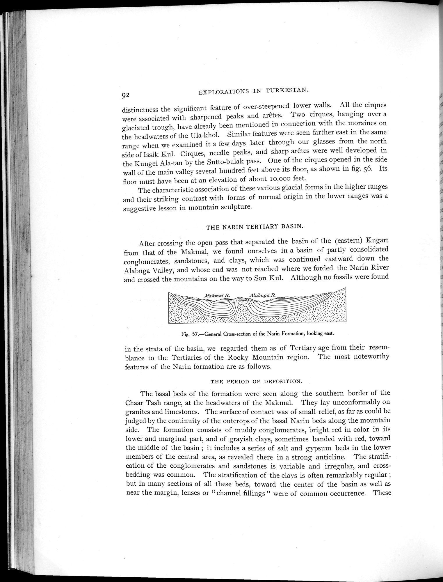
After crossing the open pass that separated the basin of the (eastern) Kugart from that of the Makmal, we found ourselves in a basin of partly consolidated conglomerates, sandstones, and clays, which was continued eastward down the Alabuga Valley, and whose end was not reached where we forded the Narin River and crossed the mountains on the way to Son Kul. Although no fossils were found
Makmal R. Alabuga R.
Fig. 57.—General Cross-section of the Narin Formation, looking east.
in the strata of the basin, we regarded them as of Tertiary age from their resemblance to the Tertiaries of the Rocky Mountain region. The most noteworthy features of the Narin formation are as follows.
THE PERIOD OF DEPOSITION.
The basal beds of the formation were seen along the southern border of the Chaar Tash range, at the headwaters of the Makmal. They lay unconformably on granites and limestones. The surface of contact was of small relief, as far as could be judged by the continuity of the outcrops of the basal Narin beds along the mountain side. The formation consists of muddy conglomerates, bright red in color in its lower and marginal part, and of grayish clays, sometimes banded with red, toward the middle of the basin ; it includes a series of salt and gypsum beds in the lower members of the central area, as revealed there in a strong anticline. The stratification of the conglomerates and sandstones is variable and irregular, and cross-bedding was common. The stratification of the clays is often remarkably regular ; but in many sections of all these beds, toward the center of the basin as well as near the margin, lenses or " channel fillings " were of common occurrence. These
|
Copyright (C) 2003-2019
National Institute of Informatics(国立情報学研究所)
and
The Toyo Bunko(東洋文庫). All Rights Reserved.
本ウェブサイトに掲載するデジタル文化資源の無断転載は固くお断りいたします。