国立情報学研究所 - ディジタル・シルクロード・プロジェクト
| |||||||||
|
| Explorations in Turkestan 1903 : vol.1 | |
| トルキスタンの調査 1903年 : vol.1 |
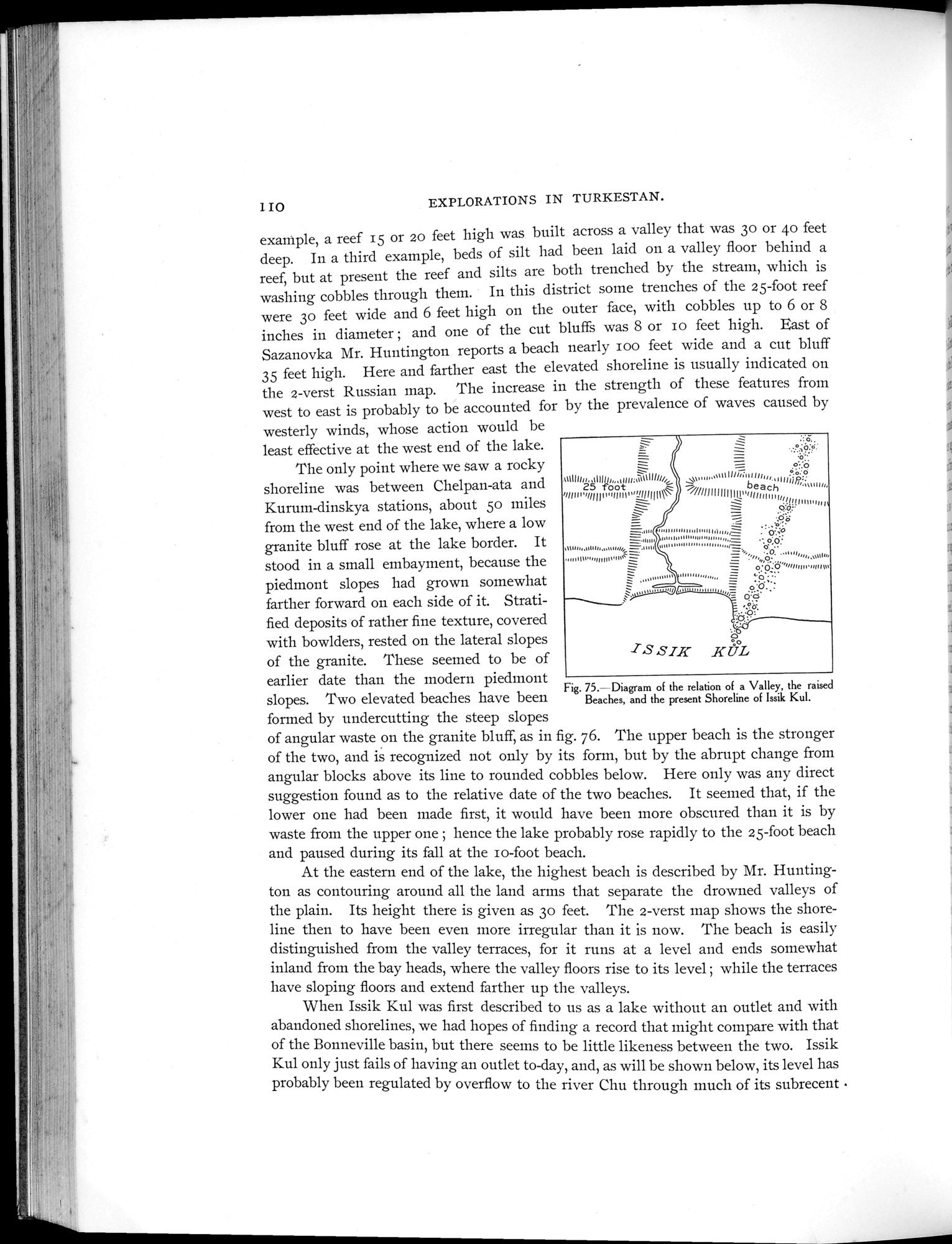 |
| 渓谷、隆起した海岸、そして現在のイシククルの汀線の関係図Diagram of the relation of a Valley, the raised Beaches, and the present Shoreline of Issik Kul. |
EXPLORATIONS IN TURKESTAN.
example, a reef 15 or 20 feet high was built across a valley that was 3o or 4o feet deep. In a third example, beds of silt had been laid on a valley floor behind a reef, but at present the reef and silts are both trenched by the stream, which is washing cobbles through them. In this district some trenches of the 25-foot reef were 3o feet wide and 6 feet high on the outer face, with cobbles up to 6 or 8 inches in diameter ; and one of the cut bluffs was 8 or io feet high. East of Sazanovka Mr. Huntington reports a beach nearly ioo feet wide and a cut bluff 35 feet high. Here and farther east the elevated shoreline is usually indicated on the 2-verst Russian map. The increase in the strength of these features from west to east is probably to be accounted for by the prevalence of waves caused by
westerly winds, whose action would be least effective at the west end of the lake.
The only point where we saw a rocky
shoreline was between Chelpan-ata and 2s foot
~lln n'~l/I I I n vlI n, I„íq1111111
Kurum-dinskya stations, about 5o miles
from the west end of the lake, where a low
granite bluff rose at the lake border. It =
.,,,,,,,,,,
stood in a small embayment, because the • .,,' 1°',,,III”
piedmont slopes had grown somewhat
farther forward on each side of it. Strati- - ~. °
Strati-
fied deposits of rather fine texture, covered
with bowlders, rested on the lateral slopes
of the granite. These seemed to be of
earlier date than the modern piedmont
Fig. 75.- Diagram of the relation of a Valley, the raised
slopes. Two elevated beaches have been Beaches, and the present Shoreline of Issik Kul.
formed by undercutting the steep slopes
of angular waste on the granite bluff, as in fig. 76. The upper beach is the stronger of the two, and is recognized not only by its form, but by the abrupt change from angular blocks above its line to rounded cobbles below. Here only was any direct suggestion found as to the relative date of the two beaches. It seemed that, if the lower one had been made first, it would have been more obscured than it is by waste from the upper one ; hence the lake probably rose rapidly to the 25-foot beach and paused during its fall at the io-foot beach.
At the eastern end of the lake, the highest beach is described by Mr. Huntington as contouring around all the land arms that separate the drowned valleys of the plain. Its height there is given as 3o feet. The 2-verst map shows the shoreline then to have been even more irregular than it is now. The beach is easily distinguished from the valley terraces, for it runs at a level and ends somewhat inland from the bay heads, where the valley floors rise to its level ; while the terraces have sloping floors and extend farther up the valleys.
When Issik Kul was first described to us as a lake without an outlet and with abandoned shorelines, we had hopes of finding a record that might compare with that of the Bonneville basin, but there seems to be little likeness between the two. Issik Kul only just fails of having an outlet to-day, and, as will be shown below, its level has probably been regulated by overflow to the river Chu through much of its subrecent •
Fhí
1IO
„1111//i~a,!/,, .•o:ti
~~///!f I I I III I \ ,bea'c1h1„l1111111;;,"`
=
,...
,,,,,Vlli„II,Ì,,,,,= .'p:;o
= o.:
_ •,,,,,0 , ,,,,,,,,,,,,,,,,,,,,,
= o:Qö""nnI„•,nu~a
,,,,,,,,,,,,,, _ ..ò . ..
ISSIK KA
3
|
Copyright (C) 2003-2019
National Institute of Informatics(国立情報学研究所)
and
The Toyo Bunko(東洋文庫). All Rights Reserved.
本ウェブサイトに掲載するデジタル文化資源の無断転載は固くお断りいたします。