国立情報学研究所 - ディジタル・シルクロード・プロジェクト
| |||||||||
|
| Explorations in Turkestan 1903 : vol.1 | |
| トルキスタンの調査 1903年 : vol.1 |
 |
| 鉄道の切り通しの図 ジザク南部Diagram of Railroad Cut, south of Jizak. |
LOESS NEAR JIZAK. 59
would be relatively barren and the finer material would be blown from it with relative ease. It is here assumed that the loess is not chiefly supplied from the products of weathering on uplands and mountains, where the finer soil has less lime than loess contains, but that it comes in greater part from flood plains, where the finer silt, largely produced by the mechanical attrition of cobbles and gravels, may be highly calcareous, as has been pointed out by Penck.
LOESS NEAR JIZAK.
A loess deposit of unusual interest was seen on June 17 on the uplands north of the Zerafshan, where the railroad contours around the eastern spurs of a detached part of the Turkestan range, west of the valley of the Sankar. The Sankar follows a valley that is rather sharply cut down in an upland or local pene-plain. The upland and the loess upon it are briefly described by Mushketof (1886, 355). The valley is about ioo feet deep where the railroad enters it, but the depth increases to 300 or 400 feet farther north, where it opens on the broad
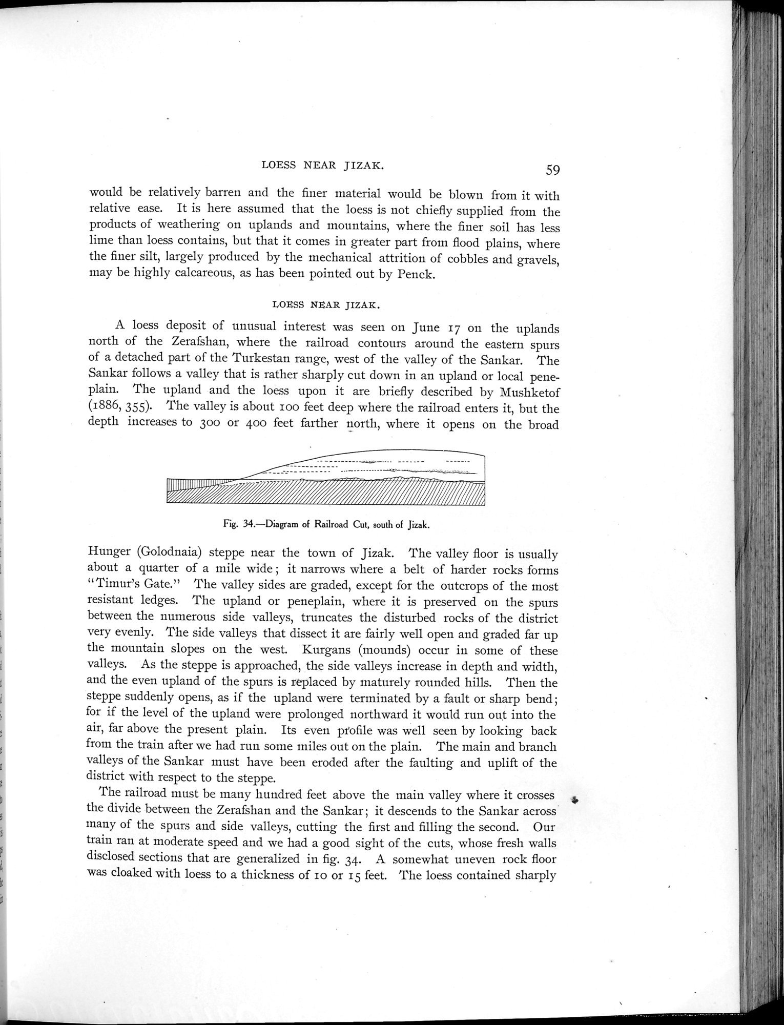
Fig. 34.—Diagram of Railroad Cut, south of Jizak.
Hunger (Golodnaia) steppe near the town of Jizak. The valley floor is usually about a quarter of a mile wide ; it narrows where a belt of harder rocks forms "Timur's Gate." The valley sides are graded, except for the outcrops of the most resistant ledges. The upland or peneplain, where it is preserved on the spurs between the numerous side valleys, truncates the disturbed rocks of the district very evenly. The side valleys that dissect it are fairly well open and graded far up the mountain slopes on the west. Kurgans (mounds) occur in some of these valleys. As the steppe is approached, the side valleys increase in depth and width, and the even upland of the spurs is replaced by maturely rounded hills. Then the steppe suddenly opens, as if the upland were terminated by a fault or sharp bend; for if the level of the upland were prolonged northward it would run out into the air, far above the present plain. Its even profile was well seen by looking back from the train after we had run some miles out on the plain. The main and branch valleys of the Sankar must have been eroded after the faulting and uplift of the district with respect to the steppe.
The railroad must be many hundred feet above the main valley where it crosses d, the divide between the Zerafshan and the Sankar ; it descends to the Sankar across many of the spurs and side valleys, cutting the first and filling the second. Our train ran at moderate speed and we had a good sight of the cuts, whose fresh walls disclosed sections that are generalized in fig. 34. A somewhat uneven rock floor was cloaked with loess to a thickness of io or 15 feet. The loess contained sharply
IIIIIIIIII~~q~~ii ""=
|
Copyright (C) 2003-2019
National Institute of Informatics(国立情報学研究所)
and
The Toyo Bunko(東洋文庫). All Rights Reserved.
本ウェブサイトに掲載するデジタル文化資源の無断転載は固くお断りいたします。