国立情報学研究所 - ディジタル・シルクロード・プロジェクト
| |||||||||
|
| Explorations in Turkestan 1903 : vol.1 | |
| トルキスタンの調査 1903年 : vol.1 |
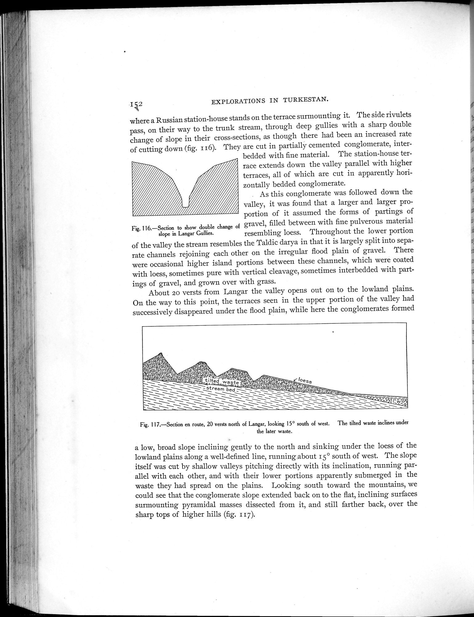 |
| Langar Gulliesの傾斜が二重に変化したことを示す断面Section to show double change of slope in Langar Gullies. | |
| 途中の断面 Langarの北20ベルスタ 西から15°南を向く 傾斜の荒れ地が、より最近の荒れ地の下に傾斜しているSection en route, 20 versts north of Langar, looking 15°south of west. The tilted waste inclines under the later waste. |
EXPLORATIONS IN TURKESTAN.
I k2
where a Russian station-house stands on the terrace surmounting it. The side rivulets pass, on their way to the trunk stream, through deep gullies with a sharp double change of slope in their cross-sections, as though there had been an increased rate of cutting down (fig. i16). They are cut in partially cemented conglomerate, inter
bedded with fine material. The station-house terrace extends down the valley parallel with higher terraces, all of which are cut in apparently horizontally bedded conglomerate.
. As this conglomerate was followed down the valley, it was found that a larger and larger proportion of it assumed the forms of partings of
Fig. 116.—Section to show double change of gravel, filled between with fine pulverous material
slope in Langar Gullies. resembling loess. Throughout the lower portion j
of the valley the stream resembles the Taldic darya in that it is largely split into sepa- rate channels rejoining each other on the irregular flood plain of gravel. There
were occasional higher island portions between these channels, which were coated .t
with loess, sometimes pure with vertical cleavage, sometimes interbedded with partings of gravel, and grown over with grass.
About 20 versts from Langar the valley opens out on to the lowland plains.
On the way to this point, the terraces seen in the upper portion of the valley had .~
successively disappeared under the flood plain, while here the conglomerates formed
._+â.
~~r~i _ •
â ~o~`_~, ~~- .
°rp° _ =~.
~ : a_Ktilte >~Tä- _~ ,i, /
~ ~\~~'. d. was_te ••',Ti =~"' °ess
~ = ~\~■==ream - — ~~..u. ="...
__ `_ _ bed
\ ~~ _ `\_`_~ `_`_~~__ \_`~~ _IMIYtYlYW1Y=YlYIYWWWW
\`~ ~ \ ~_JS.f~~..rQ
~ ~\~ ~ \\\\ \\'`` == ~~ ~~~~=ŸyWa•
\ _\ \_■~~~ ~`1■` ~
Fig. 117.—Section en route, 20 versts north of Langar, looking 15° south of west. The tilted waste inclines under
the later waste.
a low, broad slope inclining gently to the north and sinking under the loess of the lowland plains along a well-defined line, running about 15° south of west. The slope itself was cut by shallow valleys pitching directly with its inclination, running parallel with each other, and with their lower portions apparently submerged in the waste they had spread on the plains. Looking south toward the mountains, we could see that the conglomerate slope extended back on to the flat, inclining surfaces surmounting pyramidal masses dissected from it, and still farther back, over the sharp tops of higher hills (fig. i i 7).
|
Copyright (C) 2003-2019
National Institute of Informatics(国立情報学研究所)
and
The Toyo Bunko(東洋文庫). All Rights Reserved.
本ウェブサイトに掲載するデジタル文化資源の無断転載は固くお断りいたします。