国立情報学研究所 - ディジタル・シルクロード・プロジェクト
| |||||||||
|
| Explorations in Turkestan 1903 : vol.1 | |
| トルキスタンの調査 1903年 : vol.1 |
 |
| アレクサンダー山脈の遠くの側面 西向きDistant Profile of the Alexander Range, looking west. | |
| 山脈の略地図 イシククルの南西Rough sketch Map of the Ranges southwest of Issik Kul. |
THE RANGES NEAR ISSIK KUL. 75
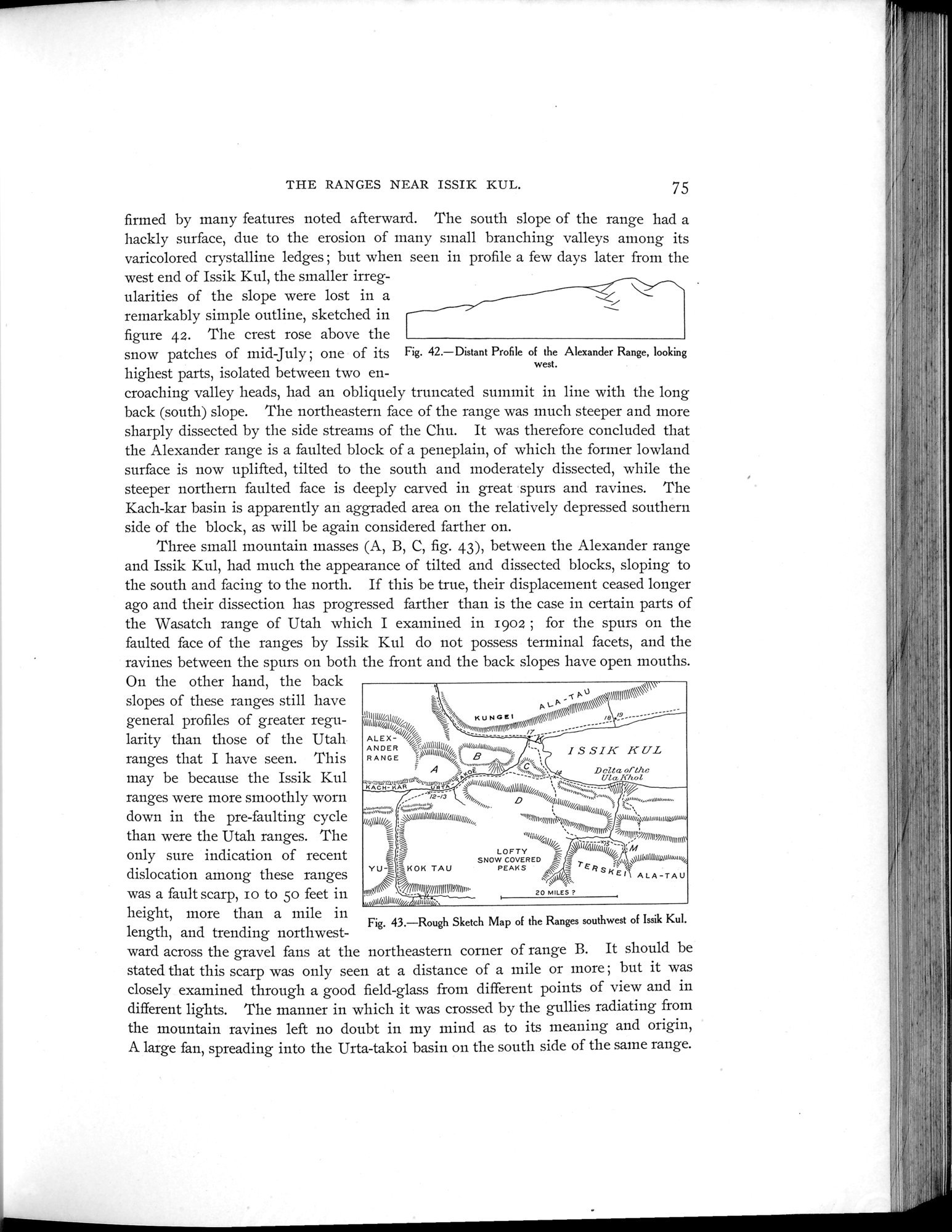
firmed by many features noted afterward. The south slope of the range had a hackly surface, due to the erosion of many small branching valleys among its varicolored crystalline ledges ; but when seen in profile a few days later from the
west end of Issik Kul, the smaller irregularities of the slope were lost in a remarkably simple outline, sketched in figure 42. The crest rose above the
snow patches of mid July ; one of its Fig. 42.—Distant Profile of the Alexander Range, looking
west.
highest parts, isolated between two en-
croaching valley heads, had an obliquely truncated summit in line with the long back (south) slope. The northeastern face of the range was much steeper and more sharply dissected by the side streams of the Chu. It was therefore concluded that the Alexander range is a faulted block of a peneplain, of which the former lowland surface is now uplifted, tilted to the south and moderately dissected, while the steeper northern faulted face is deeply carved in great spurs and ravines. The Kach-kar basin is apparently an aggraded area on the relatively depressed southern side of the block, as will be again considered farther on.
Three small mountain masses (A, B, C, fig. 43), between the Alexander range and Issik Kul, had much the appearance of tilted and dissected blocks, sloping to the south and facing to the north. If this be true, their displacement ceased longer ago and their dissection has progressed farther than is the case in certain parts of the Wasatch range of Utah which I examined in 1902 ; for the spurs on the faulted face of the ranges by Issik Kul do not possess terminal facets, and the ravines between the spurs on both the front and the back slopes have open mouths.
On the other hand, the back I\v_
slopes of these ranges still have 111 u// K U N G! t ,:u-14111141:,°„‘/\‘,-\\\\\YII1111RI1'\\\~
general profiles of greater regu- ulll)It/i;;~// , ~m„~~~ml~l~~~
//~li /i, mrn mr~rmtgla ,1
larity than those of the Utah ALEX -ranges
ANDER :ya1111111111/// "w%~Wß,4,UW F --I Kranges that I have seen. This RANGE.,yfimay be because the Issik Kulo °D/,1 /1'Lhr,Ula/f/coLAtIU//slll///////b\1111~1~/ 1 I///// OS,~L%,, __ ~r%~ranges were more smoothly wornD/,,,,,., ;,,.....,,uW ,,,,.down in the re-faultin c cle°~ry~~n \I”yfipm:: „Ill,u~,ntl,,,
P pre-faulting cycle
ro a iv' uor/I~„/~~ImmnIs //lllg ~~~nui~numnnn
than were the Utah ranges. The 1 1/;,,,/
only sure indication of recent = LOFTY '= i/
SNOW COVERED - /~: „ ~J\I(lnlllAlll4Wuµ~~w4
YU = ~KOK TAU PEAKS ~~ rElpg
dislocation among these ranges N~\tll~\~\\` ~1~~111111 U//IIIIIAII~//~lul ~\`a~G% Kre 1 ALA-TAU
was a fault scarp, Io to 5o feet in 20 MILES
,60, /Q\IIIII///,/r ttllnlüb7.
height, more than a mile in
Fig. 43.—Rough Sketch Map of the Ranges southwest of Issik Kul.
length, and trending northwest-
ward across the gravel fans at the northeastern corner of range B. It should be stated that this scarp was only seen at a distance of a mile or snore; but it was closely examined through a good field-glass from different points of view and in different lights. The manner in which it was crossed by the gullies radiating from the mountain ravines left no doubt in my mind as to its meaning and origin, A large fan, spreading into the Urta-takoi basin on the south side of the saine range.
|
Copyright (C) 2003-2019
National Institute of Informatics(国立情報学研究所)
and
The Toyo Bunko(東洋文庫). All Rights Reserved.
本ウェブサイトに掲載するデジタル文化資源の無断転載は固くお断りいたします。